The Founding Community AD 1490-1550
Double Ditch State Historic Site
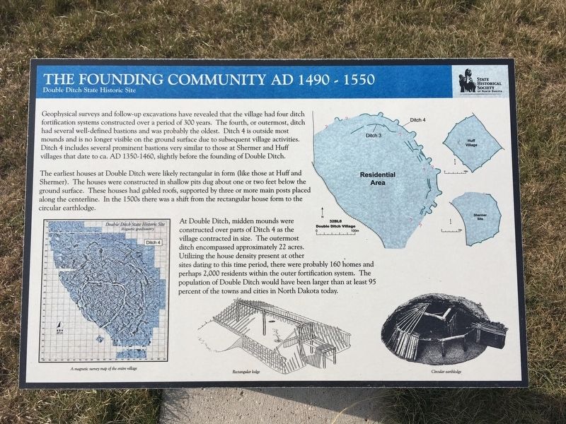
The earliest houses at Double Ditch were likely rectangular in form like those at Huff and Shermer. The houses were constructed in shallow pits dug about one or two feet below the ground surface. These houses have gabled roofs, supported by three or more main posts placed along the centerline. In the 1500s there was a shift from the rectangular house form to the circular earthlodge.
At Double Ditch, midden mounds were constructed over parts of Ditch 4 as the village contracted in size. The outermost ditch encompassed approximately 22 acres. Utilizing the house density present at other sites dating to this time period, they were probably 160 homes and perhaps 2,000 residents within the outer fortification system. The population of Double Ditch would have been larger than at least 95 percent of
the towns and cities in North Dakota today.
Photo captions:
A magnetic survey map of the entire village
Rectangular lodge
Circular earthlodge
Erected by State Historical Society of North Dakota.
Topics. This historical marker is listed in these topic lists: Anthropology & Archaeology • Native Americans. A significant historical year for this entry is 1490.
Location. 46° 56.152′ N, 100° 53.803′ W. Marker is near Bismarck, North Dakota, in Burleigh County. Marker can be reached from North Dakota Route 1804, 0.9 miles south of Double Ditch Loop, on the right when traveling south. Touch for map. Marker is in this post office area: Bismarck ND 58503, United States of America. Touch for directions.
Other nearby markers. At least 8 other markers are within walking distance of this marker. Midden Mounds (Trash Heaps) (within shouting distance of this marker); Ditch 3 (about 300 feet away, measured in a direct line); Final Occupation of Double Ditch (about 600 feet away); Double Ditch State Historic Site (about 700 feet away); Ditch 2 (about 700 feet away); Archaeological Excavations in 1905 (about 700 feet away); Geophysical Prospecting in Archaeology (about 700 feet away); Missouri River Resources (approx. 0.2 miles away). Touch for a list and map of all markers in Bismarck.
Also see . . . Double Ditch State Historic Site
Credits. This page was last revised on August 17, 2020. It was originally submitted on August 17, 2020, by Connor Olson of Kewaskum, Wisconsin. This page has been viewed 193 times since then and 47 times this year. Photo 1. submitted on August 17, 2020, by Connor Olson of Kewaskum, Wisconsin. • Mark Hilton was the editor who published this page.
Editor’s want-list for this marker. A wide shot of the marker and its surroundings. • • Can you help?
