Cumberland Township near Gettysburg in Adams County, Pennsylvania — The American Northeast (Mid-Atlantic)
Longstreet Attacks at 4 p.m.
July 2, 1863 - Second Day
General Robert E. Lee, C.S.A.
Commander, Army of Northern Virginia
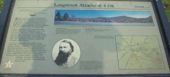
After an early morning reconnaissance, General Lee made plans for the battle's second day. He would attack the Union line at both ends - a diversionary attack on the northern end at Cemetery Hill and Culp's Hill, and a major attack here at the southern end that would "roll up" the Federal left.
Corps commander on this end of the field was Lt. Gen. James Longstreet, Lee's "old war horse." However it took Longstreet several hours to maneuver his 15,000 troops into position, using routes that would conceal them from Union lookouts on Little Round Top. The Confederate infantry assault did not begin until 4:00 p.m.
In the meantime, the Union Third Corps under Maj. Gen. Daniel E. Sickles had moved - without orders - to the high ground along the Emmitsburg Road, west of Little Round Top. Maj. Gen. John B. Hood's Confederate Division, which compromised Longstreet's right, swept out of the woods behind you and over the fields in front of you against Sickles' artillery and infantry. If successful, they could seize the strategic, yet undefended Round Tops.
(References to key points in the photo of the landscape):
(1) Little Round Top
The Federals occupied this rocky hill moments before Longstreet's Confederates struck. With its natural defenses and commanding view, it became a strong anchor for the Union line. Little Round Top is one mile from here.
(2) Big Round Top
The Federals left this wooded hill undefended until the evening of the second day.
Erected by Gettysburg National Military Park.
Topics. This historical marker is listed in this topic list: War, US Civil.
Location. Marker has been reported permanently removed. It was located near 39° 47.103′ N, 77° 15.218′ W. Marker was near Gettysburg, Pennsylvania, in Adams County. It was in Cumberland Township. Marker was on South Confederate Avenue, on the left when traveling south. Located in the Warfield Ridge section, at stop seven of the driving tour of Gettysburg National Military Park. Touch for map. Marker was in this post office area: Gettysburg PA 17325, United States of America.
We have been informed that this sign or monument is no longer there and will not be replaced. This page is an archival view of what was.
Other nearby markers. At least 8 other markers are within walking distance of this location. Longstreet Attacks (here, next to this marker); Soldiers and Sailors of the Confederacy (within shouting distance of this marker); Reilly's Battery - Henry's Battalion (within shouting distance of this marker); a different marker also named Reilly's Battery - Henry's Battalion (about 400 feet away, measured in a direct line); Alabamians! (about 600 feet away); Garden's Battery - Henry's Battalion (about 600 feet away); Law's Brigade (about 700 feet away); Fourth Alabama Infantry - Law's Brigade (about 800 feet away). Touch for a list and map of all markers in Gettysburg.
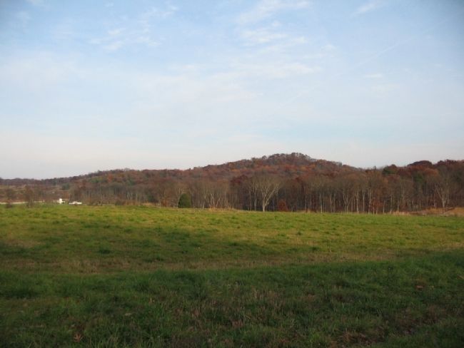
More about this marker. In the upper center is a view of the terrain, captioned: You are standing on Warfield Ridge looking east toward Little Round Top.
In the lower center is a portrait of Lt. Gen. James Longstreet, an experienced soldier, who lacked confidence in Lee's battle plan. He obeyed Lee's order to attack, but his heart was not in it. After the war, some faulted him for not attacking sooner, but General Lee was not among the critics.
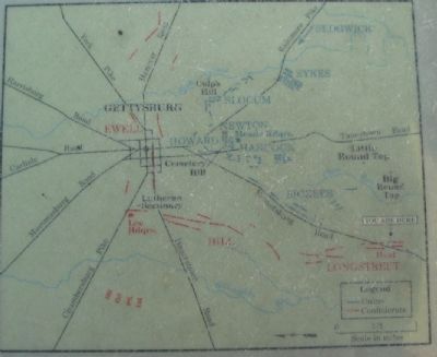
On the right is a map showing Infantry positions about 4:00 p.m., July 2, 1863. The map is oriented to the east, the direction you are facing.
Related markers. Click here for
a list of markers that are related to this marker. To better understand the relationship, study each marker in the order shown.
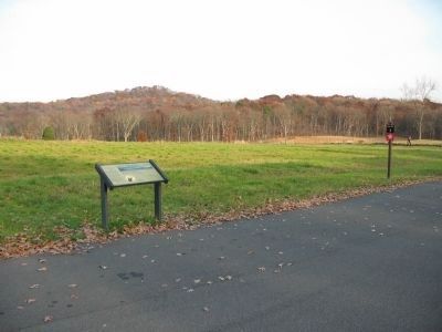
Photographed By Craig Swain, November 11, 2008
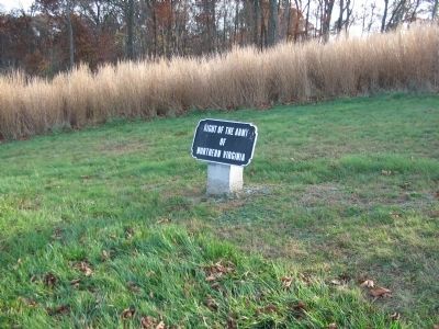
5. Right Flank of the Army of Northern Virginia
About 150 yards further east is a sign indicating the right flank of the Confederate army. The location in line with the right most units of Longstreet's Corps in their July 2 advance. It is also very close to the skirmish line maintained on July 3, also at the far right flank of the army.
Credits. This page was last revised on February 7, 2023. It was originally submitted on January 20, 2009, by Craig Swain of Leesburg, Virginia. This page has been viewed 1,283 times since then and 8 times this year. Photos: 1, 2, 3, 4, 5. submitted on January 20, 2009, by Craig Swain of Leesburg, Virginia.
