Near McDowell in Highland County, Virginia — The American South (Mid-Atlantic)
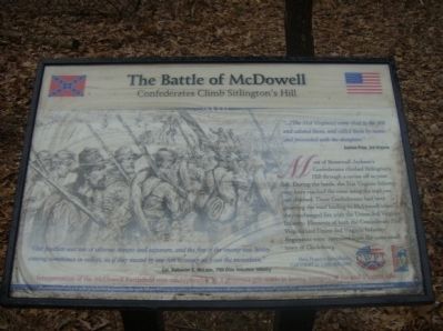
The Battle of McDowell
Confederates Climb Sitlington's Hill
Andrew Price, 3rd Virginia
Most of Stonewall Jackson’s Confederates climbed Sitlington’s Hill through a ravine off to your left. During the battle, the 31st Virginia Infantry may have reached the crest using the trail you just climbed. These Confederates had been guarding the road leading to McDowell when they exchanged fire with the Union 3rd Virginia Infantry. Elements of both the Confederate 31st Virginia and Union 3rd Virginia were recruited from the same small town of Clarksburg.
“Our position was one of extreme danger and exposure, and the fire of the enemy was heavy, coming sometimes in volleys, as if they meant by one fire to sweep us from the mountain.”
Col. Nathaniel C. McLean, 75th Ohio Volunteer Infantry
Erected by Civil War Preservation Trust and Shenandoah Valley Battlefields Foundation.
Topics. This historical marker is listed in this topic list: War, US Civil.
Location. Marker has been reported permanently removed. It was located near 38° 19.568′ N, 79° 28.537′ W. Marker was near McDowell , Virginia, in Highland County. Marker could be reached from U.S. 250, on the right when traveling east. Located in the Civil War Preservation's Trust McDowell Battlefield. Touch for map. Marker was in this post office area: Mc Dowell VA 24458, United States of America.
We have been informed that this sign or monument is no longer there and will not be replaced. This page is an archival view of what was.
Other nearby markers. At least 8 other markers are within walking distance of this location. The 12th Georgia (about 700 feet away, measured in a direct line); The Ravines (approx. 0.2 miles away); The Battle Rages (approx. 0.2 miles away); The Confederate Right (approx. ¼ mile away); Commemorating The Battle Of McDowell (approx. ¼ mile away); a different marker also named Battle of McDowell (approx. 0.3 miles away); A Spectacular Show (approx. 0.3 miles away); Sitlington's Hill (approx. 0.3 miles away). Touch for a list and map of all markers in McDowell.
More about this marker. On the left side of the marker is a sketch of soldiers on the march.
Related markers. Click here for a list of markers that are related to this marker. To better understand the relationship, study each marker in the order shown.
Credits. This page was last revised on October 18, 2023. It was originally submitted on March 4, 2009, by Robert H. Moore, II of Winchester, Virginia. This page has been viewed 1,841 times since then and 23 times this year. Last updated on March 30, 2022, by Carl Gordon Moore Jr. of North East, Maryland. Photos: 1. submitted on March 4, 2009, by Robert H. Moore, II of Winchester, Virginia. 2. submitted on March 30, 2009. • Bernard Fisher was the editor who published this page.

