Haymarket in Prince William County, Virginia — The American South (Mid-Atlantic)
Haymarket During the War
“Pass Around Their Army Without Hindrance”
| — | Gettysburg Campaign | — |
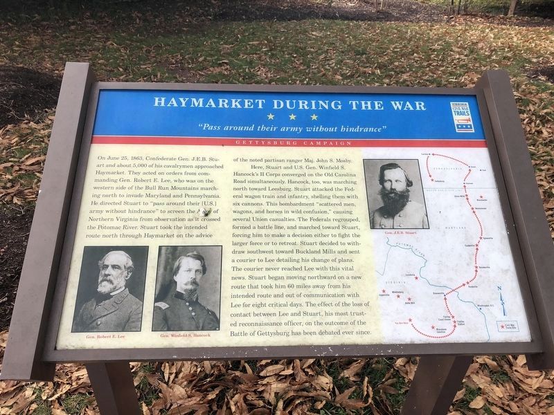
On June 25, 1863, Confederate Gen. J.E.B. Stuart and about 5,000 of his cavalrymen approached Haymarket. They acted on orders from commanding Gen. Robert E. Lee, who was on the western side of the Bull Run Mountains marching north to invade Maryland and Pennsylvania. He directed Stuart to “pass around their [U.S.] army without hindrance” to screen the Army of Northern Virginia from observation as it crossed the Potomac River. Stuart took the intended route north through Haymarket on the advice of the noted partisan ranger Maj. John S. Mosby.
Here, Stuart and U.S. Gen. Winfield S. Hancock’s II Corps converged on the Old Carolina Road simultaneously. Hancock, too, was marching north toward Leesburg. Stuart attacked the Federal wagon train and infantry, shelling them with six cannons. This bombardment “scattered men, wagons, and horses in wild confusion,” causing several Union casualties. The Federals regrouped, formed a battle line, and marched toward Stuart, forcing him to make a decision either to fight the larger force or to retreat. Stuart decided to withdraw southwest toward Buckland
this page online
Erected by Virginia Civil War Trails.
Topics and series. This historical marker is listed in this topic list: War, US Civil. In addition, it is included in the Virginia Civil War Trails series list. A significant historical month for this entry is June 1863.
Location. 38° 48.74′ N, 77° 38.232′ W. Marker is in Haymarket, Virginia, in Prince William County. It is on Washington Street (John Marshall Highway) (Virginia Route 55) west of Jefferson Street (Old Carolina Road), on the left when traveling west. Touch for map. Marker is in this post office area: Haymarket VA 20169, United States of America. Touch for directions.

Regionally, this marker is in the Washington Metropolitan Area, in Northern
Photographed by Devry Becker Jones (CC0), January 2, 2021
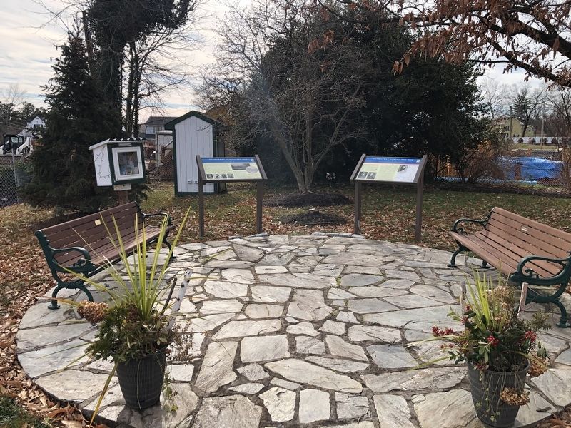
2. Two Markers Next to the Haymarket Museum
Other nearby markers. At least 8 other markers are within walking distance of this marker: A different marker also named Haymarket During the War (here, next to this marker); Colonial Roads (within shouting distance of this marker); Haymarket Post Office (within shouting distance of this marker); William Edward Ray, Sr. (about 400 feet away, measured in a direct line); In Memory of the Union Soldiers (approx. 0.2 miles away); St. Paul's, Episcopal (approx. 0.2 miles away); In This Area Are Buried (approx. 0.2 miles away); The Battle of Buckland Mills (approx. 0.9 miles away). Touch for a list and map of all markers in Haymarket.
Related markers. Click here for a list of markers that are related to this marker. To better understand the relationship, study each marker in the order shown.
Credits. This page was last revised on January 2, 2021. It was originally submitted on December 16, 2006, by J. J. Prats of Powell, Ohio. This page has been viewed 6,967 times since then and 128 times this year. Last updated on July 4, 2007, by Craig Swain of Leesburg, Virginia. Photos: 1, 2. submitted on January 2, 2021, by Devry Becker Jones of Washington, District of Columbia.
