Near Dinwiddie in Dinwiddie County, Virginia — The American South (Mid-Atlantic)
A Final Stand
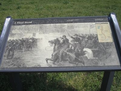
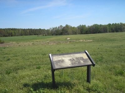
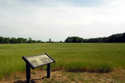
With their left at the Angle crashed and their center near the Five Forks intersection overrun, the Confederates made a final stand here, in and around Gilliam’s field. Across the open ground to your right, Brig. Gen. George Armstrong Custer led two Union cavalry brigades in a wild charge against the Confederate right flank. Southern horsemen under Maj. Gen. W.H.F. Lee held off the Federals.
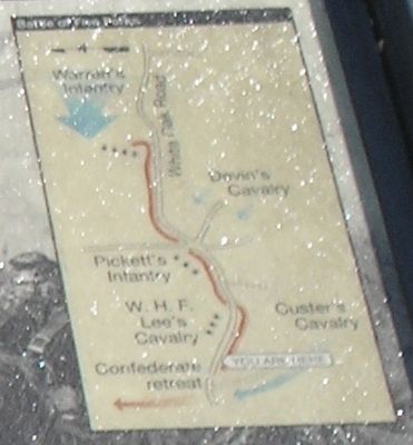
Across the road to your left, infantrymen of Brig. Gen. Montgomery Corse’s Virginia brigade struggled against an attack by Union infantry moving westward (toward you) along the White Oak Road. Though Corse’s troops were overrun, their efforts allowed Pickett’s remaining 7,000 men to escape to the north. Pickett’s survivors would not rejoin the main Confederate army until three days later at Amelia Court House.
The defeat at Five Forks forced Lee to abandon the Petersburg lines – and hence the capital at Richmond. Eight days later, caught in a vise of Union troops, Lee surrendered his army at Appomattox Court House.
Erected by Petersburg National Battlefield, National Park Service, U.S. Department of the Interior.
Topics. This historical marker is listed in these topic lists: Military • War, US Civil.
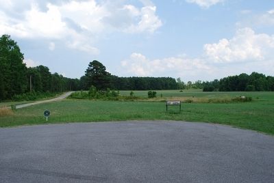
Location. 37° 8.401′ N, 77° 38.316′ W. Marker is near Dinwiddie, Virginia, in Dinwiddie County. Marker is on White Oak Road (Virginia Route 613), on the left when traveling west. The marker is in the Five Forks Unit of Petersburg National Battlefield. Touch for map. Marker is in this post office area: Dinwiddie VA 23841, United States of America. Touch for directions.
Other nearby markers. At least 8 other markers are within one mile of this marker, measured as the crow flies. Death of Pegram (approx. 0.8 miles away); "Hold Five Forks at all hazards…" (approx. 0.8 miles away); Battle of Five Forks (approx. 0.9 miles away); Five Forks Battlefield (approx. 0.9 miles away); a different marker also named The Battle of Five Forks (approx. 0.9 miles away); Crawford's Sweep (approx. one mile away); "Among my gallant officers…": (approx. one mile away); "Advanced…repulsed…charged again…" (approx. one mile away). Touch for a list and map of all markers in Dinwiddie.
More about this marker. The background of the marker includes a picture of the Union cavalry attack with the caption Custer’s cavalry attacking the Confederate right, here at Gilliam’s field.
The upper right of the marker features a map of the Confederate fortifications at Five Forks. The Union attacks and the Confederate retreat are indicated.
Also see . . .
1. Five Forks Battlefield. Wikipedia entry (Submitted on January 28, 2024, by Larry Gertner of New York, New York.)
2. Battle of Five Forks (Petersburg National Battlefield). National Park Service website entry (Submitted on January 28, 2024, by Larry Gertner of New York, New York.)
Photographed By Bill Coughlin, April 24, 2007
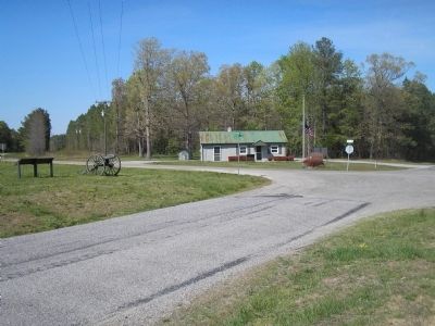
5. Five Forks Intersection
The Five Forks intersection was the objective of the Union attack on April 1, 1865. With its fall, and the subsequent fall of the South Side Railroad, Lee was forced to evacuate Petersburg and Richmond, and begin his retreat to Appomattox.
Credits. This page was last revised on January 28, 2024. It was originally submitted on March 15, 2008. This page has been viewed 1,628 times since then and 17 times this year. Last updated on August 22, 2020, by Bradley Owen of Morgantown, West Virginia. Photos: 1, 2. submitted on March 15, 2008, by Bill Coughlin of Woodland Park, New Jersey. 3. submitted on August 8, 2015, by Brandon Fletcher of Chattanooga, Tennessee. 4, 5. submitted on March 15, 2008, by Bill Coughlin of Woodland Park, New Jersey. 6. submitted on January 25, 2014, by Duane Hall of Abilene, Texas. • J. Makali Bruton was the editor who published this page.
