Near Holly Grove in Monroe County, Arkansas — The American South (West South Central)
Louisiana Territory: 1682-1800
— Louisiana Purchase Historic State Park —
Development
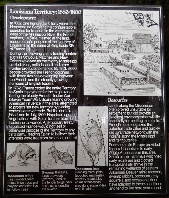
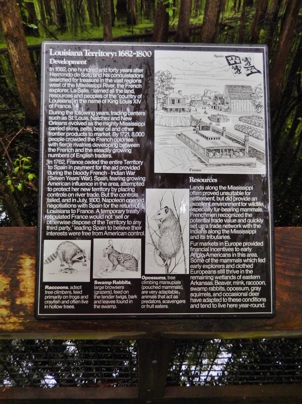
In 1682, one hundred and forty years after Hernando de Soto and his conquistadors searched for treasure in the vast regions west of the Mississippi River, the French explorer, LaSalle, claimed all the land, resources and peoples of the "country of Louisiana" in the name of King Louis XIV of France.
During the following years, trading centers such as St. Louis, Natchez and New Orleans evolved as the mighty Mississippi carried skins, pelts, bear oil and other frontier products to market. By 1721, 8,000 people crowded the French colonies with fierce rivalries developing between the French and the steadily growing numbers of English traders.
In 1762, France ceded the entire Territory to Spain in payment for the aid provided during the bloody French-Indian War (Seven Years' War). Spain, fearing growing American influence in the area, attempted to protect her new territory by placing controls on river trade. But the controls failed, and in July, 1800, Napoleon opened negotiations with Spain for the return of Louisiana to France. A temporary treaty stipulated France would not "sell or otherwise dispose of the Territory to any third party," leading Spain to believe their interests were free from American control.
Resources
Lands along the Mississippi often proved unsuitable for settlement, but did provide an excellent environment for wildlife, especially fur-bearing mammals. Frenchmen recognized the potential trade value and quickly set up a trade network with the Indians along the Mississippi and its tributaries.
Fur markets in Europe provided financial incentives to early Anglo-Americans in this area. Some of the mammals which fed early explorers and clothed Europeans still thrive in the remaining wetlands of eastern Arkansas. Beaver, mink, raccoon, swamp rabbits, opossum, gray squirrels, and occasional deer have adapted to these conditions and tend to live here year-round.
Raccoons, adept tree climbers, feed primarily on frogs and crayfish and often live in hollow trees.
Swamp Rabbits, large browsers (grazers), feed on the tender twigs, bark and leaves found in the swamp.
Opossums, tree climbing marsupials (pouched mammals), are very adaptable animals that act as predators, scavengers or fruit eaters.
Topics. This historical marker is listed in these topic lists: Colonial Era • Industry & Commerce • Settlements & Settlers • Waterways & Vessels. A significant historical year for this entry is 1682.
Location. 34° 38.699′ N, 91° 3.181′ W. Marker is near Holly Grove, Arkansas, in Monroe County. Marker can be reached from State Highway 362, 1.8 miles east
of U.S. 49. Marker is located along the swamp boardwalk in Louisiana Purchase Historic State Park. Touch for map. Marker is in this post office area: Holly Grove AR 72069, United States of America. Touch for directions.
Other nearby markers. At least 8 other markers are within walking distance of this marker. The Purchase: 1801-1803 (a few steps from this marker); The Swamp (within shouting distance of this marker); Life in the Swamp (within shouting distance of this marker); Louisiana Purchase State Park (within shouting distance of this marker); The Survey: 1815 (about 300 feet away, measured in a direct line); Two Lines Mark the Future of the United States (about 400 feet away); The Opening of the American West (about 400 feet away); Initial Point of the Louisiana Purchase Survey (about 400 feet away). Touch for a list and map of all markers in Holly Grove.
Related markers. Click here for a list of markers that are related to this marker. Louisiana Purchase Historic State Park
Also see . . .
1. Treaty of Fontainebleau (1762) (Wikipedia). The Treaty of Fontainebleau was a secret agreement of 1762 in which France ceded Louisiana to Spain. The treaty followed the last battle in the French and Indian War in North America. This agreement covered all of Louisiana: the entire valley of the Mississippi River, from the Appalachians to the Rockies. (Submitted on August 25, 2020, by Cosmos Mariner of Cape Canaveral, Florida.)
2. Third Treaty of San Ildefonso (Wikipedia)
. The Third Treaty of San Ildefonso was a secret agreement signed on 1 October 1800 between the Spanish Empire and the French Republic by which Spain agreed in principle to exchange its North American colony of Louisiana for territories in Tuscany. (Submitted on August 25, 2020, by Cosmos Mariner of Cape Canaveral, Florida.)
3. Treaty of Aranjuez (1801) (Wikipedia). The Treaty of Aranjuez was agreed on 21 March 1801 by France and Spain. It confirmed the terms of the secret Third Treaty of San Ildefonso dated 1 October 1800 in which Spain had agreed to exchange its North American colony of Spanish Louisiana in exchange for territories in Tuscany. (Submitted on August 25, 2020, by Cosmos Mariner of Cape Canaveral, Florida.)
4. Louisiana Purchase. The Spanish reminded the French that their treaty expressly forbade France from alienating the territory to any third party, but Napoleon didn't care and the Spanish were in no position to assert their rights. (Submitted on August 25, 2020, by Cosmos Mariner of Cape Canaveral, Florida.)
Credits. This page was last revised on August 26, 2020. It was originally submitted on August 23, 2020, by Cosmos Mariner of Cape Canaveral, Florida. This page has been viewed 379 times since then and 36 times this year. Photos: 1, 2, 3. submitted on August 24, 2020, by Cosmos Mariner of Cape Canaveral, Florida.


