Near Holly Grove in Monroe County, Arkansas — The American South (West South Central)
The Survey: 1815
— Louisiana Purchase Historic State Park —
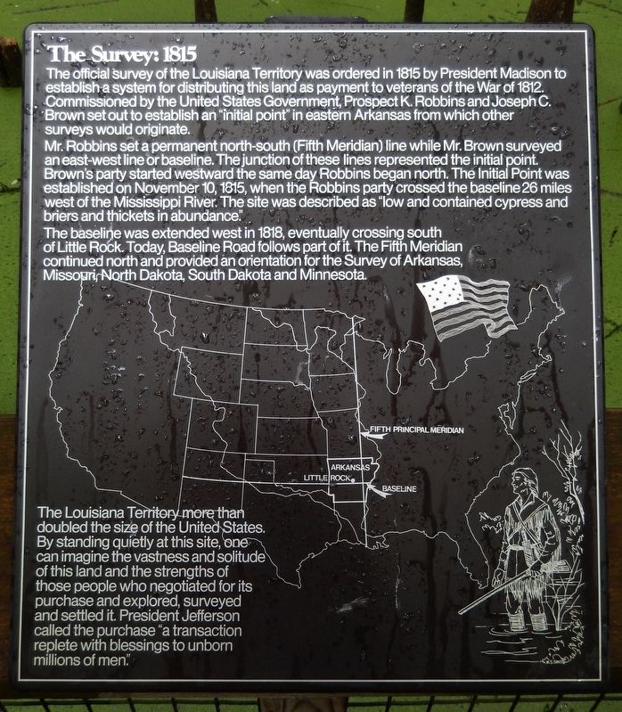
The official Survey of the Louisiana Territory was ordered in 1815 by President Madison to establish a system for distributing this land as payment to veterans of the War of 1812. Commissioned by the United States Government, Prospect K. Robbins and Joseph C. Brown set out to establish an "initial point" in eastern Arkansas from which other surveys would originate.
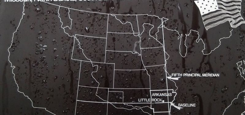
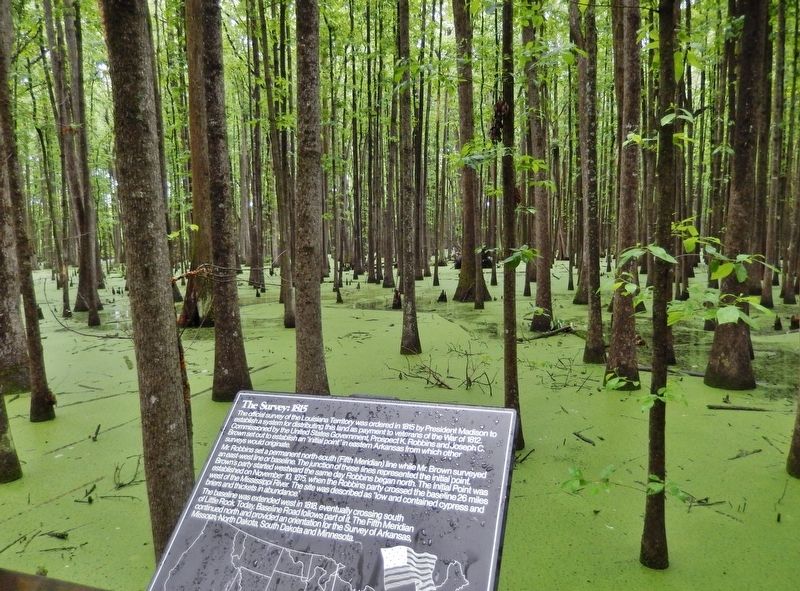
Mr. Robbins set a permanent north-south (Fifth Meridian) line while Mr. Brown surveyed an east-west line or baseline. The junction of these lines represented the initial point. Brown's party started westward the same day Robbins began north. The Initial Point was established on November 10, 1815, when the Robbins party crossed the baseline 26 miles west of the Mississippi River. The site was described as "low and contained cypress and briers and thickets in abundance."
The baseline was extended west in 1818, eventually crossing south of Little Rock. Today, Baseline Road follows part of it. The Fifth Meridian continued north and provided an orientation for the Survey of Arkansas, Missouri, North Dakota, South Dakota and Minnesota.
The Louisiana Territory more than doubled the size of the United States. By standing quietly at this site, one can imagine the vastness and solitude of this land and the strengths of those people who negotiated for its purchase and explored, surveyed and settled it. President Jefferson called the purchase "a transaction replete with blessings to unborn millions of men."
Topics. This historical marker is listed in these topic lists: Exploration • Parks & Recreational Areas • Settlements & Settlers. A significant historical date for this entry is November 10, 1815.
Location. 34° 38.726′ N, 91° 3.124′ W. Marker is near Holly Grove, Arkansas, in Monroe County. Marker can be reached from State Highway 362, 1.8 miles east of U.S. 49. Marker is located along the swamp boardwalk in Louisiana Purchase Historic State Park. Touch for map. Marker is in this post office area: Holly Grove AR 72069, United States of America. Touch for directions.
Other nearby markers. At least 8 other markers are within walking distance of this marker. Two Lines Mark the Future of the United States (within shouting distance of this marker); Initial Point of the Louisiana Purchase Survey (within shouting distance of this marker); The Opening of the American West (within shouting distance of this marker); Life in the Swamp (about 300 feet away, measured in a direct line); The Purchase: 1801-1803 (about 300 feet away); Louisiana Territory: 1682-1800 (about 300 feet away); The Swamp (about 400 feet away); Louisiana Purchase State Park (about 400 feet away). Touch for a list and map of all markers in Holly Grove.
Related markers. Click here for a list of markers that are related to this marker. Louisiana Purchase Historic State Park
Also see . . .
1. Louisiana Purchase Survey. Encyclopedia of Arkansas website entry:
During this time period, surveying land was exceptionally difficult work. Using only a compass and a chain, surveyors made their way through the wilderness, stopping every half mile to mark or “blaze” a tree. They carried all of their provisions with them for a task that lasted several months. In the vast wilderness of the Arkansas Delta where Robbins and Brown worked, the only signs of life were scattered Indian and animal trails. (Submitted on August 25, 2020, by Cosmos Mariner of Cape Canaveral, Florida.)
2. Initial Point of the 5th Principal Meridian. American Surveyor website entry:
On October 27, Brown commenced surveying the base line west from the mouth of the St Francis River. On the same day, Robbins commenced surveying the 5th P.M. north from the mouth of the Arkansas River. Brown reached the yet to be located point on November 2 and continued some 13 miles to the west. Robbins intersected Brown’s base line survey on November 10. (Submitted on August 26, 2020, by Cosmos Mariner of Cape Canaveral, Florida.)
Credits. This page was last revised on May 19, 2023. It was originally submitted on August 23, 2020, by Cosmos Mariner of Cape Canaveral, Florida. This page has been viewed 961 times since then and 119 times this year. Photos: 1, 2, 3. submitted on August 25, 2020, by Cosmos Mariner of Cape Canaveral, Florida.


