Jilotepec de Enríquez in Jilotepec de Abasolo, Mexico State, Mexico — The Central Highlands (North America)
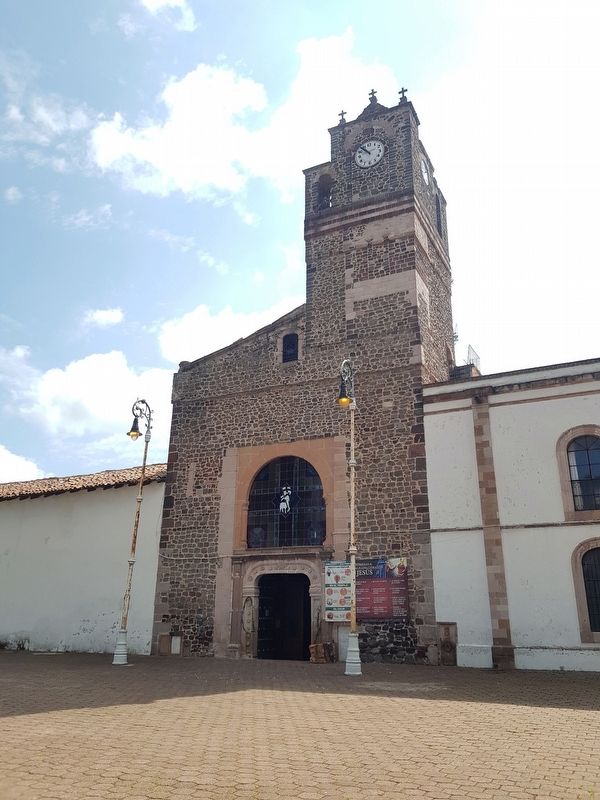
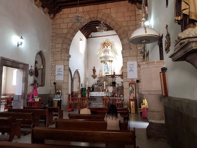
Convent and Church of San Pedro and San Pablo
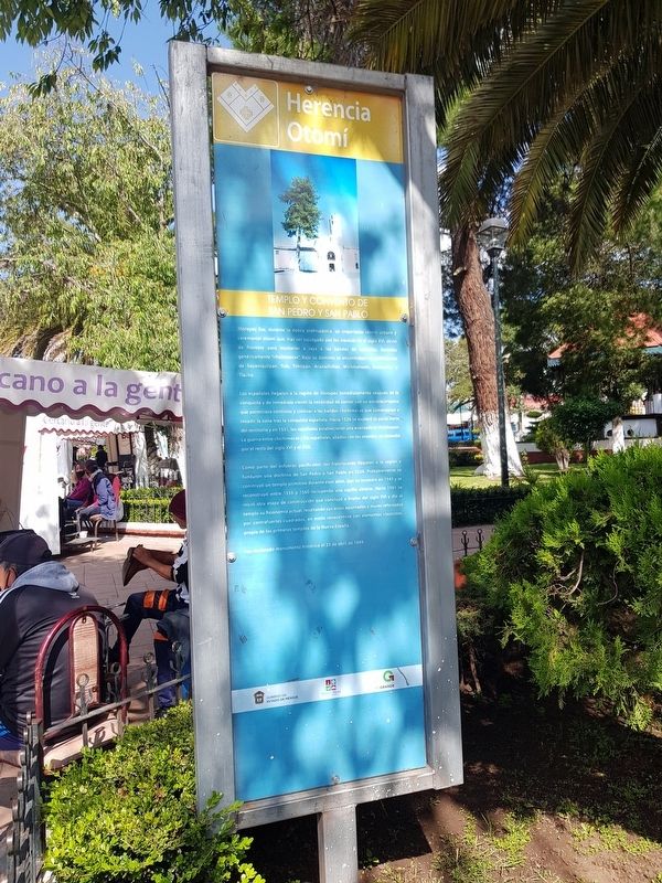
Herencia Otomí
Inscription.
Jilotepec fue, durante la época prehispánica, un importante centro urbano y ceremonial otomí que, tras ser sojuzgado por los mexicas en el siglo XVI, sirvió de frontera para mantener a raya a las bandas de nómadas, llamadas genéricamente "chichimecas". Bajo su dominio se encontraban las poblaciones de Soyaniquilpan, Tula, Timilpan, Acazuchitlan, Michmaloyan, Tecozautla y Tlacho.
Los españoles llegaron a la región de Jilotepec inmediatamente después de la conquista y de inmediato vieron la necesidad de contar con un establecimiento que permitiera controlar y civilizar a las bandas chichimecas que comenzaron a invadir la zona tras la conquista española. Hacia 1526 se exploró la parte norte del territorio y en 1531, los espanoles establecieron una avanzada en Huichapan. La guerra entre chichimecas y los españoles, aliados con los otomies, extendió por el resto del siglo XVI y el XVII.
Como parte del esfuerzo pacificador, los franciscanos llegaron a la región y fundaron una doctrina de San Pedro y San Pablo en 1529. Probablemente se construyó un templo primitivo durante esos años, que se incendió en 1545 y se reconstruyó entre 1555 y 1560 incluyendo una capilla abierta. Hacia 1561 se inició otra etapa de construcción que concluyó a finales del siglo XVI y dio al templo su fisionomia actual, resaltando sus arcos apuntados y muros reforzados por contrafuertes cuadrados, en estilo renacentista con elementos clasicistas, propia de los primeros templos de la Nueva España.
Fue declarado monumento histórico el 23 de abril de 1949.
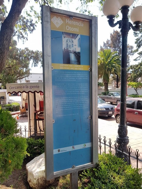
Convent and Church of San Pedro and San Pablo
Jilotepec was during the prehispanic era, a major otomí urban and ceremonial center which, after being subdued by the mexicas in the XVIth century, served as a border to keep out nomadic bands, generically called "chichimecas". Under their rule the villages of Soyaniquilpan, Tula, Timilpan. Acazuchitlan, Michmaloyan, Tecozautla and Tlacho were found.
The Spanish arrived in the region of Jilotepec immediately after the conquest and soon saw the need for a facility that would allow controlling and civilizing the chichimecas who began to invade the area after the Spanish conquest. By 1526 the northern part of the territory was explored and in 1531, the Spanish established an outpost on Huichapan. The war between the Spanish and the chichimecas, otomí allies, spread to the rest XVIth and XVIIth centuries.
As part of the peacekeeping effort, the Franciscans arrived in the region and established a doctrine of St. Peter and St. Paul in 1529. Probably a primitive church was raised during those years, which caught fire in 1545 and rebuilt between 1550 and 1560 including an open chapel. By 1561 another stage of construction was completed late in the XVIth century and gave the church its current physiognomy, highlighting its pointed arches and walls reinforced by square buttresses, in a Renaissance style, typical of the first churches in the New Spain.
It was declared a historic monument on April 23, 1949.
Erected by Gobierno del Estado de México.
Topics. This historical marker is listed in these topic lists: Churches & Religion • Colonial Era • Native Americans. A significant historical date for this entry is April 23, 1949.
Location. 19° 57.132′ N, 99° 31.968′ W. Marker is in Jilotepec de Enríquez, Estado de Mexico (Mexico State), in Jilotepec de Abasolo. Marker is on Benito Juárez just west of M.A. Camacho, on the right when traveling west. Touch for map. Marker is in this post office area: Jilotepec de Enríquez MEX 54240, Mexico. Touch for directions.
Other nearby markers. At least 8 other markers are within walking distance of this marker. Andrés Molina Enríquez (a few steps from this marker); Benito Juárez Memorial (within shouting distance of this marker); Jilotepec (within shouting distance of
this marker); Famous Sons of Jilotepec (within shouting distance of this marker); Camino Real de Tierra Adentro (within shouting distance of this marker); Municipality of Jilotepec (within shouting distance of this marker); Franciscan Chapel and Monastery (about 120 meters away, measured in a direct line); The Doendó Cross (about 120 meters away). Touch for a list and map of all markers in Jilotepec de Enríquez.
Credits. This page was last revised on August 26, 2020. It was originally submitted on August 25, 2020, by J. Makali Bruton of Accra, Ghana. This page has been viewed 87 times since then and 12 times this year. Photos: 1, 2, 3, 4, 5, 6. submitted on August 25, 2020, by J. Makali Bruton of Accra, Ghana.
