Pacifica in San Mateo County, California — The American West (Pacific Coastal)
Mori's Point Inn
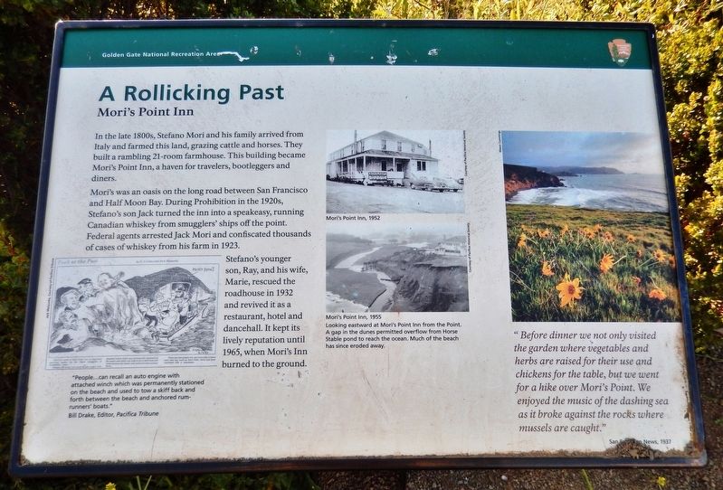
A Rollicking Past
— Golden Gate National Recreation Area —
Mori's was an oasis on the long road between San Francisco and Half Moon Bay. During Prohibition in the 1920s, Stefano's son Jack turned the inn into a speakeasy, running Canadian whiskey from smugglers' ships off the point. Federal agents arrested Jack Mori and confiscated thousands of cases of whiskey from his farm in 1923.
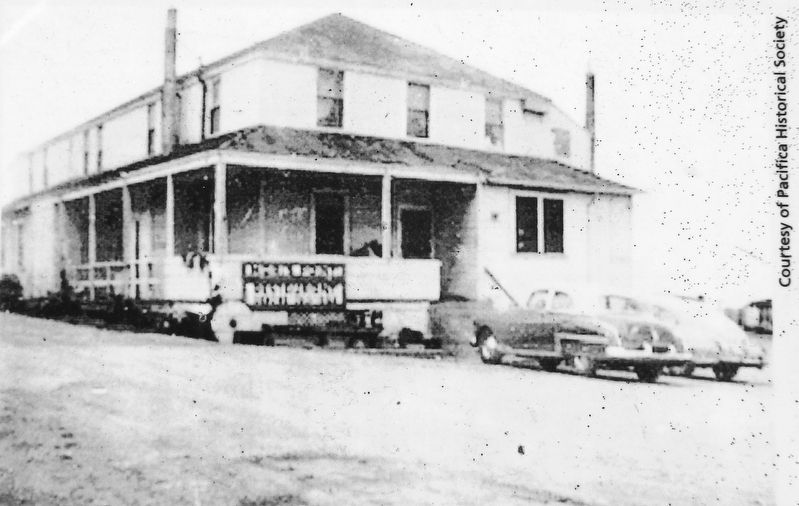
Stefano's younger son, Ray, and his wife, Marie, rescued the roadhouse in 1932 and revived it as a restaurant, hotel and dancehall. It kept its lively reputation until 1965, when Mori's Inn burned to the ground.
"Before dinner we not only visited the garden where vegetables and herbs are raised for their use and chickens for the table, but we went for a hike over Mori's Point. We enjoyed the music of the dashing sea as it broke against the rocks where mussels are caught."
—San Francisco News, 1937
Erected by National Park Service, U.S. Department of the Interior.
Topics. This historical marker is listed in these topic lists: Industry & Commerce • Law Enforcement • Parks & Recreational Areas • Settlements & Settlers.
Location. 37° 37.215′ N, 122° 29.575′ W. Marker is in Pacifica, California, in San Mateo County. Marker can be reached from Mori Point Road, 0.1 miles west of Cabrillo Highway (State Highway 1). Marker is located along the Mori Point Trail, about 1/3 mile west of the Mori Point Road trailhead and parking lot. Touch for map. Marker is in this post office area: Pacifica CA 94044, United States of America. Touch for directions.
Other nearby markers. At least 8 other markers are within 3 miles of this marker, measured as the crow flies. The Enduring Aramai (within shouting distance of this marker); Charles Gust 1888-1969 (approx. 0.8 miles away); The Little Brown Church (approx. one mile away); Discovery of San Francisco Bay (approx. 1½ miles away); Rev. Wojciech Adalbert Gluszek (approx. 1½ miles away); Captain Don Gaspar de Portolà (approx. 1.6 miles away); Sanchez Adobe (approx. 2.3 miles away); Open Spaces and Wild Places (approx. 2.6 miles away). Touch for a list and map of all markers in Pacifica.
Also see . . .
1. Mori Point History. In the 1700s, the Spanish mined a nearby limestone quarry to supply whitewash
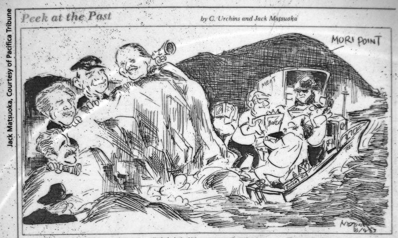
Joe Matsuoka, Courtesy of Pacifica Tribune
2. Marker detail: Peek at the Past
by C. Urchins and Jack Matsuoka
by C. Urchins and Jack Matsuoka
The cove north of Mori Point was an important receiving station for the liquor smugglers of Prohibition years.
People… can recall an auto engine with attached winch which was permanently stationed on the beach and which was used to tow a skiff back and forth between the beach and anchored rum-runners' boats.
There are also people who can remember a horse barn with hay mow on Mori Point which had been converted into a warehouse.
—Bill Drake, Editor, Pacifica Tribune
2. Mori Point (Wikipedia). Rocks from the limestone quarry were used as track ballast for the Ocean Shore Railroad and to rebuild San Francisco after the 1906 earthquake. Highway 1, which divides Mori Point from Sweeney Ridge, occupies a cut first intended to accommodate the Ocean Shore Railroad. (Submitted on August 28, 2020, by Cosmos Mariner of Cape Canaveral, Florida.)
Credits. This page was last revised on August 28, 2020. It was originally submitted on August 27, 2020, by Cosmos Mariner of Cape Canaveral, Florida. This page has been viewed 791 times since then and 133 times this year. Photos: 1, 2, 3, 4, 5, 6. submitted on August 28, 2020, by Cosmos Mariner of Cape Canaveral, Florida.
