Near High Springs in Columbia County, Florida — The American South (South Atlantic)
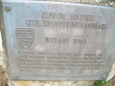
Bellamy Road
Florida Historic Civil Engineering Landmark
Erected 1929 by Florida Section, American Society of Civil Engineers.
Topics and series. This historical marker is listed in these topic lists: Bridges & Viaducts • Roads & Vehicles. In addition, it is included in the ASCE Civil Engineering Landmarks series list. A significant historical year for this entry is 1824.
Location. 29° 54.865′ N, 82° 34.789′ W. Marker is near High Springs, Florida, in Columbia County. Marker can be reached from Oleno Park Road near U.S. 441. Touch for map. Marker is at or near this postal address: 410 SE Oleno Park Road, High Springs FL 32643, United States of America. Touch for directions.
Other nearby markers. At least 8 other markers are within 4 miles of this marker, measured as the crow flies. Town of Leno (a few steps from this marker); Civilian Conservation Corps (within shouting distance of this marker); "CCC Boy" Statue (within shouting distance of this marker); Fear Stricken (about 300 feet away, measured in a direct line); 1824 - The Bellamy Road - 1952 (approx. 3.6 miles away); William Henry Traxler (approx. 4 miles away); Springhill Methodist Church/Traxler, Fla. (approx. 4 miles away); Spring Hill United Methodist Church / Bellamy Road (approx. 4 miles away). Touch for a list and map of all markers in High Springs.
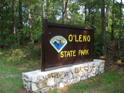
More about this marker. It is in O'Leno State Park, near the east side of the suspension bridge built by the CCC in the 1930s (still functional).
Credits. This page was last revised on September 5, 2020. It was originally submitted on October 31, 2007, by Julie Szabo of Oldsmar, Florida. This page has been viewed 3,024 times since then and 76 times this year. Last updated on August 28, 2020, by Craig Baker of Sylmar, California. Photos: 1, 2. submitted on October 31, 2007, by Julie Szabo of Oldsmar, Florida. • Bernard Fisher was the editor who published this page.
Editor’s want-list for this marker. A wide view photo of the marker and the surrounding area together in context. • Can you help?

