Downtown Los Angeles in Los Angeles County, California — The American West (Pacific Coastal)
Route of the Settlers of Los Angeles
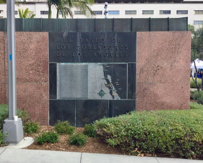
El Paseo de Los Pobladores de Los Angeles
Photographed by Craig Baker, April 19, 2018
1. Settlers of Los Angeles Marker
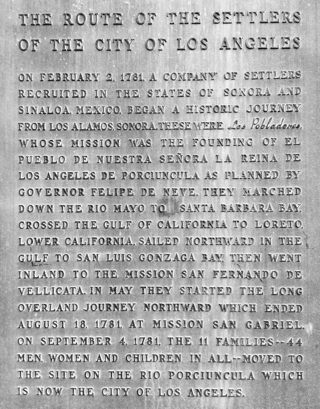
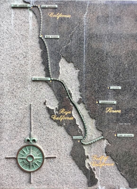
On February 2, 1781, a company of settlers recruited in the states of Sonora and Sinaloa, Mexico, began a historic journey from Los Alamos, Sonora. These were Los Pobladores, whose mission was the founding of El Pueblo de Nuestra Señora la Reina de los Angeles de Porciuncula as planned by governor Felipe de Neve. They marched down the Rio Mayo to Santa Barbara Bay, crossed the Gulf of California to Loreto, Lower California, sailed northward in the gulf to San Luis Gonzaga Bay, then went inland to the Mission San Fernando de Vellicata. In May they started the long overland journey northward which ended August 18, 1781, at Mission San Gabriel. On September 4, 1781, the 11 families — 44 men, women, and children in all — moved to the site on the Rio Porciuncula which is now the city of Los Angeles.
Erected 1965 by County of Los Angeles.
Topics. This historical marker is listed in these topic lists: Hispanic Americans • Settlements & Settlers.
Location. 34° 3.366′ N, 118° 14.818′ W. Marker is in Los Angeles, California, in Los Angeles County. It is in Downtown Los Angeles. It can be reached from Grand Avenue north of First Street. Located in Grand Park, near the fountain. Touch for map. Marker is at or near this postal address: 133 N Grand Ave, Los Angeles CA 90012, United States of America. Touch for directions.

Regionally, this marker is in the Transverse
this page online
Other nearby markers. At least 8 other markers are within walking distance of this marker: Christopher Columbus (within shouting distance of this marker); a different marker also named Route of the Settlers of Los Angeles (within shouting distance of this marker); Vietnam Memorial (about 800 feet away, measured in a direct line); Department of Water and Power (approx. 0.2 miles away); Los Angeles Times (approx. ¼ mile away); Los Angeles City Hall (approx. ¼ mile away); The Lindbergh Beacon (approx. ¼ mile away); Temple Street Grade Separation (approx. ¼ mile away). Touch for a list and map of all markers in Los Angeles.
More about this marker. Rio Porciuncula, cited on the marker’s inscription, is today’s Los Angeles River.
This marker faces south, and an identical marker 200 feet away faces north.
Also see . . .
1. The Settlement of Los Angeles. Los Angeles Almanac website entry (Submitted on June 22, 2018.)
2. Los Angeles Pobladores. Wikipedia entry:
When the Governor of Las Californias, Felipe de Neve, was assigned to establish secular settlements in what is now the state of California (after more(Submitted on August 29, 2020.)than a decade of missionary work among the natives), he commissioned a complete set of maps and plans (the Reglamento para el gobierno de la Provincia de Californias and the Instrucción) to be drawn up for the design and colonization of the new pueblo. Finding the individuals to actually do the work of building and living in the city proved to be a more daunting task. Neve finally located the new and willing dwellers in Sonora and Sinaloa, Mexico. But gathering the pobladores was a little more difficult. The original party of the new townsfolk consisted of eleven families, that is 11 men, 11 women, and 22 children of various Spanish castas (castes).Photographed by Craig Baker, April 19, 20182. Settlers of Los Angeles Marker
3. The First Map of Los Angeles May Be Older Than You Think. 2013 article by Nathan Masters for KCET’s “Lost LA” website. Excerpt:
To induce the original settlers of Los Angeles to leave their homes in Sonora and Sinaloa for an uncertain future in far-off Alta California, the Spanish authorities offered several enticements. Governor Felipe de Neve described these benefits in his 1779 Reglamento, an early planning document that prescribed the town's layout and administration in detail. Upon arrival, settlers would receive livestock and an annual salary. They would also be granted—provisionally at first—several parcels of land: one house lot, two irrigated farm lots, and two dry farm lots. After five years, if they remained pobladores in good(Submitted on August 29, 2020.)standing, the parcels would become theirs permanently.Photographed by Craig Baker, April 19, 20183. Route Map
Painting by Millard Sheets. In the the J.J. Prats magazine collection. (fair use), September 1931
4. “The Founding of Los Angeles” by Millard Sheets
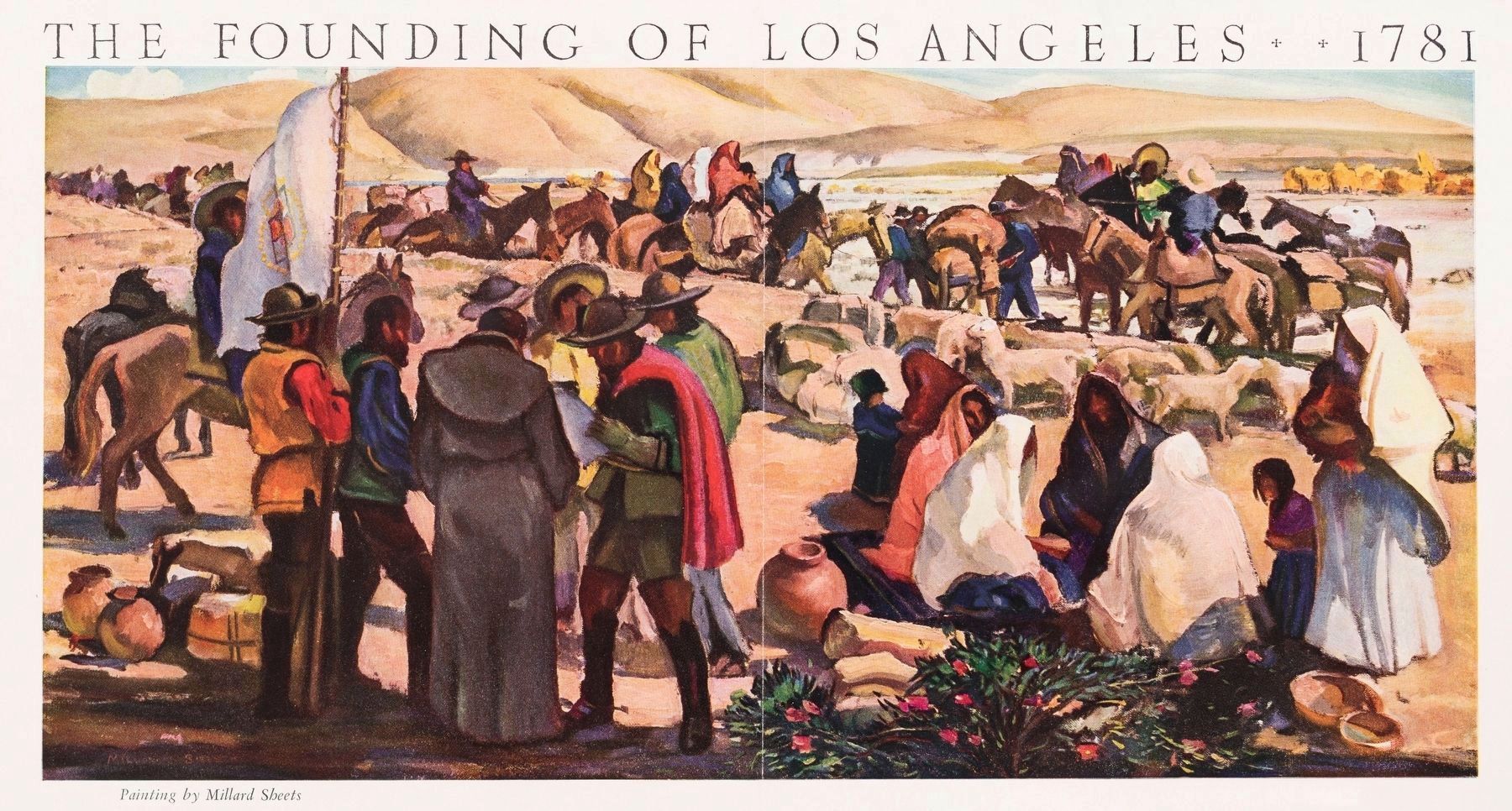
This digital image is a photograph of a chromolithograph created by an uncredited lithograph artist employed by Touring Topics magazine. The artist copied Millard Sheets’ 32½ x 16 inch oil painting manually by sight, color-by-color, onto lithograph plates that were then used to print the image you see here for the supplement included with the magazine’s September 1931 issue. The painting was likely commissioned by the magazine, retained by Mr. Sheets, and last sold at private auction in 1990, the year after he died.
The supplement is a sheet of paper 16¼ x 11¾ inches, printed on one side only and folded in half to tuck into the magazine after it was bound. The painting took up 14½ x 7½ inches of it and below it was printed a 14-stanza poem, a ballad by John Russell McCarthy, and the legend “Supplement to Touring Topics, September, 1931. Phil Townsend Hanna, Editor.”
The supplement illustrates an article in this issue, written by Mr. Hanna, titled “Our Lady in the Beginning: The story of the foundation and the original settlers—all that is known of a certainty—of El Pueblo de Nuestra Señora, la Reina de los Angeles.” The article is illustrated with line drawings by Maynard Dixon and includes a pictorial map by Dillon Lauritzen.
A black-and-white digital image of this same chromolithograph is circulating on the internet credited as a copy of a mural. There are a number murals depicting the Founding of Los Angeles at various venues in the city, but this is not one of them.
The supplement is a sheet of paper 16¼ x 11¾ inches, printed on one side only and folded in half to tuck into the magazine after it was bound. The painting took up 14½ x 7½ inches of it and below it was printed a 14-stanza poem, a ballad by John Russell McCarthy, and the legend “Supplement to Touring Topics, September, 1931. Phil Townsend Hanna, Editor.”
The supplement illustrates an article in this issue, written by Mr. Hanna, titled “Our Lady in the Beginning: The story of the foundation and the original settlers—all that is known of a certainty—of El Pueblo de Nuestra Señora, la Reina de los Angeles.” The article is illustrated with line drawings by Maynard Dixon and includes a pictorial map by Dillon Lauritzen.
A black-and-white digital image of this same chromolithograph is circulating on the internet credited as a copy of a mural. There are a number murals depicting the Founding of Los Angeles at various venues in the city, but this is not one of them.
Credits. This page was last revised on July 7, 2024. It was originally submitted on June 22, 2018. This page has been viewed 3,873 times since then and 165 times this year. Last updated on August 30, 2020, by Craig Baker of Sylmar, California. Photos: 1, 2, 3. submitted on June 22, 2018, by Craig Baker of Sylmar, California. 4. submitted on December 2, 2023, by J. J. Prats of Powell, Ohio. • J. Makali Bruton was the editor who published this page.
