Saint Anthony Main in Minneapolis in Hennepin County, Minnesota — The American Midwest (Upper Plains)
Power on the East Side
— Saint Anthony Falls Heritage Trail —
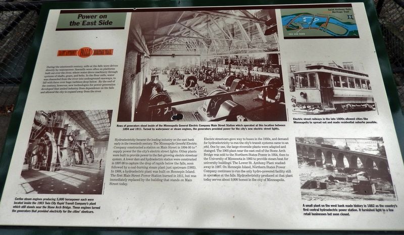
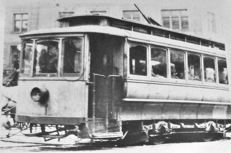
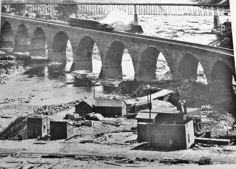
Hydroelectricity became the leading industry on the east bank early in the twentieth century. The Minneapolis General Electric Company constructed a station on Main Street in 1894-95 to supply power for the city's electric street lights. Other plants were built to provide power to the fast-growing electric streetcar system. A lower dam and hydroelectric station were constructed in 1897-98 to capture the drop of rapids below the falls, soon followed by a coal-burning steam plant just upstream (1903). In 1908, a hydroelectric plant was built on Hennepin Island. The first Main Street Power Station burned in 1911, but was immediately replaced by the building that stands on Main Street today.
Electric streetcars gave way to buses in the 1950s, and demand for hydroelectricity to run the city's transit systems came to an end. One by one, the large riverside plants were adapted and changed. The 1903 plant near the east end of the Stone Arch Bridge was sold to the Northern States Power in 1954, then to the University of Minnesota in 1983 to provide steam heat for university buildings. The Lower St. Anthony Plant washed away in 1987. On Hennepin Island, Northern States Power Company continues to run the only hydro-powered facility still in operation at the falls. Hydroelectricity produced at that plant today serves about 9,000 homes in the city of Minneapolis.
Erected by St. Anthony Falls Heritage Board.
Topics. This historical marker is listed in these topic lists: Industry & Commerce • Railroads & Streetcars • Waterways & Vessels.
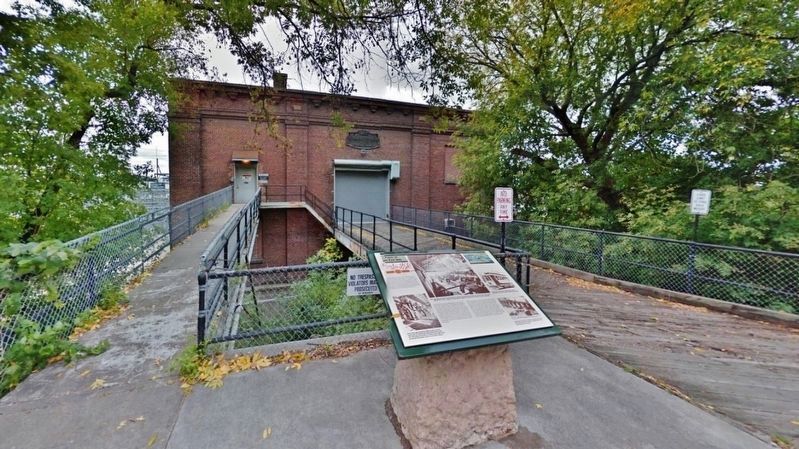
Location. 44° 59.038′ N, 93° 15.263′ W. Marker is in Minneapolis, Minnesota, in Hennepin County. It is in Saint Anthony Main. Marker is on Southeast Main Street west of Southeast 3rd Avenue, on the left when traveling west. Marker is located beside the sidewalk, directly in front of the St. Anthony Falls Hydro Project Office. Touch for map. Marker is at or near this postal address: 206 Southeast Main Street, Minneapolis MN 55414, United States of America. Touch for directions.
Other nearby markers. At least 8 other markers are within walking distance of this marker. Harnessing Waterpower (within shouting distance of this marker); Electricity and Minneapolis
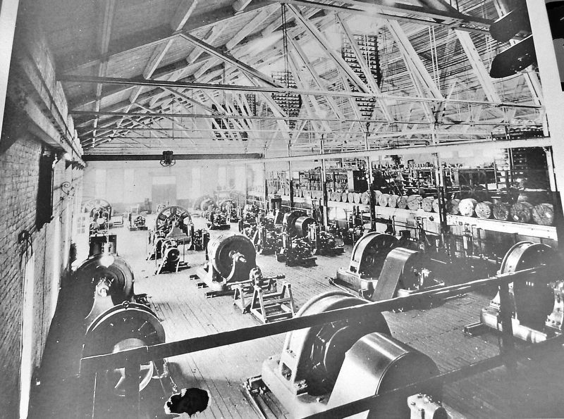
Minnesota Historical Society
2. Marker detail: Main Street Station
Rows of generators stood inside of the Minneapolis General Electric Company Main Street Station which operated at this location between 1894 and 1911. Turned by waterpower or steam engines, the generators provided power for the city's new electric street lights.
Also see . . .
1. St. Anthony Falls Hydroelectric Development (Wikipedia). St. Anthony Falls in Minneapolis, Minnesota, is the only natural falls on the Mississippi River. Since almost the beginning of settlement in the area by European descendants, the St. Anthony Falls have been used for waterpower. Hydroelectric production started very early in 1881, and the companies that owned the waterpower rights encouraged or developed three early major hydroelectric plants 1894/1911, 1895 and 1908. One of the historic St. Anthony Falls plants is still
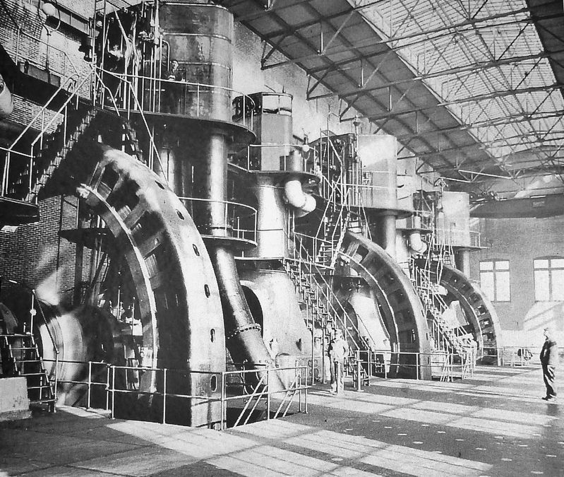
Northern States Power
3. Marker detail: Corliss Steam Engines
Corliss steam engines producing 5,000 horsepower each were located inside the 1903 Twin City Rapid Transit Company's plant which still stands near the Stone Arch Bridge. These engines turned the generators that provided electricity for the cities' streetcars.
2. Hydroelectricity in Minneapolis, September 5, 1882. Minnesota Brush Electric Company built its first power station on Upton Island, just below St. Anthony Falls in the Mississippi River. On September 5, 1882, the Upton Island station produced the first centralized hydroelectric power in the nation. The station had five generator-like Brush machines connected to a waterwheel that sent power to overhead wires installed along Washington Avenue. Power moved through the wires and on to customers, including shops and saloons on Washington Avenue. (Submitted on August 31, 2020, by Cosmos Mariner of Cape Canaveral, Florida.)
Credits. This page was last revised on February 12, 2023. It was originally submitted on August 31, 2020, by Cosmos Mariner of Cape Canaveral, Florida. This page has been viewed 284 times since then and 48 times this year. Photos: 1, 2, 3, 4, 5, 6. submitted on August 31, 2020, by Cosmos Mariner of Cape Canaveral, Florida.
