St. Francis in Milwaukee County, Wisconsin — The American Midwest (Great Lakes)
Lake Protestant Cemetery
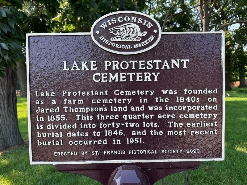
Photographed by J.T. Lambrou
1. Lake Protestant Cemetery Marker
Erected 2020 by St. Francis Wisconsin Historical Society. (Marker Number 587.)
Topics and series. This historical marker is listed in this topic list: Cemeteries & Burial Sites. In addition, it is included in the Wisconsin Historical Society series list. A significant historical year for this entry is 1855.
Location. 42° 58.304′ N, 87° 52.212′ W. Marker is in St. Francis, Wisconsin, in Milwaukee County. It is at the intersection of East Norwich Avenue and South Barland Avenue, on the right when traveling east on East Norwich Avenue. Touch for map. Marker is in this post office area: Saint Francis WI 53235, United States of America. Touch for directions.

Regionally, this marker is in Southeast Wisconsin and in Greater Milwaukee. It is also in the American Midwest and in the Corn Belt. Globally, it is in North America, on the Great Lakes, in the
this page online
Other nearby markers. At least 8 other markers are within 3 miles of this marker, measured as the crow flies: A different marker also named Lake Protestant Cemetery (here, next to this marker); a different marker also named Lake Protestant Cemetery (here, next to this marker); Lakeside Power Plant (approx. 0.7 miles away); General Mitchell Field (approx. 1.6 miles away); Bay View's Rolling Mill (approx. 2.2 miles away); Navigation Buoy (approx. 2.4 miles away); Town of Lake (approx. 2½ miles away); Johanna Brotch: Female Ship Owner (approx. 2.7 miles away).
Photographed by Fitzie Heimdahl, July 31, 2020
2. Lake Protestant Cemetery Marker
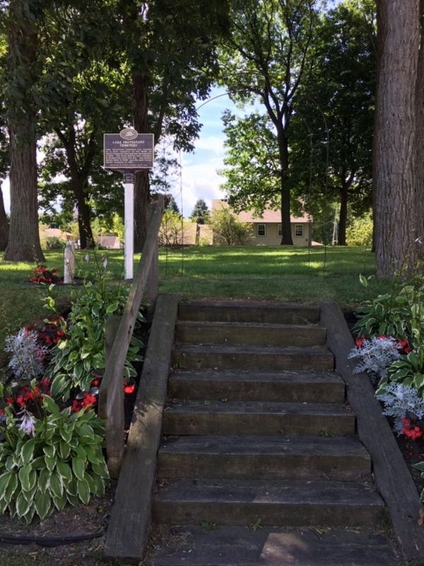
Photographed by Fitzie Heimdahl, July 31, 2020
3. Lake Protestant Cemetery Marker
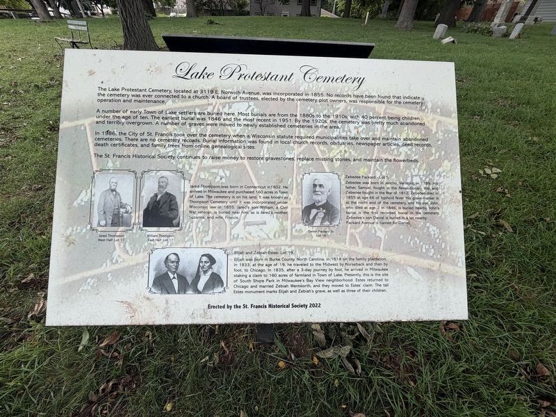
Photographed by Eric Kuntz, September 13, 2026
4. Lake Protestant Cemetery Marker
Additional cemetery details on informational plague #1 near marker
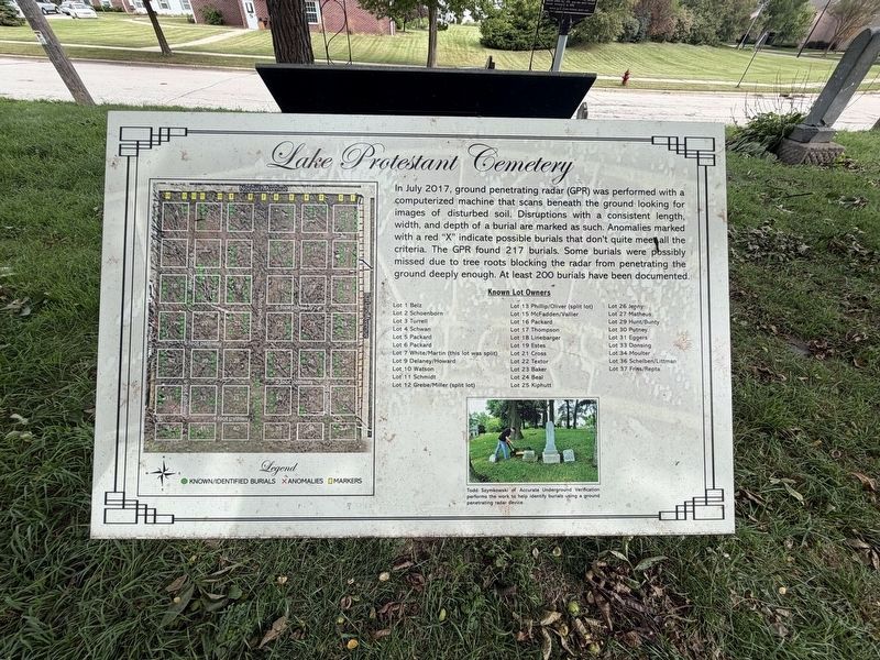
Photographed by Eric Kuntz, September 13, 2026
5. Lake Protestant Cemetery Marker
Additional cemetery details on informational plaque #2 near marker
Photographed by Eric Kuntz, September 13, 2026
6. Lake Protestant Cemetery Marker
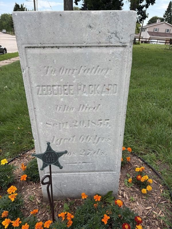
Zebedee Packard gravestone near marker
Credits. This page was last revised on September 16, 2026. It was originally submitted on August 31, 2020, by Fitzie Heimdahl of Eau Claire, Wisconsin. This page has been viewed 1,023 times since then and 62 times this year. Photos: 1. submitted on August 19, 2024, by J.T. Lambrou of New Boston, Michigan. 2, 3. submitted on August 31, 2020, by Fitzie Heimdahl of Eau Claire, Wisconsin. 4, 5, 6. submitted on September 14, 2026, by Eric Kuntz of Beaver Dam, Wisconsin. • Mark Hilton was the editor who published this page.
