Near Petersburg in Dinwiddie County, Virginia — The American South (Mid-Atlantic)
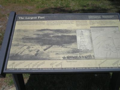
The Largest Fort
Photographed by Bill Coughlin, April 24, 2007
1. The Largest Fort Marker
“When the signal sounded the entire Corps, notwithstanding the orders to keep silent, sent up a mighty cheer and then dashed forward into the fog.”
- Lt. Col. Elisha H. Rhodes, 2nd R.I. April 2, 1865
Erected by Petersburg National Battlefield - National Park Service - Department of the Interior.
Topics. This historical marker is listed in these topic lists: Forts and Castles • War, US Civil. A significant historical date for this entry is April 2, 1885.
Location. 37° 10.454′ N, 77° 27.218′ W. Marker is near Petersburg, Virginia, in Dinwiddie County. It is at the intersection of Church Road and Church Road, on the right when traveling west on Church Road. Marker is in Petersburg National Battlefield along the Siege Line Tour. Touch for map. Marker is at or near this postal
this page online

Regionally, this marker is in the Piedmont, in Southside Virginia, and specifically in Central Virginia. It is also in the American South and specifically in the Upper South. Globally, it is in North America, the Western Hemisphere, the Western World, and the Anglosphere. Historically, it finds itself in what was once the territory of the Mississippian Culture, one of the original Thirteen Colonies, one of the Confederate States of America, and the Antebellum South.
Other nearby markers. At least 8 other markers are within walking distance of this marker: Siege of Petersburg—Grant's Fifth Offensive (within shouting distance of this marker); Petersburg Battlefields (about 500 feet away, measured in a direct line); a different marker also named Petersburg Battlefields (approx. ¼ mile away); Life Between the Picket Lines (approx. 0.3 miles away); Contested Ground (approx. 0.4 miles away); a different marker also named Petersburg Battlefields (approx. 0.4 miles away); a different marker also named Petersburg Battlefields (approx. 0.4
Photographed by Bill Coughlin, April 24, 2008
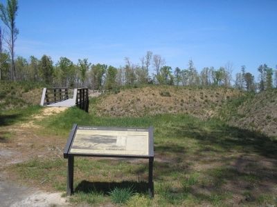
2. Marker in Petersburg National Battlefield
More about this marker. The right portion of the marker contains a photograph of “Fort Fisher in March 1865. This view shows the fort being expanded to its final size.”
The middle of the marker features a photograph of “The Union signal tower at Peebles Farm – a quarter mile behind you – [which] loomed over Fort Fisher.”
The right portion of the map contains a map of the fortifications around Petersburg at the time of the siege. It has the caption “Fort Fisher was one of several forts built to secure ground gained by the Union during the Battle of Peebles’s Farm in late September and early October 1864.”
Like many other markers in Petersburg National Battlefield, this one has a Petersburg Time Line at the bottom.
Also see . . .
1. Heritage Documentation Programs. Fort Fisher: Assessment of the Principal Earthworks: The Federal "Fish Hook" Line, Petersburg, VA. (Submitted on May 22, 2008, by Bill Coughlin of Woodland Park, New Jersey.)
2. Petersburg National Battlefield.
Photographed by Bill Coughlin, April 24, 2007
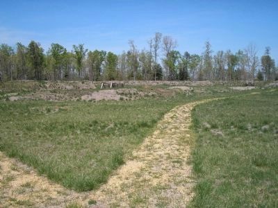
3. Interior of Fort Fisher
There is a walking trail that covers most of the interior of Fort Fisher.
Photographed by Bill Coughlin, April 24, 2007
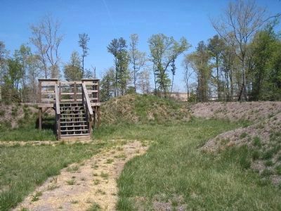
4. Observation Deck in Fort Fisher
This observation deck looks toward where the Confederate lines were located during the siege of Petersburg.
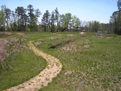
Photographed by Bill Coughlin, April 24, 2007
5. Fort Fisher Walking Trail
Fort Fisher was the largest earthen fortification in the Petersburg area, which can be seen in this photo. It was constructed in March of 1865.
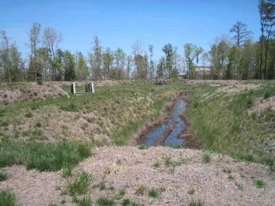
Photographed by Bill Coughlin, April 24, 2008
6. Interior of Fort Fisher
Since Fort Fisher was more than a mile from the closest Confederate fortification, it was never directly attacked and saw little bombardment during the siege.
Credits. This page was last revised on February 2, 2023. It was originally submitted on May 22, 2008. This page has been viewed 2,387 times since then and 67 times this year. Last updated on September 2, 2020, by Bradley Owen of Morgantown, West Virginia. Photos: 1, 2, 3, 4, 5, 6. submitted on May 22, 2008, by Bill Coughlin of Woodland Park, New Jersey. • J. Makali Bruton was the editor who published this page.
