Red House in Cattaraugus County, New York — The American Northeast (Mid-Atlantic)
Welcome to Thunder Rocks
Thunder Rocks
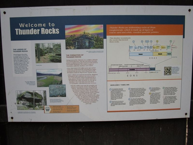
A local legend describes a competition among the guardian spirits of rocks to determine which spirit could throw the biggest rock to the top of the mountain. A nearby Iroquois tribe, after hearing the thunderous noises resulting from the contest, set out for the mountaintop where they discovered these rocks, which they named “Thunder Rocks.”
The Formation of the Thunder Rocks
During most of the Paleozoic era, a shallow saltwater sea covered this area. Near the end of the Devonian period, a collision took place between North America and another landmass. As a result, a range of mountains, called the Acadians, was created.
A river that existed 325 million years ago carried sediments, eroded from this mountainous region, westward into our area. Gravel deposited on the floodplain would one day become Thunder Rocks.
A later collision of continents formed the Allegheny Mountains to the southwest, but raised western New York and north central Pennsylvania into a high plateau. Erosion of the plateau took place throughout the entire Mesozoic era, the age of dinosaurs. New York State was worn down to a peneplain, a flat land area near sea level.
Sixty-five million years ago the peneplain was elevated, forming the modern day Allegheny Plateau. Subsequent erosion resulted in the development of deep valleys and uncovered the ancient Paleozoic Rocks. The youngest of these, including Thunder Rocks, is found on the highest hills in the park. Older Devonian rocks are exposed in the valley walls. The glacial ice did not transport Thunder Rocks here. Thunder Rocks are native bedrock and remain where they were deposited as sediments 325 million years ago.
Thunder Rocks are sedimentary rocks of Olean conglomerate, which is made up of layers of coarse sand and white, rounded quartzite pebbles. Quartzite pebbles in Thunder Rocks are irregular or rounded rather than flattened, evidence that these sediments were deposited in a stream environment. This timeline reconstructs the events that formed these rocks.
Geologic Timeline
1. The Appalachian Revolution began during the Ordovician period with the building of the Taconic Mountains. Geologists tell us this event resulted from the collision of two large continents, Laurasia, which included North America, and Gondwana, which included Africa. Our area was offshore, and was covered by a shallow sea.
2. Near the end of the Devonian period, the second of three collisions between North America and other landmasses created the Acadian Mountains.
3. Sediments from the erosion of the Acadian Mountains were transported to this area during the Pennsylvanian
period by a river approximately the size of the Allegheny. Sand and quartzite pebbles were deposited in the river valley, which existed 325 million years ago. Gravel bars deposited by the river would one day become Thunder Rocks.
4. The valley and its deposits were deeply buried under later sediments. The pressure of these overlying sediments and the presence of certain minerals, which bond the sand grains together, resulted in the cementing of sand and pebbles into solid rock.
5. The third collision of landmasses formed the Allegheny Mountains to the southwest.
6. Erosion of the land took place throughout the Triassic period. By its close, the northern portion of the Alleghenies was worn down to a peneplain, a flat land area near sea level. A later period of uplift raised western New York and north central Pennsylvania into a high plateau.
7. Erosion of the plateau during the Tertiary period created valleys much like those of the present day. As the stream valleys developed, the ancient sediments were worn away and the Paleozoic rocks were exposed. The youngest of these in the park are Thunder Rocks.
8. Twenty thousand years ago the last of the Pleistocene glaciers developed. Ice modified the valleys to the north of the park, but not within its boundaries, making the park a unique area in New York State. The glacier had no direct effect on Thunder Rocks.
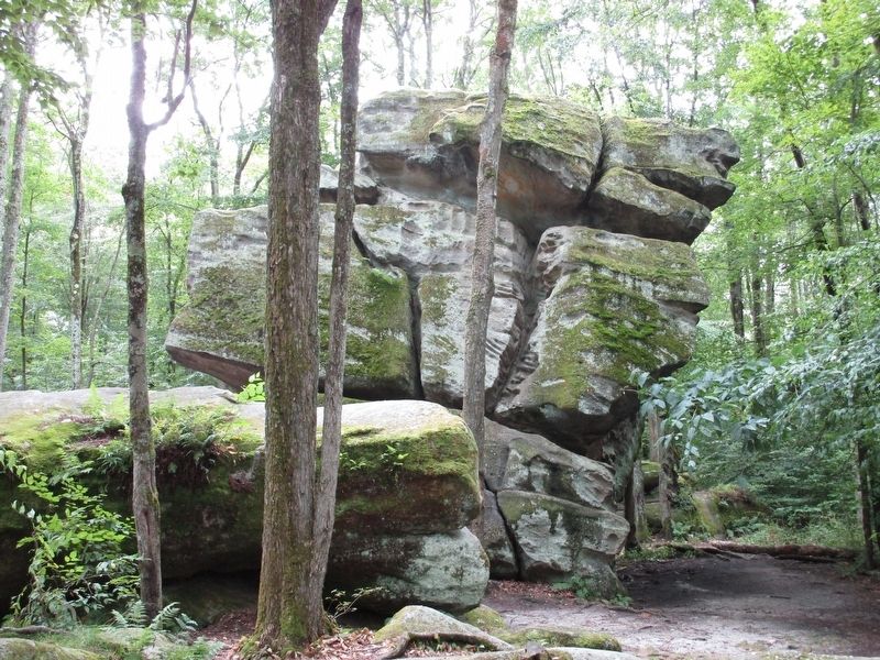
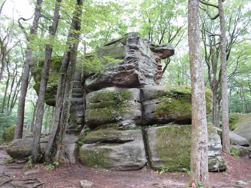
[captions] Thunder Rocks. The modern Allegheny River floodplain. Sediments are deposited in level areas of the floodplain. The force of the flowing water sorts sans and pebbles into layers. Fast water moves large pebbles; calm water deposits finer sediments. Conglomerate is a sedimentary rock. The layering characteristic of sedimentary rocks is obvious here. In the 1930s the Civilian Conservation Corps built the railings seen on this postcard.
Topics and series. This historical marker is listed in these topic lists: Charity & Public Work • Native Americans. In addition, it is included in the Civilian Conservation Corps (CCC) series list. A significant historical year for this entry is 1930.
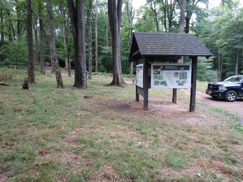
Location. 42° 2.538′ N, 78° 42.078′ W. Marker is in Red House, New York, in Cattaraugus County. Marker is on Thunder Rocks Road, ¼ mile north of Limestone Run Road, on the right when traveling north. Marker is in Allegany State Park off route ASP 2 between the Red House area and the Pennsylvania border. Touch for map. Marker is in this post office area: Limestone NY 14753, United States of America. Touch for directions.
Other nearby markers. At least 8 other markers are within 5 miles of this marker, measured as the crow flies. Site of First Wild Turkey Trap & Transfer Program (approx. 1.6 miles away); The School in the Forest (approx. 4 miles away); Stoddard Hollow (approx. 4.1 miles away); Allegany State Park's Camp Allegany (approx. 4.1 miles away); Civilian Conservation Corps (approx. 4.7 miles away); Outdoor Museum (approx. 4.7 miles away); Weather Station (approx. 4.7 miles away); Ski Jumping (approx. 5.1 miles away). Touch for a list and map of all markers in Red House.
Regarding Welcome to Thunder Rocks. Unknown which Thunder Rock had the stairs and railing installed by the CCC. There are a few very large ones; more than the two shown on this page.
Credits. This page was last revised on September 3, 2020. It was originally submitted on September 3, 2020, by Anton Schwarzmueller of Wilson, New York. This page has been viewed 1,100 times since then and 313 times this year. Photos: 1, 2, 3, 4. submitted on September 3, 2020, by Anton Schwarzmueller of Wilson, New York.


