Greenup in Cumberland County, Illinois — The American Midwest (Great Lakes)
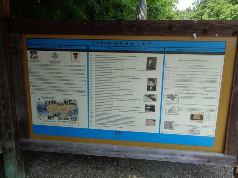
"The Road that Built the Nation"
[column 1:]
"History of The National Road"
Settlers had been moving west since the early 1700's. By 1802, so many farms and towns had been settled in the Ohio Valley that people living in the territory were calling for statehood. But the area was a long way from the eastern cities and towns where most of the nation's business took place. It took weeks of travel over rough wilderness tracks to reach the western outposts that wanted to be part of the nation.
A road was what the nation needed - a well built toad to carry its people and goods westward and to link its established cities and towns with the growing settlements on its new frontier. A road would help the nation prosper. Along it, business would grow and news and important communications could be carried to keep the growing nation working together.
In 1805, a proposal was put before Congress for a road to connect East with West. A road would run from Cumberland, Maryland, to the Ohio River. A year later, congress passed the bill, and President Thomas Jefferson appointed surveyors to lay out the route that would open the rugged Allegheny Mountains of Pennsylvania and lands beyond them to travelers and business.
Officially, this road was called the Cumberland Road, but it soon becomes known as the National Pike, the Great Turnpike, and the Old Pike. The name that stuck, however, was the National Road. True to this name, it is the only road ever built directly by the federal government.
By the time the road reached the Ohio River in 1818, many know that it did not go far enough. The call went out to extend the road across Ohio, Indiana, and Illinois to the Mississippi River. By approximately 1839 the road had reached Vandalia, Illinois, where lack of money and political disputes stopped it. By this time roads already existed west of Vandalia to the Mississippi River to St. Louis and Alton.
In its best years, the National Road was the busiest in the land. Most of America's pioneers followed its six hundred miles across six states to settle the lands along it and farther west. Stage-coaches, carriages, Conestoga wagons loaded with freight, and droves of cattle and sheep traveled the road. Inns, taverns and towns grew up along its length. It was the only good route connecting East and West.
By the mid 1800's, there was another way to travel, the railroad. Trains were faster, more comfortable, and cheaper than stagecoaches and wagons. As the railroad moved west the National Road grew quiet. It was used mostly by local traffic, so little effort was made to keep it repaired.
Early in the 1900's, however, another new vehicle, the automobile,
brought the road back to life. This spurred the Good Roads Movement as good roads were needed again as Americans began traveling by car and truck carrying goods to market. The Old Pike soon became part of a national network of roads. America's National Road, created by the Old Trails National Road Association, was created to connect East with West. The Old Pike is now part of U.S. Route 40, a highway that stretches all the way from the East to the West Coast.
The original section of the National Road from Baltimore, Maryland to East St. Louis, Illinois is now designated as an All-American Road and marked as the Historic National Road.
[column 2:]
"Time Line of Historical Events"
1803 Louisiana Purchase is secured from France, which created a need for a road to connect these western lands to the East.
1803-05 Lewis and Clark Expedition, from St. Louis to Astoria, Oregon.
1806 President Thomas Jefferson signs the act establishing a national highway from Cumberland, Maryland to the Ohio River.
1808 Albert Gallatin's Report on Roads and Canals presented to the U.S. Senate.
1808 Congress approves funding for surveying the National Road.
1811 Construction on the National Road begins.
1818 Illinois admitted to the Union as a state.
1818 The National Road reaches Wheeling, West Virginia, on the Ohio River. (At this time W. Virginia was part of Virginia)
1825 President Monroe appropriates the money to build the National Road from Wheellig Va to the capital of Missouri. Ground is broken on July 4 at St. Clairsville, Ohio.
1828-30 Surveys in Illinois completed to Vandalia Illinois.
1828-31 The National Road completed to Zanesville, Ohio. (Sources vary on exact dates)
1830 Construction of the National Road begins in Illinois.
1830's First Railroads in the United States begins to form. (Railroads are more efficient at transporting goods than land routes)
1830's Congress starts turning over maintenance of the National Road to the states it has crossed. The states erect tollgates to fund repairs.
1833 The National Road completed to Columbus, Ohio.
1834 Abraham Lincoln elected to the Illinois State Legislature, serving at the state capital located at Vandalia.
1835-41 National Road completed to Richmond Indiana. (Sources vary on exact dates)
1838 The National Road completed to Springfield, Ohio.
1838 The National Road completed from Indianapolis to Terre Haute Indiana.
1837-39 The National Road reached Vandalia, Illinois. (Sources vary on exact dates)
1839 The nation's first iron bridge was
completed carrying the Nation Road over Dunlap's Creek at Brownsville, Pennsylvania.
1849 At Wheeling, West Virginia, a new suspension bridge opens to carry National Road traffic across the Ohio River.
1851 The Illinois Central Railroad is granted a charter.
1852 The Baltimore & Ohio Railroad reaches Wheeling, West Virginia. (at this time W. Virginia was part of Virginia)
1856 By this date, the federal government has ceded all rights to the entire National Road to the states.
1857 The Ohio Stage Company, operating on the National Road Fails.
1860-65 The St. Louis - Vandalia - Terre Haute Railroad was built across Illinois. (This Rail Road latter became part of the Pennsylvania System)
1880 The safety bicycle is developed and the League of American Wheelmen is organized to reform America's road system.
1893 The first all-concrete road in the nation is built in Ohio
1900 Americans own about 8,000 registered motor vehicles.
1905 Americans own about 78,000 registered motor vehicles.
1907 The Restoration and Construction of a Cross State Highway (This was to become the Missouri section of the "Old Trails National Road").
1908 Henry Ford's first Model-T comes off the assembly line.
1910 By the end of the year, more than 125,000 automobile inventions have been patented, including the steering wheel to replace the tiller.
1912 The National Old Trails Road Association was incorporated to promote the Restoration, Construction, and marking of a cost to cost highway. (The Old Trails National Road)
1920 U.S. automobile registrations reach 8.1 million.
1920-1926 The National Road through Illinois is paved with Brick and/or concrete.
1926 Federal law standardizes federal highway numbering the National Road becomes U.S. 40.
1950-55 Many sections of US-40 in Illinois re-designed to become a four lane freeway and many communities by-passed. (second lane never constructed)
1960-72 Interstate 70 is constructed across Illinois, parallel to US-40-diminishing the importance of U.S. 40 (The National Road)
1997 National Road Association of Illinois formed to promote the preservation and use of the old National Road.
1998 Indiana section of the National Road is designated a National Scenic Byway, by the U.S. Department of Transportation.
2000 Illinois section of the National Road is designated a National Scenic Byway, by the U.S. Department of Transportation.
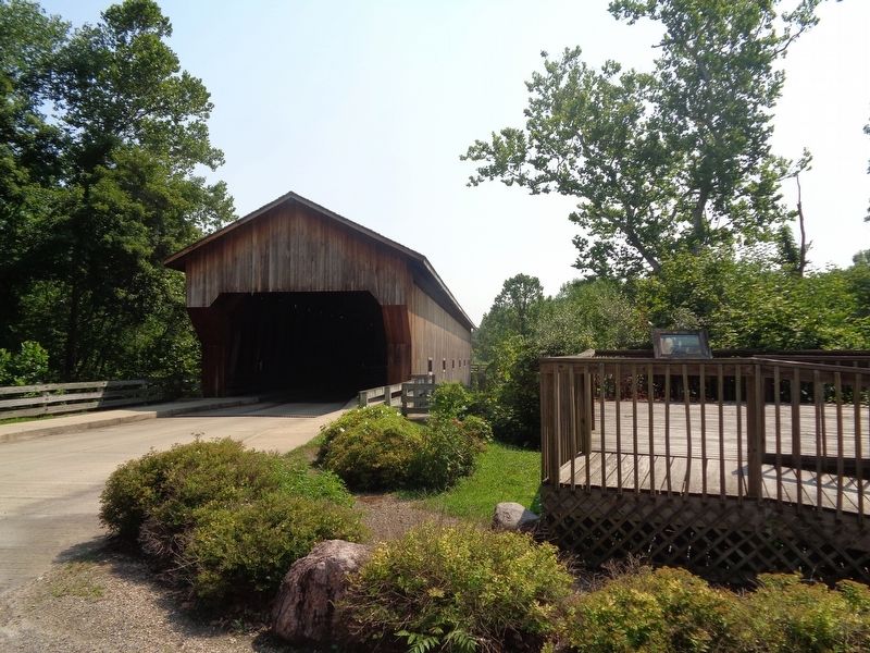
2000 Cumberland County Covered Bridge opened up to traffic. (Original bridge had been closed 135 years earlier, 1865)
2002 The National Road from Baltimore, Maryland to East St. Louis Illinois is designated an All-American Road, by the U.S. Department of Transportation. (the highest designation given within the Scenic Byway Program)
2006 Parking and Interpretive area for the Cumberland County Covered Bridge completed.
[column 3:]
"Historical Events at this Site"
Survey for Location of "Cumberland Road"
Between
Terre Haute, Ind. And Saint Louis, Mo.
-Made by Joseph Shriver, Engineer in charge
"Note book located in Missouri Historical Society, St. Louis, Mo"
May 25, 1828 - Received notification of my appointment at Washington the 25th of May: - repaired as soon as practicable to the duties which the appt. enjoined on me.
June 28, 1828 - Arrived in Terre Haute in company with O.C. Morris, engaged in procuring hands, repairing tents & procuring camp equipage until the 1st of July.
July 2, 1828 - Left Terre Haute with the company at 12 o'clock, encamped on the E. bank of Clear Cr. 4 1/2 miles W. of Terre Haute, - evening occupied in settling matters with hands.
July 3, 1828 - Commenced work today at the State line, run 1 1/4 miles west of Hock's Cr.; encamped on the 40 ft. span, 2 miles W. of said Cr.
July 11, 1828 - Run to the E. bluff of the Embarrass River, - encamped in the bottom on ground of an old Indian encamped. Afternoon made a reconnaissance across the bottom. Ground, as the river is approached, increases in the richness of the soil. Greater appearance of stone. Timber on the high land of the stream Oaks, Hickory & c.. Bottom Walnut, Sugar trees, Cottonwood, Sycamore and other smaller kinds.
July 12, 1828 - Remained in camp to plat whilst Morris surveyed the bluff of the River.
July 13, 1828 - (Sunday) Made further surveys & examinations with a view for a Xing of Embarrass River. Encamped on the W. bluff at E. edge of the Prairie. Indian Adventure last night. Rock is found in the bluffs of this river suitable for building.
Abraham Lincoln Connection to the Bridge and Local Area
1830 - Thomas Lincoln and family traveled from Indiana to settle in New Salem Illinois. Local history says that their wagon broke down in area of Barber Inn (now Greenup) and the youngster (Abe) assisted with the well being dug at the site of the Inn.
1831- Thomas Lincoln brought his family back south to Goose Nest Prairie area north of here. During this period Abe traveled down the Mississippi River on a flatboat.
1832 - After his trip down the Mississippi River Abraham Lincoln volunteered for service in the Black Hawk War. Lincoln visited his parents before and after his military service. Local history says that during one of these visits he traveled to the bridge site to visit with his father "Thomas" and his cousin "Dennis Hanks" and while there helped with the work.
1847 - Abraham Lincoln served as defensive lawyer for Sigler H. Lester case that was held in Greenup. Local history says the lawyers involved in the case came to the bridge site and swam in the Embarrass River.
Erected by America's Byways.
Topics and series. This historical marker is listed in these topic lists: Bridges & Viaducts • Railroads & Streetcars • Roads & Vehicles • Settlements & Settlers. In addition, it is included in the Covered Bridges, the Former U.S. Presidents: #16 Abraham Lincoln, and the The Historic National Road series lists.
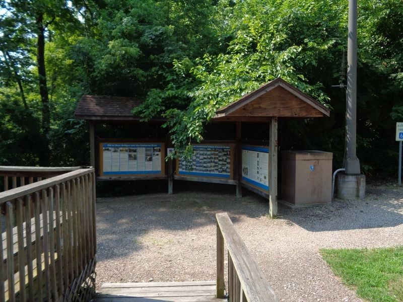
Location. 39° 14.308′ N, 88° 11.274′ W. Marker is in Greenup, Illinois, in Cumberland County. Marker is on Cumberland Road north of U.S. 40, on the right when traveling east. Marker is near a platform, near the west end of the Cumberland County Covered Bridge. Touch for map. Marker is at or near this postal address: 1417 Cumberland Rd, Greenup IL 62428, United States of America. Touch for directions.
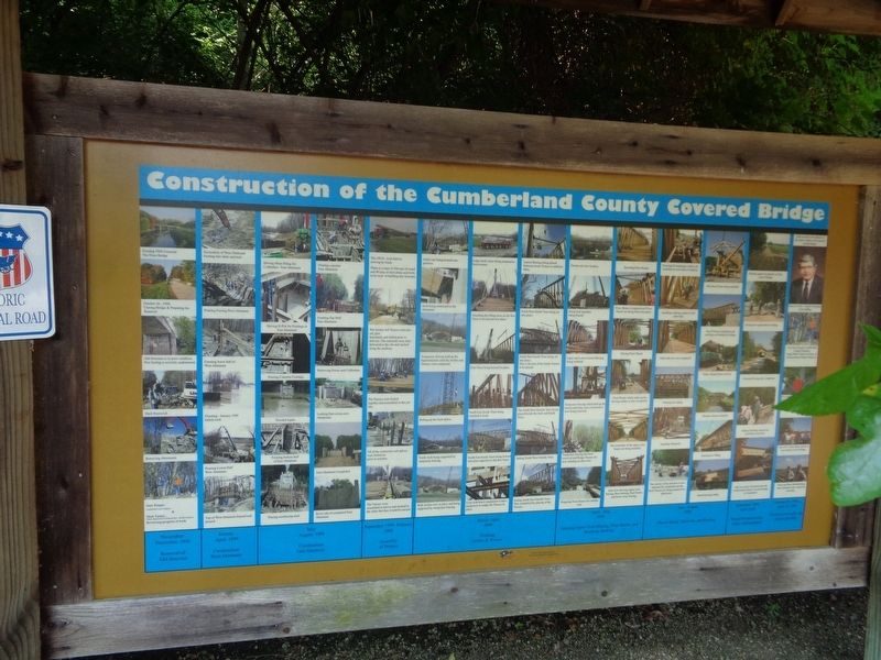
Other nearby markers. At least 8 other markers are within 2 miles of this marker, measured as the crow flies. Old to New: Bridges over the Embarras River (here, next to this marker); Construction of the Cumberland County Covered Bridge (a few steps from this marker); Cumberland County Covered Bridge (a few steps from this marker); Greenup (approx. 1.3 miles away); Site of Barbour Inn (approx. 1.3 miles away); First Hotel (approx. 1.3 miles away); Greenup Township Carnegie Library (approx. 1.3 miles away); Abraham Lincoln Well (approx. 1.3 miles away). Touch for a list and map of all markers in Greenup.
Credits. This page was last revised on September 4, 2020. It was originally submitted on September 3, 2020, by Jason Voigt of Glen Carbon, Illinois. This page has been viewed 466 times since then and 79 times this year. Photos: 1, 2, 3, 4. submitted on September 3, 2020, by Jason Voigt of Glen Carbon, Illinois.


