Near Spotsylvania Courthouse in Spotsylvania County, Virginia — The American South (Mid-Atlantic)
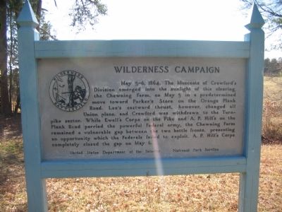
Wilderness Campaign
Erected by U.S. Department of the Interior - National Park Service.
Topics. This historical marker is listed in this topic list: War, US Civil. A significant historical year for this entry is 1864.
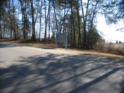
Location. 38° 17.733′ N, 77° 44.622′ W. Marker is near Spotsylvania Courthouse, Virginia, in Spotsylvania County. Marker is on Hill Ewell Drive, on the right when traveling south. Located near stop five (Chewning Farm) on the driving tour of the Wilderness Battlefield. Touch for map. Marker is at or near this postal address: 12517 Wilderness Park Dr, Spotsylvania VA 22551, United States of America. Touch for directions.
Other nearby markers. At least 8 other markers are within one mile of this marker, measured as the crow flies. The Chewning Farm (within shouting distance of this marker); Key Terrain (approx. 0.2 miles away); A.P. Hill Escapes Capture (approx. 0.2 miles away); a different marker also named Wilderness Campaign (approx. 0.6 miles away); The Higgerson Farm (approx. one mile away); The Widow Tapp House (approx. one mile away); The Home of Widow Tapp (approx. one mile away); a different marker also named Wilderness Campaign (approx. one mile away). Touch for a list and map of all markers in Spotsylvania Courthouse.
Also see . . . Wilderness Battlefield. National Park Service page. (Submitted on April 29, 2008, by Craig Swain of Leesburg, Virginia.)
Credits. This page was last revised on July 9, 2021. It was originally submitted on April 29, 2008. This page has been viewed 1,025 times since then and 8 times this year. Last updated on September 5, 2020, by Bradley Owen of Morgantown, West Virginia. Photos: 1, 2. submitted on April 29, 2008, by Craig Swain of Leesburg, Virginia. • J. Makali Bruton was the editor who published this page.

