Near Earleville in Cecil County, Maryland — The American Northeast (Mid-Atlantic)
Essex Lodge
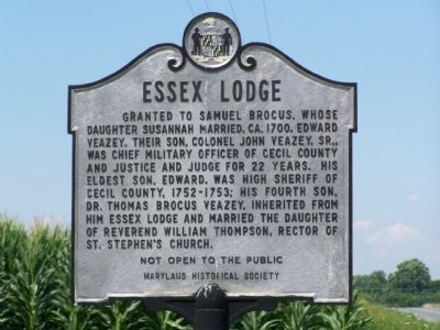
Photographed by Beverly Pfingsten, July 14, 2007
1. Essex Lodge Marker
Granted to Samuel Brocus, whose daughter Susannah married, circa 1700, Edward Veazey. Their son, Colonel John Veazey, Sr., was Chief Military Officer of Cecil County and Justice and Judge for 22 years. His eldest son, Edward, was High Sheriff of Cecil County, 1732-1753; his fourth son, Dr. Thomas Brocus Veazey, inherited from him Essex Lodge and married the daughter of Reverend William Thompson, Rector of St. Stephen's Church.
Erected 1969 by Maryland Historical Society.
Topics and series. This historical marker is listed in these topic lists: Colonial Era • Government & Politics • Military • Religion & Religious Structures. In addition, it is included in the Maryland Historical Trust series list. A significant historical year for this entry is 1700.
Location. 39° 26.687′ N, 75° 54.18′ W. Marker is near Earleville, Maryland, in Cecil County. It is on Glebe Road 0.3 miles south of Cherry Grove Road, on the left when traveling north. Touch for map. Marker is at or near this postal address: 645 Glebe Road, Earleville MD 21919, United States of America. Touch for directions.

Regionally,
this page online
Other nearby markers. At least 8 other markers are within 3 miles of this marker, measured as the crow flies: Original Vestry House Memorial (approx. 1½ miles away); St. Peters Episcopal Church Bell (approx. 1.6 miles away); North Sassafras Parish (approx. 1.6 miles away); Cherry Grove (approx. 1.6 miles away); Bohemia (approx. 1.8 miles away); St. Francis Xavier Church (approx. 2.4 miles away); Mount Pleasant (approx. 2.6 miles away); The Anchorage (approx. 2.7 miles away). Touch for a list and map of all markers in Earleville.
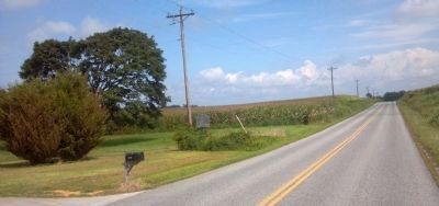
Photographed by Keith S Smith, August 22, 2013
2. Essex Lodge Marker Roadside
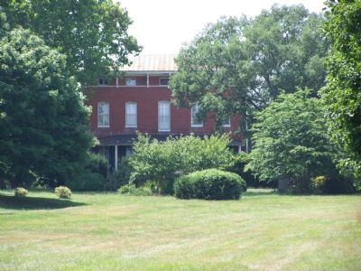
Photographed by Beverly Pfingsten, July 14, 2007
3. Essex Lodge visible from Glebe Road
Credits. This page was last revised on October 13, 2025. It was originally submitted on July 15, 2007, by Bill Pfingsten of Bel Air, Maryland. This page has been viewed 3,643 times since then and 107 times this year. Last updated on September 7, 2020, by Carl Gordon Moore Jr. of North East, Maryland. Photos: 1. submitted on July 15, 2007, by Bill Pfingsten of Bel Air, Maryland. 2. submitted on August 23, 2013, by Keith S Smith of West Chester, Pennsylvania. 3. submitted on July 15, 2007, by Bill Pfingsten of Bel Air, Maryland.
