Fishers Hill in Shenandoah County, Virginia — The American South (Mid-Atlantic)
Fisher’s Hill
“To give up all hope”—Confederate Left Disintegrates
— 1864 Valley Campaign —
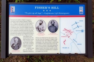
Fearing for the ability of Battle’s brigade to withstand Crook’s assault, Ramseur ordered Gen. William R. Cox’s North Carolina brigade to form on Battle’s left flank to your left. As Cox, regarded as one of the finest-dressed men in the Confederate army, moved his brigade toward the sound of combat, he became confused and turned his six regiments southwest and away from Battle’s command. Cox’s movement exposed Battle’s left flank and enabled Col. Rutherford B. Hayes’s division to fire directly into it. Hayes wrote that when Battle’s men learned that their left flank had been turned “they seemed to give up all hope of holding their works and fled in confusion toward the [Valley] turnpike.”
As Battle’s men gave way, the other regiments in Ramseur’s division soon followed. Not only Crook’s corps, but also Union Gen. Horatio G. Wright’s corps pressed them hard. One of Ramseur’s brigade commanders—Gen. Bryan Grimes—tried to hold the Confederate left by facing three of his regiments west to confront Crook while keeping his other two facing north to block Wright’s corps. Despite Grimes’s best efforts, however, the fire from two directions compelled him to withdraw his brigade from the field.
(captions)
Col. Rutherford B. Hayes Courtesy Library of Congress
Gen. William R. Cox Courtesy North Carolina Office of Archives & History
Gen. Bryan Grimes Courtesy University of North Carolina
Erected by Virginia Civil War Trails.
Topics and series. This historical marker is listed in this topic list: War, US Civil. In addition, it is included in the Virginia Civil War Trails series list. A significant historical date for this entry is September 22, 1864.
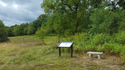
Location. 38° 59.217′ N, 78° 25.311′ W. Marker is in Fishers Hill, Virginia, in Shenandoah County. Marker can be reached from Battlefield Road (Virginia Route 601) 0.3 miles east of Tumbling Run Lane, on the left when traveling west. Located along the 1-mile loop trail on the Ramseur's Hill - Fisher's Hill Battlefield. Touch for map. Marker is at or near this postal address: 601 Battlefield Rd, Fishers Hill VA 22626, United States of America. Touch for directions.
Other nearby markers. At least 8 other markers are within walking distance of this marker. A different marker also named Fisher’s Hill (about 300 feet away, measured in a direct line); a different marker also named Fisher’s Hill (about 600 feet away); a different marker also named Fisher's Hill (about 600 feet away); a different marker also named Fisher’s Hill (about 600 feet away); a different marker also named Fisher’s Hill (approx. 0.2 miles away); a different marker also named Fisher’s Hill (approx. 0.2 miles away); a different marker also named Fisher’s Hill (approx. ¼ mile away); Battle of Fisher’s Hill (approx. 0.3 miles away). Touch for a list and map of all markers in Fishers Hill.
Also see . . .
1. Battle of Fisher’s Hill. Shenandoah at War website entry (Submitted on September 13, 2015.)
2. Fisher’s Hill. American Battlefield Trust website entry (Submitted on September 13, 2015.)
Credits. This page was last revised on June 2, 2022. It was originally submitted on September 13, 2015, by Bernard Fisher of Richmond, Virginia. This page has been viewed 528 times since then and 37 times this year. Last updated on September 8, 2020, by Bradley Owen of Morgantown, West Virginia. Photos: 1, 2, 3. submitted on September 13, 2015, by Bernard Fisher of Richmond, Virginia.


