Near Spotsylvania Courthouse in Spotsylvania County, Virginia — The American South (Mid-Atlantic)
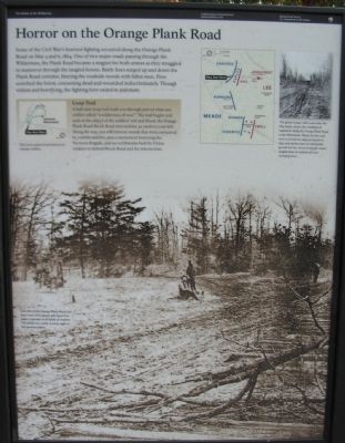
Horror on the Orange Plank Road
The Battle of the Wilderness
Fredericksburg and Spotsylvania National Military Park
| — | National Park Service, U.S. Department of the Interior | — |
Photographed by Craig Swain, November 10, 2007
1. Horror on the Orange Plank Road Marker
Some of the Civil War's heaviest fighting occurred along the Orange Plank Road on May 5 and 6, 1864. One of two major roads passing through the Wilderness, the Plank Road became a magnet for both armies as they struggled to maneuver through the tangled forests. Battle lines surged up and down the Plank Road corridor, littering the roadside woods with fallen men. Fires scorched the forest, consuming the dead and wounded indiscriminately. Though violent and horrifying, the fighting here ended in stalemate.
Loop Trail
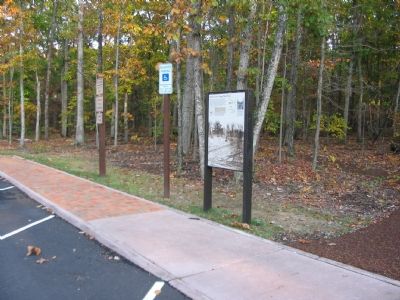
A half-mile loop trail leads you through part of what one soldier called "a wilderness of woe." The trail begins and ends at the object of the soldiers' toil and blood: the Orange Plank Road-Brock Road intersection, 50 yards to your left. Along the way, you will traverse the woods that were consumed by combat and fire, pass a monument honoring the Vermont Brigade, and see earthworks built by Union soldiers to defend Brock Road and the intersection.
Erected by National Park Service, U.S. Department of the Interior.
Topics. This historical marker is listed in this topic list: War, US Civil. A significant historical month for this entry is May 1864.
Location. 38° 18.044′ N,
this page online

Regionally, this marker is in the Washington Metropolitan Area, in Northern Virginia, and in the Piedmont. It is also in the American South, specifically in the Upper South, in the Mid-Atlantic, and on the Eastern Seaboard. Globally, it is in the North Atlantic Region, North America, the Western Hemisphere, the Western World, and the Anglosphere. Historically, it finds itself in what was once the territory of the Mississippian Culture, one of the original Thirteen Colonies, one of the Confederate States of America, and the Antebellum South.
Other nearby markers. At least 8 other markers are within walking distance of this
Photographed by Craig Swain, November 10, 2007
2. Battle Map
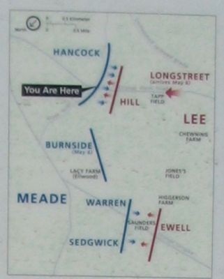
Note the north seeking arrow points to the lower left of the map, and thus the Orange Plank-Brock Road section of the battlefield is in the upper section, although it is on the southern part of the battlefield.
More about this marker. The background photo on the marker shows One lane of the Orange Plank Road had three-inch thick blanks laid upon it to make it passable in all kinds of weather. The planks are visible at lower right of the postwar photo.
An inset photo is captioned This grainy image, taken soon after the 1864 battle, shows the condition of vegetation along the Orange Plank Road in the Wilderness. Planks for the road were cut from the adjacent forests in 1852, and twelve years of subsequent growth left the woods lining the road a tangled mess of underbrush and emerging trees.
A
Photographed by Craig Swain, November 10, 2007
3. Trail Head for the Loop Trail
Related markers. Click here for a list of markers that are related to this marker. Wilderness Battlefield - Brock Road/Orange Plank Road Intersection virtual tour by markers.
Credits. This page was last revised on February 15, 2026. It was originally submitted on January 26, 2008. This page has been viewed 6,425 times since then and 122 times this year. Last updated on September 10, 2020, by Bradley Owen of Morgantown, West Virginia. Photos: 1, 2, 3. submitted on January 26, 2008, by Craig Swain of Leesburg, Virginia. • J. Makali Bruton was the editor who published this page.
