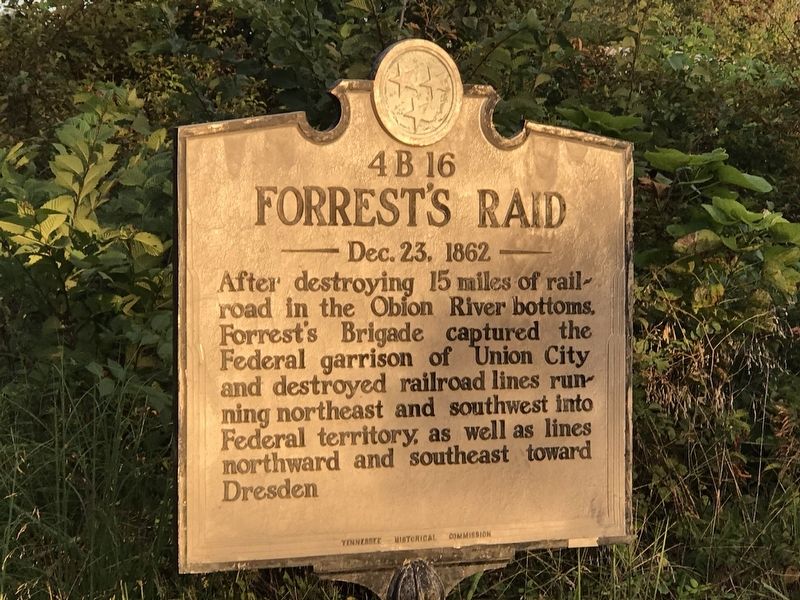
Near Rives in Obion County, Tennessee — The American South (East South Central)
Forrest's Raid
Dec. 23, 1862
Erected by Tennessee Historical Commission. (Marker Number 4B 16.)
Topics. This historical marker is listed in this topic list: War, US Civil. A significant historical date for this entry is December 23, 1862.
Location. 36° 21.503′ N, 89° 3.999′ W. Marker is near Rives, Tennessee, in Obion County. Marker is at the intersection of U.S. 45W and Pleasant Hill Road (State Highway 216), on the right when traveling north on U.S. 45W. Touch for map. Marker is in this post office area: Rives TN 38253, United States of America. Touch for directions.
Other nearby markers. At least 8 other markers are within 6 miles of this marker, measured as the crow flies. First Monument to Unknown Confederate Dead (approx. 4 miles away); First Christian Church (approx. 4.4 miles away); Unknown Confederate Dead Monument (approx. 4˝ miles away); Obion County Confederate Monument (approx. 4.6 miles away); Union City, Mobile and Ohio Railroad Depot (approx. 4.6 miles away); Mt. Zion Christian Methodist Episcopal Church (approx. 5 miles away); The Barber Shop (approx. 5.4 miles away); Liberty Hall (approx. 5.4 miles away).
Credits. This page was last revised on September 12, 2020. It was originally submitted on September 11, 2020, by Duane and Tracy Marsteller of Murfreesboro, Tennessee. This page has been viewed 231 times since then and 33 times this year. Photos: 1, 2. submitted on September 11, 2020, by Duane and Tracy Marsteller of Murfreesboro, Tennessee. • Bernard Fisher was the editor who published this page.

