Powhatan in Lawrence County, Arkansas — The American South (West South Central)
Powhatan Courthouse State Park
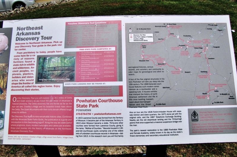
Northeast Arkansas Discovery Tour
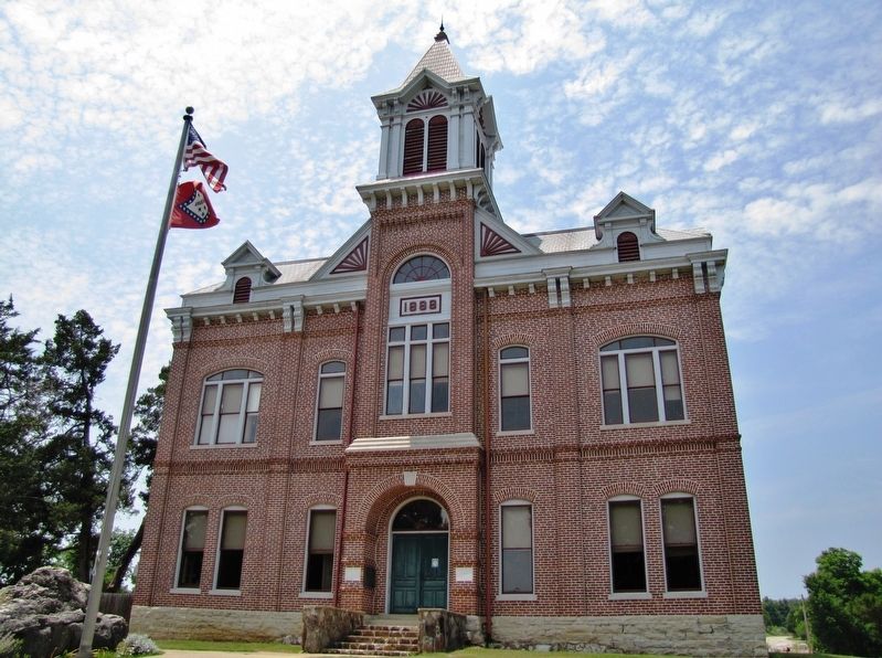
A tour of the five original structures in historic Powhatan will take you deep into the 19th century. The 1888 Italianate courthouse features such modern conveniences as a dumbwaiter and a speaking tube. It houses exhibits that interpret the history of north Arkansas settlement and life in this once bustling riverport. Learn about river transportation and the Great Powhatan Pearl Rush.
Also on tour are the 1828 Ficklin-Imboden House with separate kitchen and slave quarters, the 1875 stone jail with the original cells, and the 1887 Telephone Exchange Building. Nearby are the old steamboat landing and the 70-foot-high pylons that once supported a massive suspension bridge over the river.
The park's newest restoration is the 1889 Powhatan Male and Female Academy, widely known in its day as the state's finest elementary and secondary educational institution.
870-878-6794 • [email protected]
Northeast Arkansas Discovery Tour
Welcome to Northeast Arkansas. Pick up your Discovery Tour guide in the park visitor center.
From pre-history to today, people have come here for a variety of reasons. Settlers found a state rich in wildlife and wilderness. Ancient peoples, explorers, planters, builders and visionaries who would shape the frontier of America all called this region home. Enjoy discovering their stories.
On the Discovery Tour you will explore over 300 miles of Delta and Ozark scenery as you travel through three of Arkansas's Natural Divisions. The Delta stretches flat and fertile as far as the eye can see. Crowley's Ridge and its beautiful forest rises above the Delta. The Ozark Mountains with their rocky terrain offered tough times to settlers.
The Discovery Tour leads to nine remarkable historic sites. Combined with the Arkansas State Parks Guide, the publication is a guide and introduction to this fascinating region. Along the way are state parks where programs, tours, modern campsites and cabins are available. Enjoy your journey into the history of Arkansas on the Northeast Arkansas Discovery Tour.
Timeline: Discovery Tour Locations
1500-1860 • Parkin Archeological State Park
1815-1830 • Old Davidsonville State Park
1820s • Crowley’s Ridge State Park
1820s-present • Old Independence Regional Museum
1830s • Village Creek State Park
1830s-1880s • Jacksonport State Park
1840s-1890s • Powhatan Courthouse State Park
1880s-1920s • Mammoth Spring State Park
Pre 1940s • Ozark Folk Center
Erected by Arkansas State Parks.
Topics. This historical marker is listed in these topic lists: Architecture • Parks & Recreational Areas • Settlements & Settlers • Waterways & Vessels. A significant historical year for this entry is 1815.
Location. 36° 4.923′ N, 91° 7.113′ W. Marker is in Powhatan, Arkansas, in Lawrence County. Marker can be reached from the intersection of Arkansas Route 25 and 3rd Street, on the left when traveling south. Located along the walkway on the west/front side of the 1888 Powhatan Courthouse. Touch for map. Marker is at or near this postal address: 4414 AR Highway 25, Powhatan AR 72458, United States of America. Touch for directions.
Other nearby markers. At least 8 other markers are within walking distance of this marker. Uses of the Jail House (within shouting distance of this marker); The Conviction of Samuel Helms (within shouting distance of this marker); Powhatan Jail (within shouting distance of this marker); Log Cabin Kitchen (within shouting distance of this marker); Log Cabin (within shouting distance of this marker); Changes made to the Jail (about 300 feet away, measured in a direct line); Commercial Building (about 400 feet away); The Black River (about 400 feet away). Touch for a list and map of all markers in Powhatan.
Regarding Powhatan Courthouse State Park. Powhatan Courthouse is listed on the National Register of Historic Places, #70000122.
Also see . . .
1. Powhatan Courthouse. During the construction process in 1887, the Arkansas General Assembly passed legislation splitting Lawrence County into two judicial districts, with Powhatan managing the western judicial district and Walnut Ridge (Lawrence County) becoming a second county seat for residents in the east. The standing Powhatan courthouse opened in 1888 and housed many notable cases on its dockets over the years, including the trials of alleged murderers, disgraced bankers, and crooked sheriffs. (Submitted on September 12, 2020, by Cosmos Mariner of Cape Canaveral, Florida.)
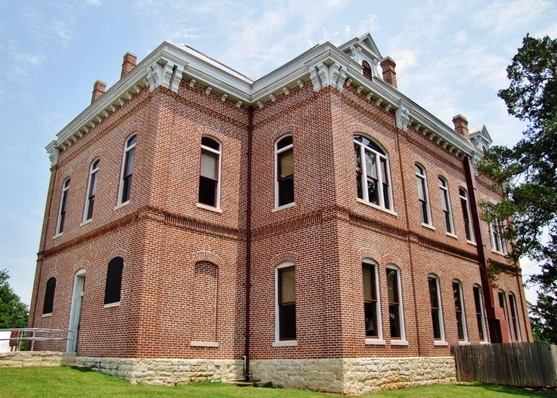
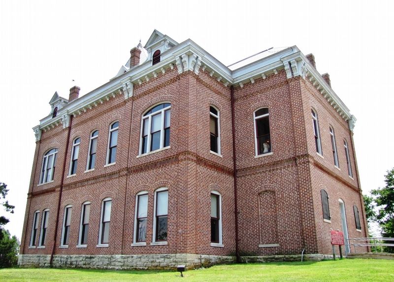
2. Powhatan Courthouse (Wikipedia). The courthouse is set on a rise overlooking the Black River. It is a two-story brick building, set on a stone foundation. Brick pilasters rise two stories at its corners, and between its window bays. It square tower is decorated with heavily bracketed cornices at the top of each stage, and is topped by a pyramidal roof. It was built in 1888, and is one of the government buildings from that period remaining in northeastern Arkansas. (Submitted on September 12, 2020, by Cosmos Mariner of Cape Canaveral, Florida.)
3. Powhatan Courthouse National Register of Historic Places Nomination. (Submitted on September 12, 2020, by Cosmos Mariner of Cape Canaveral, Florida.)
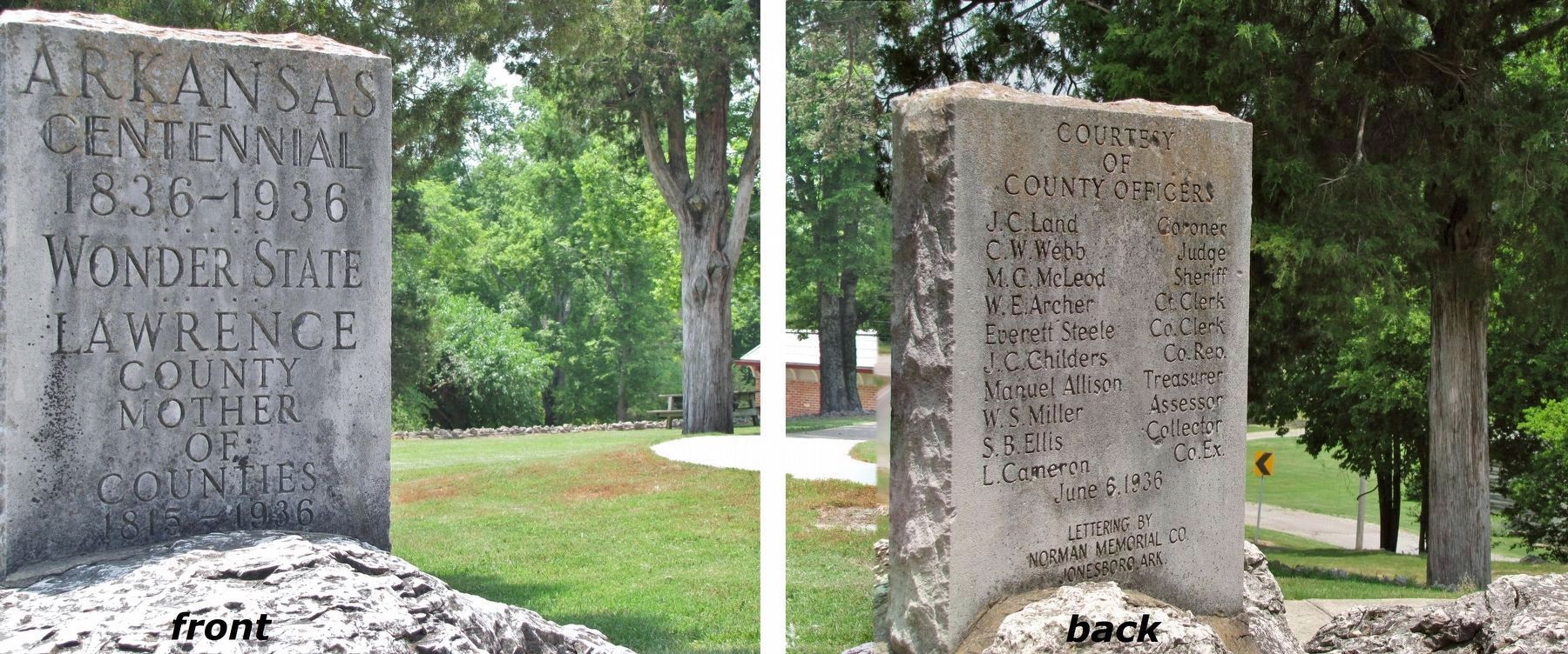
Photographed By Cosmos Mariner, June 9, 2011
5. Arkansas Centennial Marker (located in front of Powhatan Courthouse)
1836-1936
Wonder State
Lawrence County
Mother of Counties
1815-1936
(back side)
Courtesy
of
County Officers
J.C. Land, Coroner • C.W. Webb, Judge • M.C. McLeod, Sheriff • W.E. Archer, Ct. Clerk • Everett Steele, Co. Clerk • J.C. Childers, Co. Rep. • Manuel Allison, Treasurer • W.S. Miller, Assessor • S.B. Ellis, Collector • L. Cameron, Co. Ex.
June 6, 1936
Lettering by
Norman Memorial Co.
Jonesboro, Ark.
Credits. This page was last revised on March 5, 2021. It was originally submitted on September 11, 2020, by Cosmos Mariner of Cape Canaveral, Florida. This page has been viewed 199 times since then and 23 times this year. Photos: 1. submitted on September 11, 2020, by Cosmos Mariner of Cape Canaveral, Florida. 2, 3, 4, 5. submitted on September 12, 2020, by Cosmos Mariner of Cape Canaveral, Florida.
