Louisa in Louisa County, Virginia — The American South (Mid-Atlantic)
Decisive Confederate Victory
The Largest All-Cavalry Battle of the Western Hemisphere
| — | The Battle of Trevilian Station | — |
Photographed by Craig Swain, January 12, 2008
1. Decisive Confederate Victory Marker
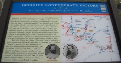
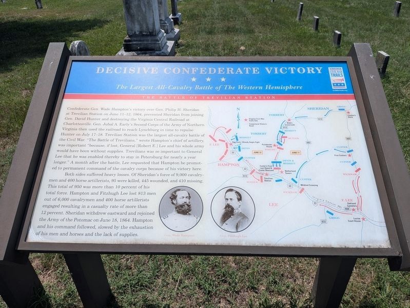
Confederate Gen. Wade Hampton's victory over Gen. Philip H. Sheridan at Trevilian Station on June 11-12, 1864, prevented Sheridan from joining Gen. David Hunter and destroying the Virginia Central Railroad at Charlottesville. Gen. Jubal A. Early's Second Corps of the Army of Northern Virginia then used the railroad to reach Lynchburg in time to repulse Hunter on July 17-18. Trevilian Station was the largest all-cavalry battle of the Civil War. "The Battle of Trevilians," wrote Hampton's chief of artillery, was important "because, if lost, General [Robert E.] Lee and his whole army would have been without supplies. Trevilians was so important to General Lee that he was enabled thereby to stay in Petersburg for nearly a year longer." A month after the battle, Lee requested that Hampton be promoted to permanent command of the cavalry corps because of his victory here.
Both sides suffered heavy losses. Of Sheridan's force of 9,000 cavalrymen, and 400 horse artillerists, 95 were killed, 445 wounded, and 410 missing. This total of 950 was more than 10 percent of his total force. Hampton and Fitzhugh Lee lost 813 men out
this page online
Erected by Virginia Civil War Trails.
Topics and series. This historical marker is listed in this topic list: War, US Civil. In addition, it is included in the Virginia Civil War Trails series list. A significant historical date for this entry is June 11, 1864.
Location. 38° 1.732′ N, 78° 0.7′ W. Marker is in Louisa, Virginia, in Louisa County. It is at the intersection of West Street (County Route 666) and Purcell Drive, on the left when traveling west on West Street. Located at the entrance gate to Oakland Cemetery. This is stop nine of the driving tour of Trevilian Station Battlefield. Touch for map. Marker is in this post office area: Louisa VA 23093, United States of America. Touch for directions.

Regionally, this marker is in the Piedmont and in Central Virginia. It is also in the American
Photographed by Evan Dwyer, June 11, 2026
2. Decisive Confederate Victory Marker
The original marker has been replaced with this essentially identical version, the only change being where the line breaks fall on the first paragraph's text. No words were added, removed, or otherwise changed, and the map and photographs remain identical to the original.
Of note, the Poindexter Farm property is still in private hands the Civil War Trails marker indicated on the map does not exist (yet?).
Of note, the Poindexter Farm property is still in private hands the Civil War Trails marker indicated on the map does not exist (yet?).
Other nearby markers. At least 8 other markers are within walking distance of this marker: Oakland Cemetery (here, next to this marker); Battle of Trevilians Memorial (a few steps from this marker); Louisa Court House (approx. half a mile away); Second Louisa County Courthouse Threshold (approx. half a mile away); Patrick Henry's Home (approx. half a mile away); Confederate Memorial (approx. half a mile away); Bicentennial Monument (approx. half a mile away); In Memory of All Veterans (approx. 0.6 miles away). Touch for a list and map of all markers in Louisa.
Another marker is no longer nearby. Louisa Court House (was approx. half a mile away but has been replaced with another marker now near it).
More about this marker. The marker text incorrectly states the Battle of Lynchburg
Photographed by Craig Swain, January 12, 2008
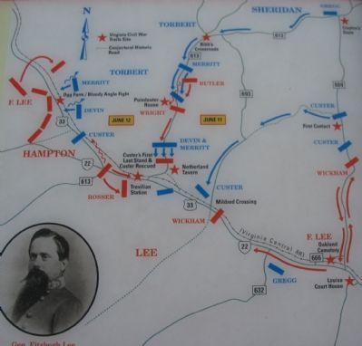
3. Battle Area Map
Regarding Decisive Confederate Victory. This is one of several markers interpreting the Battle of Trevilian Station, June 11-12, 1864. See the Battle of Trevilian Station Virtual Tour by Markers linked below for additional related markers.
Also see . . .
1. American Battlefield Trust - Trevilian Station. An authoritative source for information on the battle and battlefield preservation. (Submitted on November 25, 2008.)
2. Trevilian Station Battlefield Foundation. The foundation has worked to preserve the remaining sections of the battlefield. A detailed self-guided driving tour of the battlefield is offered. This marker is at stop nine (now eight, with the deletion of the intended marker at the Poindexter Farm) of the tour. (Submitted on January 21, 2008.)
3. Battle of Trevilian Station Virtual Tour by Markers. A set of markers that document the Battle of Trevilian Station, June 11-12, 1864. The order of appearance is generally aligned to the Trevilian Station Battlefield
Photographed by Craig Swain
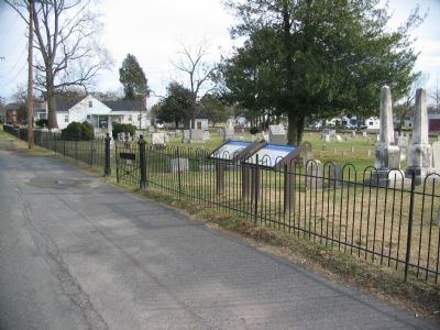
4. Trevilian Station Battlefield Driving Tour Stop Nine
Credits. This page was last revised on August 15, 2026. It was originally submitted on January 20, 2008. This page has been viewed 2,531 times since then and 43 times this year. Last updated on September 12, 2020, by Bradley Owen of Morgantown, West Virginia. Photos: 1. submitted on January 20, 2008, by Craig Swain of Leesburg, Virginia. 2. submitted on August 13, 2026, by Evan Dwyer of Richmond, Virginia. 3, 4. submitted on January 20, 2008, by Craig Swain of Leesburg, Virginia. • J. Makali Bruton was the editor who published this page.
