Cumberland Township near Round Top in Adams County, Pennsylvania — The American Northeast (Mid-Atlantic)
Fourth Brigade
First Division - Second Corps
— Army of the Potomac —
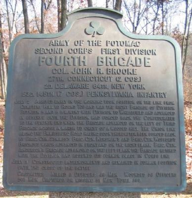
Inscription.
Second Corps First Division
Fourth Brigade
Col. John R. Brooke
27th. Connecticut (2 Cos.)
2d. Delaware 64th. New York
53d. 145th. (7 Cos.) Pennsylvania Infantry
July 2 Arrived early in the morning took position on the line from Cemetery Hill to Round Top and was the right Brigade of Division. Between 5 and 6 p.m. went with Division to Wheatfield and advanced in reserve until the Division had forced back the Confederates to the further end when the Brigade advanced on the left of Third Brigade across a marsh to the crest of a wooded hill. The Union line along the Emmitsburg Road having soon thereafter been forced back by Brig. Gen. Semmes's, Brig. Gen. Kershaw's and Brig. Gen. Wofford's Brigades which advanced in front and on the right flank. Brig. Gen. Anderson's Brigade advancing on the left flank the Brigade retired with the Division and resumed its former place in Corps line.
July 3 Constructed entrenchments and remained in former position until the close of the battle.
Casualties. Killed 8 officers 46 men. Wounded 38 officers 246 men. Captured or missing 51 men. Total 389.
Erected 1912 by Gettysburg National Military Park Commission.
Topics. This historical marker is listed in this topic list: War, US Civil. A significant historical date for this entry is July 2, 1863.
Location. 39° 47.704′ N, 77° 14.82′ W. Marker is near Round Top, Pennsylvania, in Adams County. It is in Cumberland Township. Marker is on Brooke Avenue, on the right when traveling north. Located in the Rose Woods in Gettysburg National Military Park. Touch for map. Marker is in this post office area: Gettysburg PA 17325, United States of America. Touch for directions.
Other nearby markers. At least 8 other markers are within walking distance of this marker. 64th New York Infantry (a few steps from this marker); Semmes's Brigade (a few steps from this marker); 53rd Pennsylvania Infantry (a few steps from this marker); 2nd Regiment Delaware Infantry (a few steps from this marker); 27th Regiment Connecticut Volunteers Position (within shouting distance of this marker); 27th Connecticut Infantry (within shouting distance of this marker); 145th Pennsylvania Infantry (within shouting distance of this marker); Kershaw's Brigade (about 300 feet away, measured in a direct line). Touch for a list and map of all markers in Round Top.
Photographed By Craig Swain, November 11, 2008
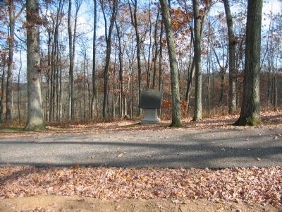
2. Fourth Brigade Tablet
Note the sharp drop in elevation behind the tablet. Rose Run passes to the east of Brooke Avenue (which was not a wartime road). The slope descending to the run offered several outcroppings which were used by Brooke's Brigade in their defense.
Also see . . . Reports of Col. John R. Brooke. Col. Brooke described the fighting in the Rose Woods in his official report:
I now found my flanks threatened by a strong force of the enemy, and immediately sent an officer to the general commanding the division for assistance, and finding also a part of the Third Brigade close at hand, I immediately ordered them in and held my ground. Both my aides being wounded, and myself severely bruised, I with great difficulty was able to maintain a proper knowledge of the enemy. Being notified about this time that a heavy column of the enemy was coming upon my left, I immediately took measures to meet them, sending word to that effect to the general commanding. I held them at bay for some time, when word was brought me that my right was being turned, and finding no troops coming to my support, and finding that unless I retired all would be killed or captured, I reluctantly gave the order to retire, and in good order the whole command came off the field slowly, and, firing as they retired, succeeded in bringing off nearly all their wounded. In passing back over the wheat-field,
Photographed By Craig Swain, November 11, 2008
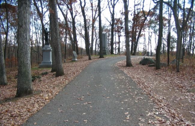
3. The Monument Line of Brooke's Brigade
Looking south on Brooke Avenue toward the tablet location. On the left of this view are the monuments for the 53rd Pennsylvania and 64th New York. Between them is the Fourth Brigade tablet. On the right side of the road is the tablet for Semmes' Confederate Brigade. The monument for the 2nd Delaware is just beyond the crest of this rise, above Semmes' tablet. Note again how quickly the ground slopes off behind the tablet (to the left). The ground provided Brooke's men a classic reverse slope defense, but had the disadvantage of being in the woods, thus limiting fields of fire. Furthermore, the Brigade was advanced so far as to be easily isolated.
Photographed By Craig Swain, November 11, 2008
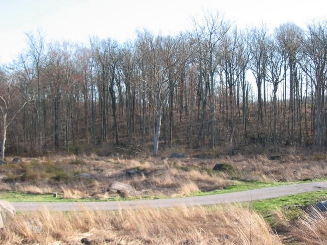
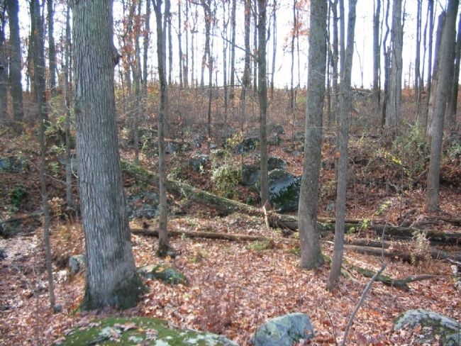
4. Slope on West Side of Rose Run
From Rose Run looking west up the slope defended by Brooke's Brigade. Even with the fall foliage, the rock outcroppings used by the Brigade in their defense are visible at the top of the slope. Just beyond view are the monuments on Brooke Avenue.
Credits. This page was last revised on February 7, 2023. It was originally submitted on January 25, 2009, by Craig Swain of Leesburg, Virginia. This page has been viewed 894 times since then and 6 times this year. Photos: 1, 2, 3. submitted on January 25, 2009, by Craig Swain of Leesburg, Virginia. 4. submitted on January 26, 2009, by Craig Swain of Leesburg, Virginia. 5. submitted on April 15, 2009, by Craig Swain of Leesburg, Virginia.
