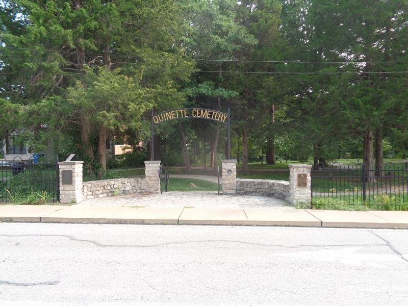
Quinette Cemetery in Kirkwood in St. Louis County, Missouri — The American Midwest (Upper Plains)
Quinette Cemetery
History of the Site
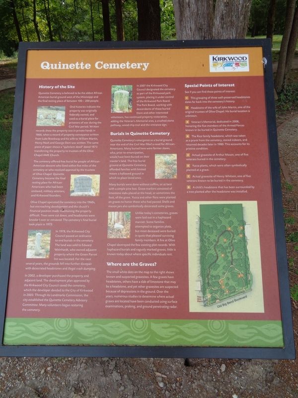
Quinette Cemetery is believed to be the oldest African American burial ground west of the Mississippi and the final resting place of between 100-200 people.
Oral histories indicate the property was originally federally owned, and used as a burial place for prisoners of war during the Civil War period. Written records show the property was in private hands in 1866, when a record of property conveyance written from Luke Brockway and his wife to William Martin, Henry Nash and George Sleet was written. The same piece of paper shows a "quitclaim deed" dated 1873 transferring the property to trustees of the Olive Chapel AME Church.
The cemetery offered free burial for people of African-American descent who lived within five miles of the cemetery or who received approval by the trustees of Olive Chapel. Quinette Cemetery became the final resting place for African-Americans who had been enslaved, military veterans, and Kirkwood founders.
Olive Chapel operated the cemetery into the 1960s, but encroaching development and the church's financial position made maintaining the property difficult. Trees were cut down, and headstones were knocked over or removed. The cemetery's final burial took place in 1973.
In 1978, the Kirkwood City Council passed an ordinance to end burials in the cemetery. The land was sold to Edward Weinhardt, who owned adjacent property where the Green Parrot Inn was located. For the next several years, the grounds fell into further disrepair with desecrated headstones and illegal trash dumping.
In 2002, a developer purchased the property and adjacent land. The development plan approved by the Kirkwood City Council saved the cemetery, which the developer deeded to the City of Kirkwood in 2003. Through its Landmarks Commission, the city established the Quinette Cemetery Advisory Committee. Many volunteers began restoring the cemetery.
In 2007 the Kirkwood City Council designated the cemetery as part of the Kirkwood park system, placing it under control of the Kirkwood Park Board. The Park Board, working with descendants of those buried there and other interested volunteers, has continued property restoration, adding the Veteran's Memorial area, a crushed stone pathway, wood chip trail and the entrance sign.
Burials in Quinette Cemetery
Quinette Cemetery's emergence as a burial ground near the end of the Civil War filled a need for African-Americans. Many buried here were former slaves, who, prior to emancipation, would have been buried on their master's land. The free burial ground at Quinette Cemetery afforded families with limited means a hallowed ground in which
to place loved ones.
Many burials were done without coffins, or at best with a simple pine box. Grave markers consisted of limestone slabs placed at the head, or sometimes the foot, of the grave. Yucca and other flora were planted on graves to honor those who had passed. Shells and mason jars also symbolically decorated some graves.
Unlike today's cemeteries, graves were laid out in a haphazard manner. Some families attempted to organize plots, but most deceased were buried in spots that pleased surviving family members. A fire at Olive Chapel destroyed the few existing plot records. With haphazard burials and vaguely marked graves, little is known today about where specific individuals rest.
Where are the Graves?
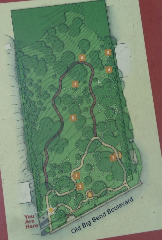
The small white dots on the map to the right shows known and suspected gravesites. A few graves have headstones, others have a slab of limestone that may be a headstone, and yet other gravesites are suspected because of depressions in the ground. Over the years, numerous studies to determine where actual graves are located have been conducted using surface examinations, probing, and ground penetrating radar.
Special Points of Interest
See if you can find these points of interest:
1) This grouping of three well-preserved headstones dates far back into the cemetery's history.
2)
Headstone of the wife of John Martin, one of the original trustees of Olive Chapel. His burial location is unknown.
3) Veteran's Memorial, dedicated in 2008, honoring the five members of the Armed Forces known to be buried in Quinette Cemetery.
4) The Rice family headstone, which was taken as a prank from the cemetery, stored indoors, and returned decades later in 1980. This accounts for its pristine condition.
5) Actual gravesite of Arthur Mason, one of five veterans buried in the cemetery.
6) Yucca plants, which were often symbolically planted at a grave.
7) Actual gravesite of Henry Whitson, one of five veterans known to be buried in the cemetery.
8) A child's headstone that has been surrounded by a tree planted after the headstone was installed.
Erected by Kirkwood Parks & Recreation Department.
Topics and series. This historical marker is listed in these topic lists: African Americans • Cemeteries & Burial Sites. In addition, it is included in the African Methodist Episcopal (AME) Church series list. A significant historical year for this entry is 1866.
Location. 38° 34.145′ N, 90° 26.063′ W. Marker is in Kirkwood, Missouri, in St. Louis County. It is in Quinette Cemetery. Marker is on Old Big Bend Road east of South Ballas Road
, on the right when traveling east. Touch for map. Marker is at or near this postal address: 12180 Old Big Bend Rd, Saint Louis MO 63122, United States of America. Touch for directions.
Other nearby markers. At least 8 other markers are within 2 miles of this marker, measured as the crow flies. Historic Quinette Cemetery (a few steps from this marker); Veteran's Memorial (within shouting distance of this marker); Greentree Park and Meramec Greenway (approx. 0.8 miles away); Meramec River Greenway - Unger Park (approx. 1.3 miles away); #9 (approx. 1.4 miles away); #750 (approx. 1.4 miles away); The Gasconade Bridge Disaster (approx. 1.4 miles away); Civil War Destruction (approx. 1.4 miles away). Touch for a list and map of all markers in Kirkwood.
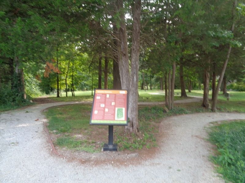
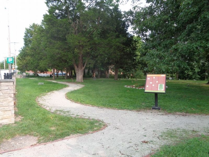
More about this marker. Two identical markers are on both left and right sides of the cemetery.
Also see . . .
1. Quinette Cemetery on Wikipedia. (Submitted on September 13, 2020, by Jason Voigt of Glen Carbon, Illinois.)
2. Quinette Cemetery on Findagrave. From the user-generated cemetery website Findagrave.com, this is the profile for Quinette Cemetery. As of September 2020, there are 55 persons found and identified on this page. As the marker says, it is not known how many interments are there, but through continued research from historians, some may be unearthed as the page progresses.
(Submitted on September 13, 2020, by Jason Voigt of Glen Carbon, Illinois.)
Credits. This page was last revised on September 13, 2020. It was originally submitted on September 13, 2020, by Jason Voigt of Glen Carbon, Illinois. This page has been viewed 350 times since then and 62 times this year. Photos: 1, 2, 3, 4, 5. submitted on September 13, 2020, by Jason Voigt of Glen Carbon, Illinois.
