Regent Square in Pittsburgh in Allegheny County, Pennsylvania — The American Northeast (Mid-Atlantic)
Early Land Use
Frick Park
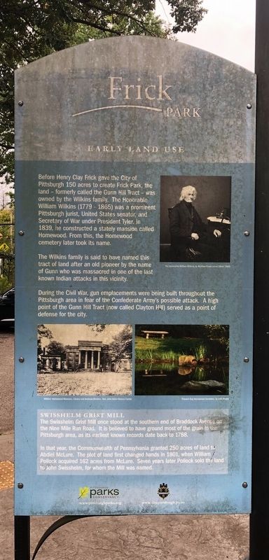
Before Henry Clay Frick gave the City of Pittsburgh 150 acres to create Frick Park, the land — formerly called the Gunn Hill Tract — was owned by the Wilkins family. The Honorable William Wilkins (1779 - 1865) was a prominent Pittsburgh jurist, United States senator, and Secretary of War under President Tyler. In 1839, he constructed a stately mansion called Homewood. From this, the Homewood cemetery later took its name.
The Wilkins family is said to have named this tract of land after an old pioneer by the name of Gunn who was massacred in one of the last known Indian attacks in this vicinity.
During the Civil War, gun emplacements were being built throughout the Pittsburgh area in fear of the Confederate Army's possible attack. A high point of the Gunn Hill Tract (now called Clayton Hill) served as a point of defense for the city.
Swisshelm Grist Mill
The Swisshelm Grist Mill once stood at the southern end of Braddock Avenue on the Nine Mile Run Road. It is believed to have ground most of the grain in the Pittsburgh area, as its earliest known records date back to 1788.
In that year, the Commonwealth of Pennsylvania granted 250 acres of land to Abdiel McLure. The plot of land first changed hands in 1801, when William Pollock acquired 162 acres from McLure. Seven years later Pollock sold the land to John Swisshelm, for whom the Mill was named.
Erected by Pittsburgh Parks Conservancy, City of Pittsburgh, Pennsylvania.
Topics. This historical marker is listed in these topic lists: Government & Politics • Industry & Commerce • Settlements & Settlers • War, US Civil. A significant historical year for this entry is 1839.
Location. 40° 26.236′ N, 79° 53.813′ W. Marker is in Pittsburgh, Pennsylvania, in Allegheny County. It is in Regent Square. It is on South Braddock
this page online

Regionally, this marker is in the American Northeast, in the Mid-Atlantic, in Appalachia, and specifically in Northern Appalachia. Globally, it is in North America, the Western Hemisphere, the Western World, and the Anglosphere. Historically, it finds itself in what was once the Viceroyalty of New France, the Haudenosaunee (Iroquois) Confederacy, and one of the original Thirteen Colonies.
Other nearby markers. At least 8 other markers are within walking distance of this marker: Influential Figures (here, next to this marker); Frick Woods Nature Preserve (here, next to this marker); In Honor of Service (about 600 feet away, measured in a direct line); Old Heidelberg Apts. (approx. half a mile away); Welcome to the Frick Woods / Pennsylvania - Forest Land (approx. half a mile away); Frick Park Today (approx. 0.6 miles away); Park Development (approx. 0.6 miles away); Frick Family (approx. 0.6 miles away).


Photographed by Devry Becker Jones (CC0), September 11, 2020
3. Wildlife in Our Parks Marker
Nearby nature marker

Photographed by Devry Becker Jones (CC0), September 11, 2020
4. Plants and Trees
Nearby nature marker

Photographed by Devry Becker Jones (CC0), September 11, 2020
5. Birds and Insects Marker
Additional nearby nature marker
Credits. This page was last revised on February 2, 2023. It was originally submitted on September 13, 2020, by Devry Becker Jones of Washington, District of Columbia. This page has been viewed 596 times since then and 44 times this year. Photos: 1, 2, 3, 4, 5. submitted on September 13, 2020, by Devry Becker Jones of Washington, District of Columbia.
