Squirrel Hill South in Pittsburgh in Allegheny County, Pennsylvania — The American Northeast (Mid-Atlantic)
Park Development
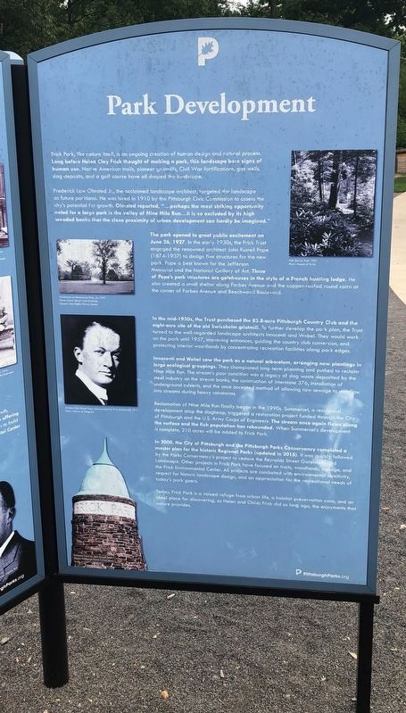
Frick Park, like nature itself, is an ongoing creation of human design and natural process. Long before Helen Clay Frick thought of making a park, this landscape bore signs of human use. Native American trails, pioneer gristmills, Civil War fortification, gas wells, slag deposits, and a golf course have all shaped the landscape.
Frederick Law Olmstead Jr., the acclaimed landscape architect, targeted the landscape as future parkland. He was hired in 1910 by Pittsburgh Civic Commission to assess the city's potential for growth. Olmstead reported, "…perhaps the most striking opportunity noted for a large park is the valley of Nine Miles Run…it is so excluded by its high wooded banks that the close proximity of urban development can hardly be imagined."
The park opened to great public excitement on June 26, 1927. In the early 1930s, the Frick Trust engaged the renowned architect John Russell Pope (1874-1937) to design five structures for the new park. Pope is best known for the Jefferson Memorial and the National Gallery of Art. Three of Pope's structures are gatehouses in the style of a French hunting lodge. He also created a small shelter along Forbes Avenue and the copper-roofed round cairn at the corner of Forbes Avenue and Beechwood Boulevard.
In the mid-1930s, the Trust purchased the 83.8-acre Pittsburgh Country Club and the eight-acre site of the old Swisshelm gristmill. To further develop the park plan, the Trust turned to the well-regarded landscape architects Innocenti and Webel. They would work on the park until 1957, improving entrances, guiding the country club conversion, and protecting interior woodlands by concentrating recreation facilities along park edges.
Innocenti and Webel saw the park as a natural arboretum, arranging new plantings in large ecological groupings. They championed long-term planning and pushed to reclaim Nine Mile Run. The stream's poor condition was a legacy of slag waste deposited by the steel industry on the stream banks, the construction of Interstate 376, installation of underground culverts, and the once accepted method of allowing raw sewage to overflow into streams during heavy rainstorms.
Reclamation of Nine Mile Run finally began in the 1990s. Summerset, a residential development atop the slagheap, triggered a restoration project funded through the City of Pittsburgh and the U.S. Army Corps of Engineers. The stream once again flows along the surface and the fish population has rebounded. When Summerset's development in complete, 210 acres will be added to Frick Park.
In 2000, the City of Pittsburgh and the Pittsburgh Parks Conservancy completed a master
Today, Frick Park is a valued refuge from urban life, a habitat preservation zone, and an ideal place for discovering, as Helen and Childs Frick and did so long ago, the enjoyments that nature provides.
Erected by Pittsburgh Parks Conservancy.
Topics. This historical marker is listed in these topic lists: Animals • Architecture • Environment • Parks & Recreational Areas. A significant historical date for this entry is June 26, 1927.
Location. 40° 26.219′ N, 79° 54.458′ W. Marker is in Pittsburgh, Pennsylvania, in Allegheny County. It is in Squirrel Hill South. Marker can be reached from Beechwood Boulevard, 0.1 miles east of Shaw Avenue, on the right when traveling north. Touch for map. Marker is at or near this postal address: 1981 Beechwood Blvd, Pittsburgh PA 15217, United States of America. Touch for directions.
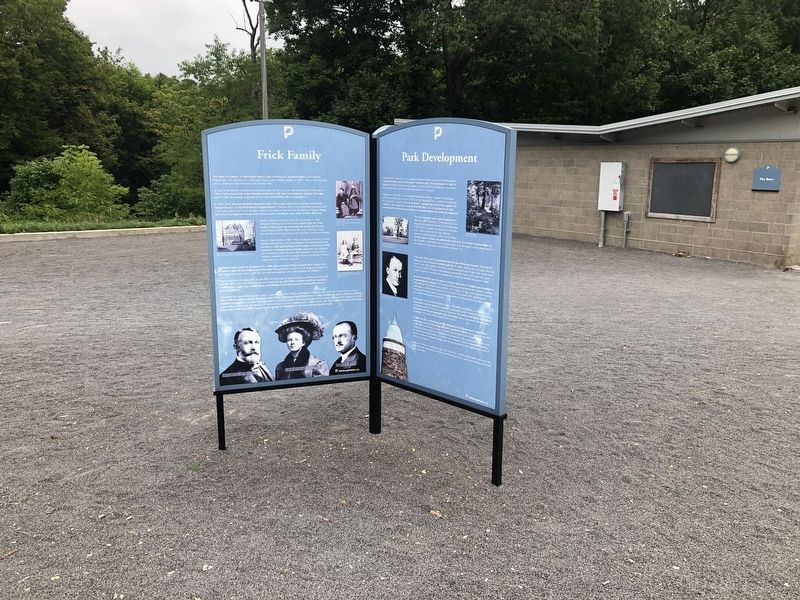
Other nearby markers. At least 8 other markers are within walking distance of this marker. Frick Family (here, next to this marker); Frick Park Today (here, next to this marker); From Slavery to Freedom Garden (a few steps from this marker); a different marker also named From Slavery to Freedom Garden (within shouting distance of this marker); Welcome to the Frick Woods / Pennsylvania - Forest Land (about 300 feet away, measured in a direct line); Veterans Memorial (approx. 0.3 miles away); a different marker also named Veterans Memorial (approx. 0.4 miles away); The Homewood Cemetery (approx. 0.4 miles away). Touch for a list and map of all markers in Pittsburgh.
Credits. This page was last revised on February 2, 2023. It was originally submitted on September 14, 2020, by Devry Becker Jones of Washington, District of Columbia. This page has been viewed 95 times since then and 18 times this year. Photos: 1, 2. submitted on September 14, 2020, by Devry Becker Jones of Washington, District of Columbia.

