Matewan in Mingo County, West Virginia — The American South (Appalachia)
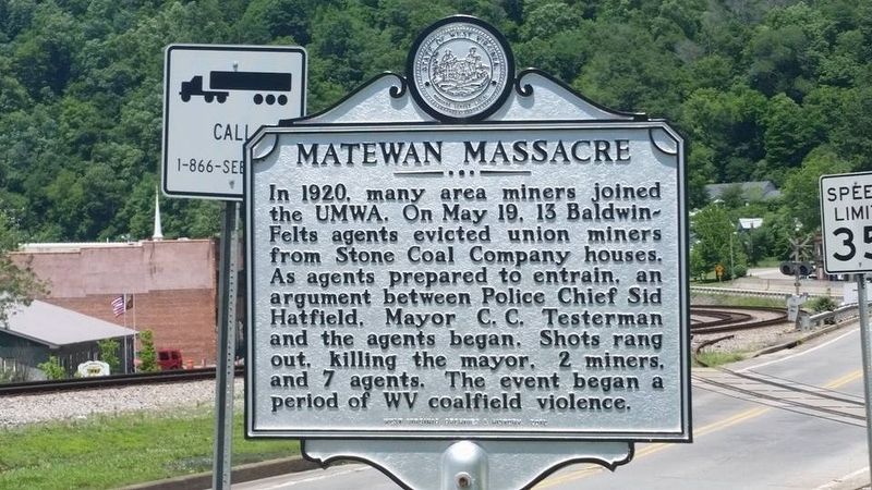
Matewan Massacre
Erected by West Virginia Archives & History.
Topics and series. This historical marker is listed in these topic lists: Labor Unions • Law Enforcement. In addition, it is included in the West Virginia Archives and History series list. A significant historical date for this entry is June 19, 1920.
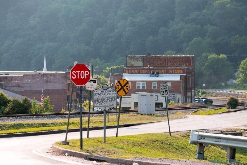
Location. 37° 37.324′ N, 82° 9.775′ W. Marker is in Matewan, West Virginia, in Mingo County. Marker is at the intersection of Main Street (West Virginia Route 65) and Magnolia Avenue (listed on some maps as Mate St.) (West Virginia Route 49), on the right when traveling west on Main Street. Touch for map. Marker is in this post office area: Matewan WV 25678, United States of America. Touch for directions.
Other nearby markers. At least 8 other markers are within walking distance of this marker. M.E. South Church (within shouting distance of this marker); Working Together for One Another (about 700 feet away, measured in a direct line); Cecil E. Roberts Building (about 800 feet away); The Battle of Matewan (about 800 feet away); a different marker also named Matewan Massacre (approx. 0.2 miles away); Hatfield-McCoy Feud (approx. 0.2 miles away); Divided Loyalties (approx. 0.2 miles away); Paw Paw Tree Incident (approx. 0.3 miles away in Kentucky). Touch for a list and map of all markers in Matewan.
More about this marker. There is a tin copy of this marker some 1000 feet away in town. Go to that page to find more information about the Matewan Massacre.

Photographed By J. J. Prats, July 23, 2021
2. Matewan Massacre Marker
Photographer is standing on Main Street (Route 65). The stop sign is for Magnolia Avenue (Route 49) that runs left to right beside the railroad tracks. In the distance is today’s Mate Street, the main street of the town. It is probable that Main Street here and Mate Street across the tracks were contiguous back in 1921 via a railroad crossing.
Credits. This page was last revised on July 31, 2021. It was originally submitted on September 10, 2020, by Mike McKeown of Baltimore, Maryland. This page has been viewed 618 times since then and 53 times this year. Last updated on September 14, 2020, by Bradley Owen of Morgantown, West Virginia. Photos: 1. submitted on September 10, 2020, by Mike McKeown of Baltimore, Maryland. 2. submitted on July 31, 2021, by J. J. Prats of Powell, Ohio. • Devry Becker Jones was the editor who published this page.
