Near Fairfax in Fairfax County, Virginia — The American South (Mid-Atlantic)
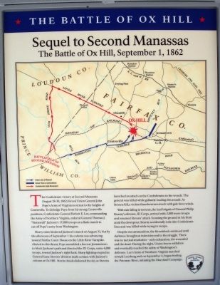
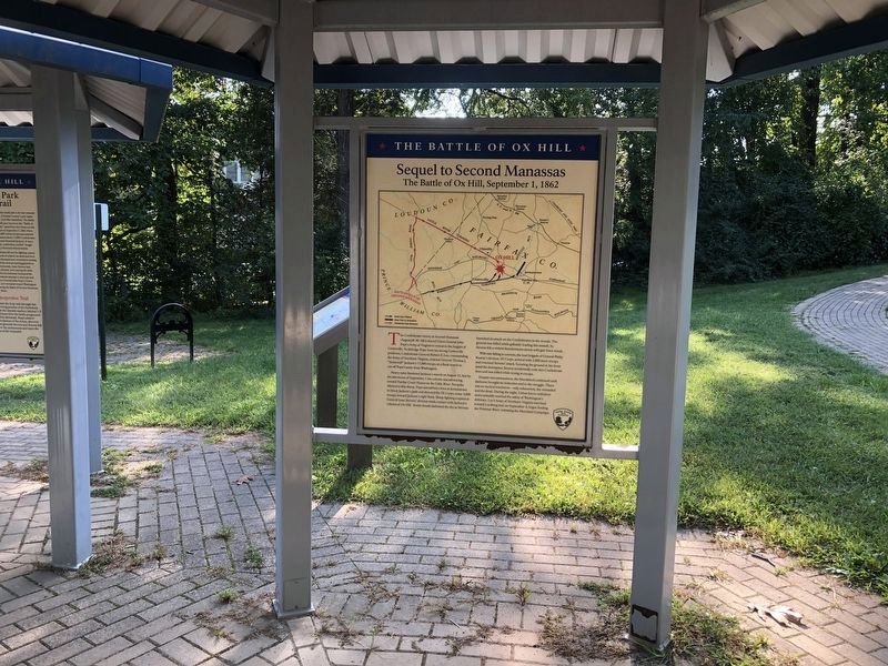
Sequel to Second Manassas
The Battle of Ox Hill, September 1, 1862
— ★ The Battle of Ox Hill ★ —
The Confederate victory at Second Manassas (August 28-30, 1862) forced Union General John Pope’s Army of Virginia to retreat to the heights of Centreville. To dislodge Pope from his strong Centreville positions, Confederate General Robert E. Lee, commanding the Army of Northern Virginia, ordered General Thomas J. “Stonewall” Jackson’s 17,000 troops on a flank march to cut off Pope’s army from Washington.
Heavy rains hindered Jackson’s march on August 31, but by the afternoon of September 1 his column was advancing toward Fairfax Court House on the Little River Turnpike. Alerted to this threat, Pope assembled a force at Jermantown to block Jackson’s path and directed the IX Corps, some 4,000 troops, toward Jackson’s right flank. Sharp fighting erupted as General Isaac Stevens’ division made contact with Jackson’s column at Ox Hill. Storm clouds darkened the sky as Stevens launched an attack on the Confederates in the woods. The general was killed while gallantly leading this assault. As Stevens fell, a violent thunderstorm struck with gale force winds.
With rain falling in torrents, the lead brigade of General Philip Kearny’s division, III Corps, arrived with 2,000 more troops and resumed Stevens’ attack. Scouting the ground in his front amid the downpour, Kearny accidentally rode into Confederate lines and was killed while trying to escape.
Despite wet ammunition, the bloodshed continued until darkness brought an indecisive end to the struggle. There was no tactical resolution—only exhaustion, the wounded and the dead. During the night, Union forces withdrew and eventually reached the safety of Washington’s defenses. Lee’s Army of Northern Virginia marched toward Leesburg and, on September 4, began fording the Potomac River, initiating the Maryland Campaign.
Erected 2008 by Fairfax County Park Authority.
Topics. This historical marker is listed in this topic list: War, US Civil. A significant historical month for this entry is September 1810.
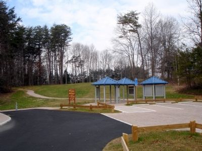
Location. 38° 51.863′ N, 77° 22.193′ W. Marker is near Fairfax, Virginia, in Fairfax County. Marker can be reached from West Ox Road (Virginia Route 608). These panels are in the middle of three interpretive kiosks at the Ox Hill Battlefield Park. Touch for map. Marker is at or near this postal address: 4134 West Ox Road, Fairfax VA 22033, United States of America. Touch for directions.
Other nearby markers. At least 8 other markers are within walking distance of this marker. Wounds Suffered at Ox Hill (Chantilly) (here, next to this marker); Ox Hill Battlefield Park & Interpretive Trail (here, next to this marker); La Batalla de Ox Hill (Chantilly) (here, next to this marker); Who Fought Here: The Generals (here, next to this marker);
Also see . . .
1. The Battle of Ox Hill (Chantilly). “A Last Salute” (Submitted on January 25, 2009.)
2. The Battle of Chantilly. Civil War Preservation Trust (Submitted on January 25, 2009.)

Photographed By Craig Swain
5. From Manassas to Chantilly
Jackson left the battleground of 2nd Manassas taking Gum Springs Road to the Little River Turnpike (somewhat represented today in that area as US 50). After an uncharacteristically slow march, Jackson brought his men down the Turnpike toward Fairfax City. His objective was the intersection of the Little River and Warrenton Turnpikes (generally the same as modern US 29 in western Fairfax County). However, the Federals had shifted enough to the east to block Jackson.
This view, taken from the overpass of Fairfax Parkway (CR 7100) over US 50 just north of the marker location, offers a view of Jackson's approach. In the far distance to the left (south) of the highway is the northern end of the Bull Run Mountains.
This view, taken from the overpass of Fairfax Parkway (CR 7100) over US 50 just north of the marker location, offers a view of Jackson's approach. In the far distance to the left (south) of the highway is the northern end of the Bull Run Mountains.
Credits. This page was last revised on September 20, 2021. It was originally submitted on January 25, 2009. This page has been viewed 1,429 times since then and 11 times this year. Photos: 1. submitted on January 25, 2009. 2. submitted on September 20, 2021, by Devry Becker Jones of Washington, District of Columbia. 3, 4. submitted on January 25, 2009. 5. submitted on May 26, 2008, by Craig Swain of Leesburg, Virginia. • Craig Swain was the editor who published this page.


