Rainsville in DeKalb County, Alabama — The American South (East South Central)
McCurdy House
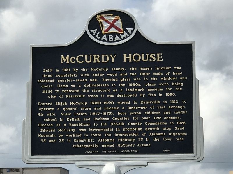
Photographed by Duane and Tracy Marsteller, September 12, 2020
1. McCurdy House Marker
Edward Elijah McCurdy (1880-1954) moved to Rainsville in 1912 to operate a general store and became a landowner of vast acreage. His wife, Susie Lofton (1877-1975), bore seven children and taught school in DeKalb and Jackson Counties for over five decades. Elected as a Republican to the DeKalb County Commission in 1926, Edward McCurdy was instrumental in promoting growth atop Sand Mountain by working to route the intersection of Alabama highways 75 and 35 in Rainsville; Alabama Highway 75 in the town was subsequently named McCurdy Avenue.
Erected 2016 by Alabama Historical Association.
Topics and series. This historical marker is listed in these topic lists: Architecture • Roads & Vehicles. In addition, it is included in the Alabama Historical Association
this page online
Location. 34° 29.67′ N, 85° 50.838′ W. Marker is in Rainsville, Alabama, in DeKalb County. It is at the intersection of McCurdy Avenue North (State Highway 75) and Main Street (State Highway 35), on the right when traveling south on McCurdy Avenue North. Touch for map. Marker is at or near this postal address: 32 Main St W, Rainsville AL 35986, United States of America. Touch for directions.

Regionally, this marker is in North Alabama. It is also in the American South, specifically in the Deep South, in Appalachia, and specifically in Southern Appalachia. Globally, it is in North America, a Gulf of Mexico state, the Western Hemisphere, the Western World, and the Anglosphere. Historically, it finds itself in what was once the original Cherokee Nation, the territory of the Mississippian Culture, one of the Confederate States of America, and the Antebellum South.
Other nearby markers. At least 8 other markers are within 8 miles of this marker, measured as the crow flies: Fort Payne Residential Historic District (approx. 8 miles away); Main Street Historic District
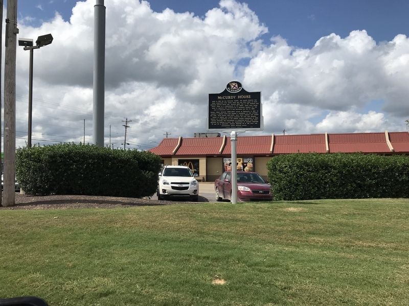
Photographed by Duane and Tracy Marsteller, September 12, 2020
2. McCurdy House Marker
Other markers no longer nearby. Trail of Tears (was approx. 6.7 miles away but has been confirmed missing); Sequoyah (was approx. 8.1 miles away but has been confirmed missing); Wills Town Mission (was approx. 8.1 miles away but has been confirmed missing); Fort Payne’s Fort (was approx. 8.1 miles away but has been confirmed missing).
Credits. This page was last revised on September 16, 2020. It was originally submitted on September 15, 2020, by Duane and Tracy Marsteller of Murfreesboro, Tennessee. This page has been viewed 1,480 times since then and 297 times this year. Photos: 1, 2. submitted on September 15, 2020, by Duane and Tracy Marsteller of Murfreesboro, Tennessee. • Mark Hilton was the editor who published this page.
