Near New Braunfels in Comal County, Texas — The American South (West South Central)
Natural Bridge Caverns
Photographed by James Hulse, April 14, 2019
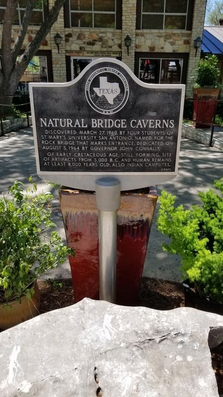
1. Natural Bridge Caverns Marker
Discovered March 27, 1960, by four students of St. Mary's University, San Antonio. Named for the rock bridge that marks entrance. Dedicated on August 5, 1964 by Governor John Connally.
Of Early Cretaceous age; still forming. Site of artifacts from 5,000 B.C. and human remains at least 8,000 years old; also Indian campsites.
Erected 1967 by State Historical Survey Committee. (Marker Number 3552.)
Topics. This historical marker is listed in these topic lists: Bridges & Viaducts • Education • Exploration • Parks & Recreational Areas. A significant historical date for this entry is March 27, 1960.
Location. 29° 41.552′ N, 98° 20.564′ W. Marker is near New Braunfels, Texas, in Comal County. It is on Natural Bridge Caverns Road 0.8 miles west of Highway 3009, on the right when traveling south. Touch for map. Marker is in this post office area: San Antonio TX 78266, United States of America. Touch for directions.

Regionally, this marker is in the Hill Country and in the San Antonio Metropolitan Area. It is also in the American South. Globally, it is in North America, a Gulf of Mexico state, the Western Hemisphere, the Western World, and the Anglosphere. Historically, it finds itself in what was once New Spain, the Republic of Texas, and one of the Confederate States of America.
Other nearby markers. At least 8 other markers are within 8 miles of this marker, measured as the crow flies: Zions Kirche (approx. 5.9 miles away); Kings Highway Camino Real — Old San Antonio Road (approx. 6.2 miles away); a different marker also named Kings Highway Camino Real — Old San Antonio Road (approx. 6.2 miles away); Davenport Cemetery (approx. 6.2 miles away); New Braunfels Schuetzen Verein (approx. 7.4 miles away); Comanche Lookout (approx. 7.7 miles away); Comanche Lookout Park (approx. 7.7 miles away);
this page online
Also see . . . Natural Bridge Caverns - Our Story. NaturalBridgeCaverns.com (Submitted on September 19, 2020, by James Hulse of Medina, Texas.)

Photographed by Brian Anderson, May 7, 2022
2. Natural Bridge Caverns Marker
Photographed by James Hulse, April 14, 2019
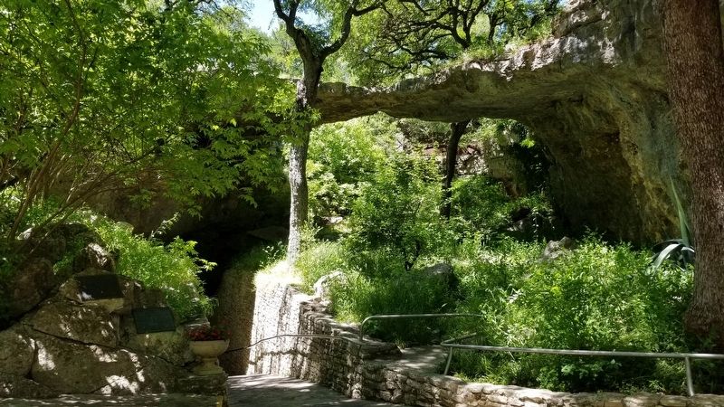
3. Entrance to the Natural Bridge Caverns
Credits. This page was last revised on October 22, 2022. It was originally submitted on September 19, 2020, by James Hulse of Medina, Texas. This page has been viewed 496 times since then and 29 times this year. Photos: 1. submitted on September 19, 2020, by James Hulse of Medina, Texas. 2. submitted on October 22, 2022, by Brian Anderson of New Albany, Ohio. 3. submitted on September 19, 2020, by James Hulse of Medina, Texas. • J. Makali Bruton was the editor who published this page.
