Near Pittsburg in Coos County, New Hampshire — The American Northeast (New England)
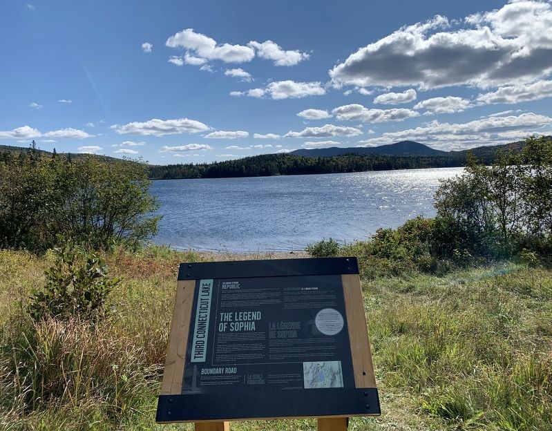
Third Connecticut Lake
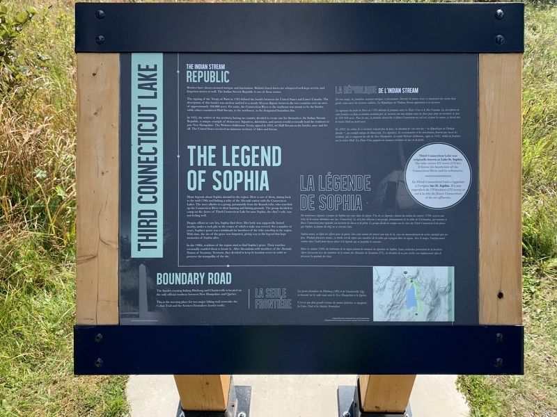
THE INDIAN STREAM REPUBLIC
Borders have always aroused intrigue and fascination. Behind closed doors are whispered well-kept secrets, and forgotten stories as well. The Indian Stream Republic is one of those stories.
The signing of the Treaty of Paris in 1783 defined the border between the United States and Lower Canada. The description of this border was unclear and led to a nearly 60-year dispute between the two countries over an area of approximately 160,000 acres. For some, the Connecticut River to the southeast was meant to be the border, while others considered Hall Stream, to the northwest, as the designated boundary line.
In 1832, the settlers of this territory created one for themselves: the Indian Stream Republic, a unique example of democracy. Injustices, skirmishes, and arrests would eventually lead the residents to join New Hampshire. The Webster-Ashburton Treaty, signed in 1842, set Hall Stream as the border, once and for all. The United States received an immense territory of lakes and forests.
THE LEGEND OF SOPHIA
Many legends about Sophia abound in the region. Here is one of them, dating back to the mid-1700s and linking a tribe of the Abenaki nation with the Connecticut Lakes. The story alludes to a group, presumably from the Koasek tribe, who travelled up the Connecticut River to their hunting and fishing grounds. The group decided to camp on the shores of Third Connecticut Lake because Sophia, the chief's wife, was not feeling well.
Despite efforts to cure her, Sophia died there. Her body was supposedly buried nearby, under a rock pile in the center of which a stake was erected. For a number of years, Sophia's grave was a landmark for members of the tribe traveling in the region.With time, the site of the grave was forgotten, giving way to the legend that kept memories of Sophia alive.
In the 1980s, residents of the region tried to find Sophia's grave. Their searches eventually enabled them to locate it. After discussions with members of the Abenaki Nation of Swanton, Vermont, they decided to keep its location secret in order to preserve the tranquility of the site.
BOUNDARY ROAD
The border crossing linking Pittsburg and Chartierville is located on the only official roadway between New Hampshire and Quebec.
This is the meeting place for two major hiking trail networks: the Cohos Trail and the Sentiers Frontaliers (border trails).
française
LA RÉPUBLIQUE DE L’INDIAN STREAM
De tout temps, les frontières suscitent intrigues et fascination. Derrière les portes closes se chuchotent des secrets bien gardés mais aussi des histoires oubliées. La République de l'Indian Stream appartient à ces histoires.
La signature du traité de Paris en 1783 délimite la frontière entre les États-Unis et le Bas-Canada. La description de celte frontière est floue et entraine pendant près de soixante ans une dispute entre les deux pays pour un territoire de près de 160 000 acres. Pour les uns, la frontière devait être le fleuve Connecticut au sud-est, et pour les autres, ce devait être la rivière Hall au nord-ouest.
En 1832, les colons de ce territoire n'ayant pas de pays, ils décident de s'en créer un - la République de l'Indian Stream -, un exemple unique de démocratie. Les injustices, les escarmouches et les arrestations finiront par lasser les résidents, qui se rangeront du côté du New Hampshire. Le traité Webster-Ashburton, signé en 1842, établit la frontière sur la rivière Hall. Les États-Unis gagnent un immense territoire de lacs et de forêts.
LA LÉGENDE DE SOPHIA
De nombreuses légendes à propos de Sophia ont cours dans la région. Une de ces légendes, datant du milieu. des années 1700, associe une tribu de la nation abénakise aux lacs Connecticut. Le récit fait allusion à un groupe, présumément de la tribu de Coöshaukee, qui remonte le fleuve Connecticut pour rejoindre son territoire de chasse et de pêche. Le groupe décide de camper sur les rives du Third Connecticut Lake parce que Sophia,
la femme du chef, ne se sent pas bien.
Sophia meurt, en dépit des efforts pour la guérir. Son corps aurait été enterré non loin de là, sous un amoncellement de roches identifié par un pieu. Pendant plusieurs années, sa tombe sert de repère aux membres de la tribu qui voyagent dans la région. Avec le temps, l'emplacement sombre dans l'oubli pour laisser place à la légende qui en perpétue le souvenir.
Dans les années 1980, des habitants de la région tentent de retrouver la sépulture de Sophia. Leurs recherches permettent de la localiser. Après discussion avec des membres de la nation des Abénakis de Swanton (VT), ils décident de ne pas révéler son emplacement afin de préserver la quiétude des lieux.
LA SEULE FRONTIÈRE
Les postes frontaliers de Pittsburg (NH) et de Chartierville (Qc) se trouvent sur la seule route entre le New Hampshire et le Québec.
C'est ici que deux grands réseaux de sentiers pédestres se rejoignent : la Cohos Trail et les Sentiers Frontaliers.
Right Inset
Third Connecticut Lake was originally known as Lake St. Sophia. The lake covers 231 acres (570 hc). It forms the headwater of the Connecticut River and its tributaries.
Le Third Connecticut Lake s'appelait à l'origine lac St. Sophia. Il a une superficie de 570 hectares (231 acres) et est à la tête du fleuve Connecticut et de ses affluents.
Map Caption:
Geography of the territory and Canada-US border near Third Connecticut Lake
Géographie du territoire et de la frontière canado-américaine près du lac Third Connecticut
Topics. This historical marker is listed in these topic lists: Native Americans • Roads & Vehicles • Settlements & Settlers. A significant historical year for this entry is 1783.
Location. 45° 14.349′ N, 71° 11.753′ W. Marker is near Pittsburg, New Hampshire, in Coos County. Marker can be reached from Daniel Webster Highway (U.S. 3) one mile south of US-Canadian Border Station, on the right when traveling south. Touch for map. Marker is in this post office area: Pittsburg NH 03592, United States of America. Touch for directions.
Other nearby markers. At least 5 other markers are within 16 miles of this marker, measured as the crow flies. Indian Stream Republic (approx. 14½ miles away); Pittsburg Honor Roll (approx. 16 miles away); Pittsburg World War II Honor Roll (approx. 16 miles away); a different marker also named Pittsburg Honor Roll (approx. 16 miles away); Republic of Indian Stream (approx. 16 miles away).
Also see . . .
1. The Connecticut Lakes. (Submitted on September 21, 2020, by Steve Stoessel of Niskayuna, New York.)
2. Indian Stream Republic. (Submitted on September 21, 2020, by Steve Stoessel of Niskayuna, New York.)
Credits. This page was last revised on September 24, 2020. It was originally submitted on September 20, 2020, by Steve Stoessel of Niskayuna, New York. This page has been viewed 706 times since then and 90 times this year. Photos: 1. submitted on September 20, 2020, by Steve Stoessel of Niskayuna, New York. 2, 3. submitted on September 21, 2020, by Steve Stoessel of Niskayuna, New York. • Bill Pfingsten was the editor who published this page.


