Near Chesapeake City in Cecil County, Maryland — The American Northeast (Mid-Atlantic)
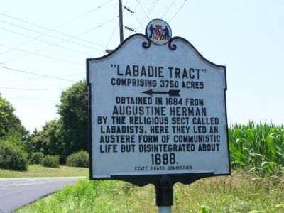
“Labadie Tract”
Comprising 3750 Acres
Augustine Herman
by the religious sect called Labadists. Here they led an austere form of communistic life but disintegrated about
1698.
Erected by State Roads Commission.
Topics. This historical marker is listed in these topic lists: Churches & Religion • Colonial Era • Settlements & Settlers. A significant historical year for this entry is 1684.
Location. 39° 29.215′ N, 75° 50.635′ W. Marker is near Chesapeake City, Maryland, in Cecil County. Marker is on Cayots Corner Road (Maryland Route 310) 0.2 miles east of Augustine Herman Highway (Maryland Route 213), on the left. Touch for map. Marker is in this post office area: Chesapeake City MD 21915, United States of America. Touch for directions.
Other nearby markers. At least 8 other markers are within 4 miles of this marker, measured as the crow flies. “Bohemia Mannor” (approx. 1˝ miles away); St. Augustine’s Church (approx. 1.9 miles away); St. Augustine School (approx. 2.4 miles away); Bohemia (approx. 3 miles away); Jennie Whiteoak House (approx. 3.1 miles away); McReynolds-Woods House (approx. 3.1 miles away); Stubbs-Caldwell House (approx. 3.1 miles away); Bayard-Bouchelle House (approx. 3.1 miles away). Touch for a list and map of all markers in Chesapeake City.
Also see . . . Labadists. Entry from the Catholic Encyclopedia. (Submitted on July 11, 2007.)
Credits. This page was last revised on November 22, 2019. It was originally submitted on July 6, 2007, by Bill Pfingsten of Bel Air, Maryland. This page has been viewed 1,997 times since then and 55 times this year. Photo 1. submitted on July 6, 2007, by Bill Pfingsten of Bel Air, Maryland. • J. J. Prats was the editor who published this page.
