Near Mechanicsville in Hanover County, Virginia — The American South (Mid-Atlantic)
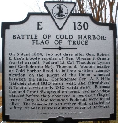
Battle of Cold Harbor
Flag of Truce
Erected 2005 by Department of Historic Resources. (Marker Number E-130.)
Topics and series. This historical marker is listed in this topic list: War, US Civil. In addition, it is included in the Virginia Department of Historic Resources (DHR) series list. A significant historical date for this entry is June 5, 1864.
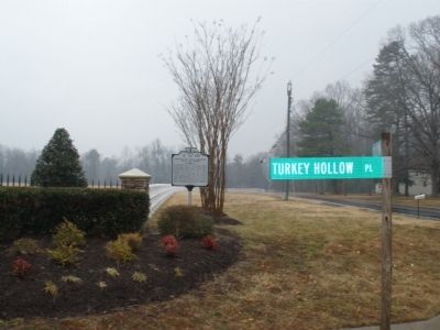
Location. 37° 33.954′ N, 77° 15.982′ W. Marker is near Mechanicsville, Virginia, in Hanover County. Marker is at the intersection of Cold Harbor Road (State Highway 156) and Turkey Hollow Place, on the right when traveling south on Cold Harbor Road. Touch for map. Marker is in this post office area: Mechanicsville VA 23111, United States of America. Touch for directions.
Other nearby markers. At least 8 other markers are within 2 miles of this marker, measured as the crow flies. Seven Days Battles (approx. 0.6 miles away); Chickahominy Water Trail (approx. one mile away); a different marker also named Seven Days Battles (approx. 1.1 miles away); Grapevine Bridge (approx. 1.1 miles away); a different marker also named Seven Days Battles (approx. 1.4 miles away); The Trent House (approx. 1.4 miles away); Springfield Plantation (approx. 1.4 miles away); Scars of Conflict (approx. 1.4 miles away). Touch for a list and map of all markers in Mechanicsville.
Credits. This page was last revised on June 16, 2016. It was originally submitted on January 27, 2009, by Bernard Fisher of Richmond, Virginia. This page has been viewed 1,498 times since then and 18 times this year. Photos: 1, 2. submitted on January 27, 2009, by Bernard Fisher of Richmond, Virginia. • Craig Swain was the editor who published this page.

