Taylorsville in Alexander County, North Carolina — The American South (South Atlantic)
Confederate Monument
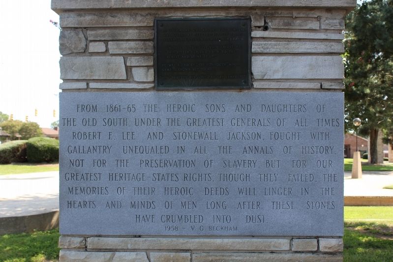
Photographed by Tom Bosse, September 6, 2020
1. Confederate Memorial
1958 - V.G. Beckham
The young man who adorns this pedestal was killed at Gettysburg, July 3, 1863. Perhaps his dying lips were murmuring
"Oh, fate of the just, thou gavest me this bitter cup, and I bow to thy behest and drink it up".
He was a lad of "The Old South" whose name is known but to me.
"How bravely her sons can say farewell".
Erected 1959 by Virgil "Gus" Beckham and Alexander County.
Topics. This monument and memorial is listed in this topic list: War, US Civil.
Location. 35° 55.36′ N, 81° 10.533′ W. Monument is in Taylorsville, North Carolina, in Alexander County. It is at the intersection of West Main Avenue (State
this page online

Regionally, this memorial monument is in North Carolina’s Piedmont. It is also in the American South, specifically in the Upper South, in Appalachia, and specifically in Southern Appalachia. Globally, it is in North America, the Western Hemisphere, the Western World, and the Anglosphere. Historically, it finds itself in what was once the territory of the Mississippian Culture, one of the original Thirteen Colonies, one of the Confederate States of America, and the Antebellum South.
Other nearby markers. At least 8 other markers are within 5 miles of this marker, measured as the crow flies: Picket's Charge (here, next to this marker); The Bell (within shouting distance of this marker); Alexander County Veterans Memorial Bell Tower (within shouting distance of this marker); Alexander County Veterans Memorial - Korea & Viet Nam (within shouting distance of this marker); Alexander County Veterans Memorial - World Wars I & II
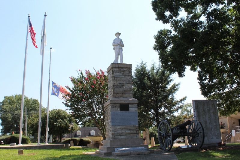
Photographed by Tom Bosse, September 6, 2020
2. Confederate Memorial
Also see . . . Alexander County Confederate Monument, Taylorsville. Commemorative Landscapes of North Carolina (Submitted on September 27, 2020.)
Additional commentary.
1. Use of phrase in Lincoln's funeral sermon
One of the phrases on the monument was first used in the funeral sermon for Lincoln given on April 19, 1865 by Dr. Phineas Gurley at the White House. Originally it was "God of the just, Thou gavest us the cup: We yield to thy behest, and drink it up."
— Submitted September 27, 2020, by J. Makali Bruton of Washington, District of Columbia.
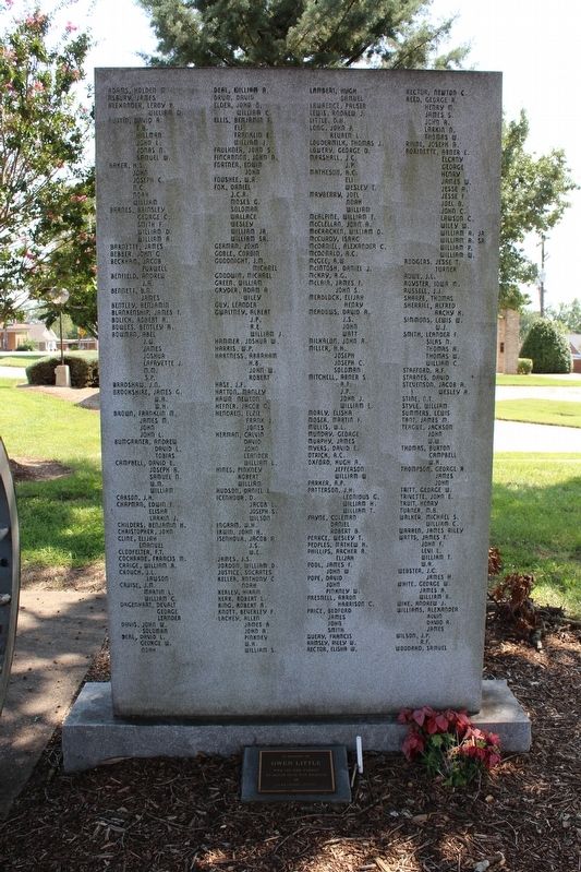
Photographed by Tom Bosse, September 6, 2020
3. Confederate Memorial
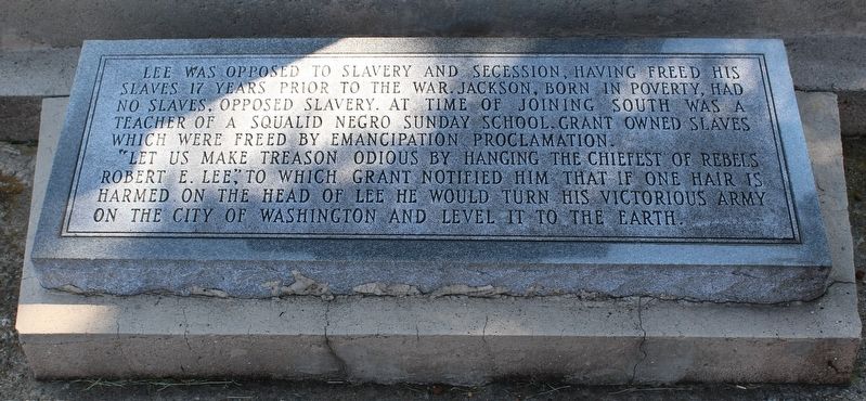
Photographed by Tom Bosse, September 6, 2020
4. Confederate Memorial
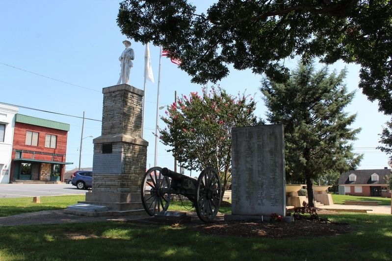
Photographed by Tom Bosse, September 6, 2020
5. Confederate Memorial
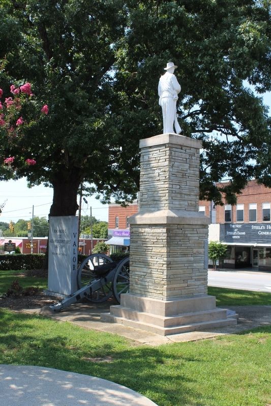
Photographed by Tom Bosse, September 6, 2020
6. Confederate Memorial (Back)
Credits. This page was last revised on September 27, 2020. It was originally submitted on September 27, 2020. This page has been viewed 771 times since then and 51 times this year. Last updated on September 27, 2020, by Bradley Owen of Morgantown, West Virginia. Photos: 1, 2, 3, 4, 5, 6. submitted on September 27, 2020, by Tom Bosse of Jefferson City, Tennessee. • J. Makali Bruton was the editor who published this page.
