Near Chappell Hill in Washington County, Texas — The American South (West South Central)
Chappell Hill Masonic Cemetery

Photographed by James Hulse, September 9, 2018
1. Chappell Hill Masonic Cemetery Marker
Opened as Masonic burial ground, 1853. Jacob Haller, founder of Chappell Hill, was first interment. Final resting place of pioneers, soldiers, statesmen, heroes of Texas. Until formation of Cemetery Association in 1965, cared for by Hubert Lodge No. 67, A. F. & A. M.
Erected 1973 by State Historical Survey Committee. (Marker Number 8322.)
Topics. This historical marker is listed in this topic list: Cemeteries & Burial Sites. A significant historical year for this entry is 1853.
Location. 30° 9.211′ N, 96° 15.644′ W. Marker is near Chappell Hill, Texas, in Washington County. It is on Old Chappell Hill Road 0.7 miles north of Chestnut Street (Farm to Market Road 2447), on the right when traveling north. Touch for map. Marker is in this post office area: Chappell Hill TX 77426, United States of America. Touch for directions.

Regionally, this marker is in the American South and on the Gulf Coast. Globally, it is in North America, a Gulf of Mexico state, the Western Hemisphere, the Western World, and the Anglosphere. Historically, it finds itself in what was once New Spain, the Republic of Texas, one of the Confederate States of America, and the Antebellum South.
Other nearby markers. At least 8 other markers are within walking distance of this marker: Cedar Creek Community (here, next to this marker); Major William Edward Howth (within shouting distance of this marker); William Jones E. Heard (within shouting distance of this marker); Permelia Haynie Home (approx. 0.7 miles away); Jacob Haller House (approx. 0.7 miles away); Julius Yanch Home (approx. 0.7 miles away); Farmers State Bank and Reinstein Store (approx. 0.8 miles away); Old Rock Store (approx. 0.8 miles away). Touch for a list and map of all markers in Chappell Hill.
Also see . . . Chappell Hill Texas. TSHA Texas State
this page online

Photographed by James Hulse, September 9, 2018
2. The Chappell Hill Masonic Cemetery Marker is the second marker from the left
The markers are at the entrance to the Chappell Hill Masonic Cemetery.
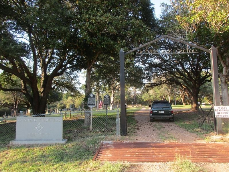
Photographed by Jeff Leichsenring, October 15, 2026
3. Chappell Hill Masonic Cemetery and marker
Marker is on the right; Cedar Creek Community marker (17831) is on the left.
Credits. This page was last revised on October 18, 2026. It was originally submitted on September 27, 2020, by James Hulse of Medina, Texas. This page has been viewed 523 times since then and 82 times this year. Photos: 1, 2. submitted on September 27, 2020, by James Hulse of Medina, Texas. 3. submitted on October 17, 2026, by Jeff Leichsenring of Garland, Texas. • J. Makali Bruton was the editor who published this page.
