Fort Smith in Sebastian County, Arkansas — The American South (West South Central)
Osage Nation
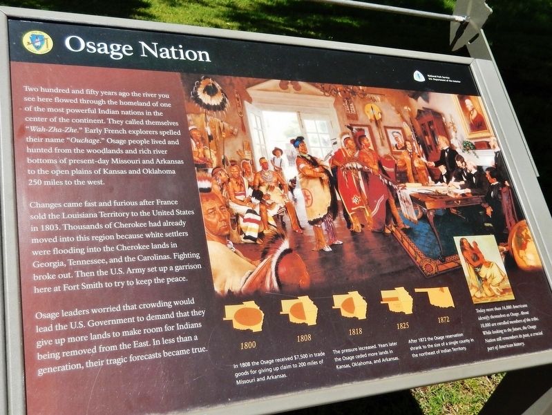
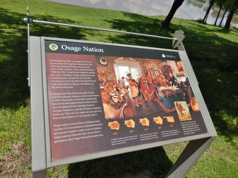
Changes came fast and furious after France sold the Louisiana Territory to the United States in 1803. Thousands of Cherokee had already moved into this region because white settlers were flooding into the Cherokee lands in Georgia, Tennessee, and the Carolinas. Fighting broke out. Then the U.S. Army set up a garrison here at Fort Smith to try to keep the peace.
Osage leaders worried that crowding would lead the U.S. Government to demand that they give up more lands to make room for Indians being removed from the East. In less than a generation, their tragic forecasts became true.
In 1808 the Osage received $7,500 in trade goods for giving up claim to 200 miles of Missouri and Arkansas.
The pressure increased. Years later the Osage ceded more lands in Kansas, Oklahoma, and Arkansas.
After 1872 the Osage reservation shrank to the size of a single county in the northeast of Indian Territory.
Today more than 16,000 Americans identify themselves as Osage. About 10,000 are enrolled members of the tribe. While looking to the future, the Osage Nation still remembers its past, a crucial part of American history.
Erected by National Park Service, U.S. Department of the Interior.
Topics. This historical marker is listed in this topic list: Native Americans.
Location. 35° 23.219′ N, 94° 25.979′ W. Marker is in Fort Smith, Arkansas, in Sebastian County. Marker can be reached from the intersection of Parker Avenue and South 3rd Street. Marker is located on the Fort Smith National Historic Site grounds, near Belle Point on the west side of the fort. Touch for map. Marker is at or near this postal address: 301 Parker Avenue, Fort Smith AR 72901, United States of America. Touch for directions.
Other nearby markers. At least 8 other markers are within walking distance of this marker. Defending Fort Smith (within shouting distance of this marker); Who Served Here? (within shouting distance of this marker); Establishing Fort Smith (within shouting distance of this marker); Major Long Surveys the Western Frontier (within shouting distance of this marker); Cherokee Nation (about 300 feet away, measured in a direct line); Abandoned and Forgotten (about 300 feet away); Chickasaw Nation (about 300 feet away); Choctaw Nation (about 300 feet away). Touch for a list and map of all markers in Fort Smith.
Also see . . .
1. Osage Nation (Wikipedia). Between the first treaty with the US and 1825, the Osages ceded their traditional lands across Missouri, Arkansas, and Oklahoma in the treaties of 1818 and 1825. Subsequent U.S. treaties and laws through the 1860s further reduced the lands of the Osage. By a treaty in 1865, they ceded another 4 million acres to the United States. The Drum Creek Treaty was passed by in 1870 and provided that the remainder of Osage land in Kansas be sold and the proceeds used to relocate the tribe to Indian Territory in the Cherokee Outlet. (Submitted on October 1, 2020, by Cosmos Mariner of Cape Canaveral, Florida.)
2. The history of the Osage Nation. By the time of the Treaty of 1839 at Fort Gibson, the Cherokee Trail of Tears was underway, exiling the Cherokee to Indian territory, but the Osage people lived there already. This decision by the U.S. government created conflict, so the 1839 treaty called for cession of the Osage’s remaining land in Oklahoma and their removal to Kansas to alleviate the tension. (Submitted on October 1, 2020, by Cosmos Mariner of Cape Canaveral, Florida.)
3. The Osage Nation. (Submitted on October 1, 2020, by William Fischer, Jr. of Scranton, Pennsylvania.)
Credits. This page was last revised on October 1, 2020. It was originally submitted on September 28, 2020, by Cosmos Mariner of Cape Canaveral, Florida. This page has been viewed 298 times since then and 35 times this year. Photos: 1, 2, 3, 4. submitted on October 1, 2020, by Cosmos Mariner of Cape Canaveral, Florida.


