Near Newark in New Castle County, Delaware — The American Northeast (Mid-Atlantic)
The Hundreds of Delaware
Photographed by Don Morfe, September 8, 2019
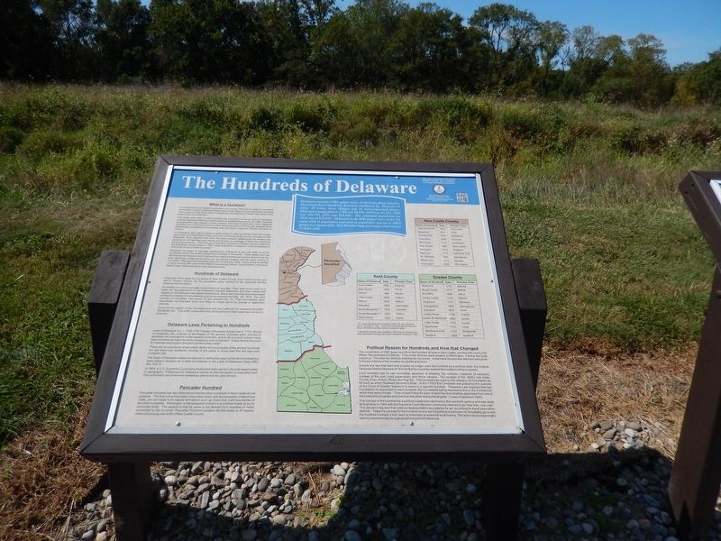
1. The Hundreds of Delaware Marker
The name was used in many colonies but survived in America only in Delaware, probably because there the counties were all established so early - by 1680 - that little reorganization was needed. In New England, the newer English term, town, replaced hundred, and in Pennsylvania and New Jersey, the term township was adopted. Most states today are divided into counties, then into Ward, Township, Parish, Precinct, or District.
For Delaware, the origin is cited in a letter written in 1682 by William Penn, the newly appointed Lord Proprietor of the province of Pennsylvania and the counties on the Delaware. Penn directed that from this point forward, settlements be divided into sections of 100 families; each family would have an average of about ten members (including servants). The first use of the term Hundred in official
this page online
Whatever its origin or intended significance, Delaware is the only state in which hundreds exist in the United States and possibly in the world. Other states such as Pennsylvania, Maryland and Virginia once used hundreds as a county division but the only remaining evidence would be an occasional location with its name ending in “hundred”. Maryland had stopped using the hundred by 1825. Some of the hundreds in Cecil County, MD were North Milford (containing Elkton), South Milford, Elk Neck, Back Creek, East Nottingham and Susquehanna.
Hundreds are unincorporated divisions of counties. They were once used as a basis for representation in the Delaware General Assembly and their names still appear on all Delaware real estate transactions. Many early records were kept based on the boundaries
Photographed by Don Morfe, September 8, 2019
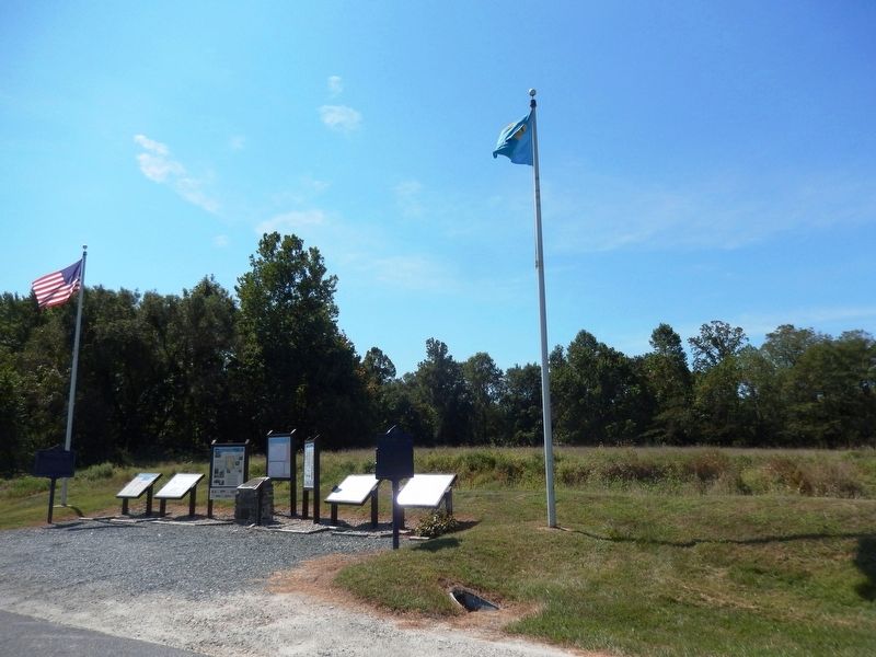
2. The Hundreds of Delaware Marker
Some names of the hundreds end with the suffix kill, for example Broadkill, Murderkill, etc. This suffix comes from the Old Dutch word "kille" meaning river bed or channel.
There are no provisions of law which define the boundaries of the ancient hundreds nor are there any authentic records of the same to show that this Act was ever complied with.
The State of Delaware makes no attempt to define the origin of the term hundred but does make a decision as to their boundaries in the Laws of Delaware Code, 1852, Sec. 8-9-10.
In 1964, a U.S. Supreme Court ruling disallowed state election districts based solely on geography. Following this, Delaware redrew its districts based on population and this continues to be done when necessary after every ten year census.
[top center of marker]
Delaware contains 1,982 square miles divided into three counties. New Castle County has 11 hundreds, Kent nine and Sussex 13. There are 33 cities, 43 towns, three villages and 30 unincorporated places. Delaware's population in 1790 was 59,096, 1850 was 91,532, 1900 was 184,735, 1950 was 318,085. The estimated population for 2014 was at 935,614. Delaware is the 49th largest state in the US, ranks 45th in population and sixth in population density at 460.8 people per square mile. It is 96 miles long and ranges from nine to 35 miles wide.
[top right of marker]
Pencader Heritage Area Association
A non-profit all-volunteer organization
2029 Sunset Lake Road
Newark, Delaware 19702
[In the lists of hundreds below, do not confuse the two hundreds called Little Creek in Kent and Sussex counties.]
New Castle County
Appoqunimink -- 1682 -- Townsend
Blackbird -- 1875 -- none
Brandywine -- 1682 -- Bellefonte
Christiana -- 1682 -- Elsmere
Mill Creek -- 1710 -- Hockessin
New Castle -- 1682 -- New Castle
Pencader -- 1710 -- Glasgow
Red Lion -- 1710 -- Delaware City
St. Georges -- 1682 -- Middletown
White Clay -- 1710 -- Newark
Wilmington -- 1833 -- Wilmington
Name of Hundred -- Date -- Primary Town
Duck Creek -- 1682 -- Smyrna
East Dover * -- 1859 -- Dover
Kenton -- 1869 -- Kenton
Little Creek -- 1682 -- Leipsic
Milford -- 1830 -- Milford
North Murderkill ** -- 1855 -- Camden
South Muderkill ** -- 1855 -- Felton
West Dover * -- 1859 -- Hartly
* St. Jones Hundred was created in 1682 and was renamed Dover Hundred in 1823. Dover Hundred was divided into East Dover Hundred and West Dover Hundred in 1859.
** Muderkill Hundred was created in 1682 and was divided into North Murderkill Hundred and South Muderkill Hundred in 1855.
Baltimore -- 1775 -- Millville
Broad Creek -- 1775 -- Bethel
Broadkill -- 1696 -- Milton
Cedar Creek -- 1702 -- Milford
Dagsboro -- 1773 -- Millsboro
Georgetown -- 1863 -- Georgetown
Gumboro -- 1873 -- none
Indian River -- 1706 -- Angola
Lewes & Rehoboth -- 1692 -- Lewes
Little Creek -- 1774 -- Laurel
Nanticoke -- 1775 -- none
Northwest Fork -- 1775 -- Bridgeville
Seaford -- 1775 -- Seaford
Despite the fact that Kent and Sussex no longer used the hundred as a political area, the original Delaware Historic Markers of 1933 for the two counties marked the locations of the hundreds[.]
Each hundred had its own constable,assessor of property, tax collector, inspector of elections, trustees of the poor, road supervisors, and fence viewers. Tax receipts of the 1800's lists State, County, Poor, School, Road, and Dog Tax. The hundred was used for the selection of Constables as far back as when Delaware became a State. In the 1700's the Constable was picked by the Justices of the Court of Quarter Sessions to serve in a specific hundred. Delaware Law required that two Constables be appointed to each hundred, the Constables being required to live in the hundred for which they were chosen. "One of said Police for each of said Hundred shall be appointed from one of the chief political parties and one from the other chief political party." (Laws of Delaware 1935)
The concept of the hundred as a political subdivision declined in the twentieth century and was dealt its final blow in 1964 with the Supreme Court decision commonly referred to as "one man, one vote". This decision required that political representation boundaries be set according to equal population districts. Today the concept of the hundred as any sort of political subdivision is completely gone and the hundred is simply a tool used by historians to examine local history. The term has no meaningful use or purpose except as a geographic point of reference.
Erected by Pencader Heritage Area Association.
Topics. This historical marker is listed in these topic lists: Colonial Era • Government & Politics. A significant historical year for this entry is 1682.
Location. 39° 38.459′ N, 75° 43.942′ W. Marker is near Newark, Delaware, in New Castle County. It is on Dayett Mills Road south of Old Baltimore Pike, on the right when traveling south. Touch for map. Marker is in this post office area: Newark DE 19702, United States of America. Touch for directions.

Regionally, this marker is in Greater Wilmington and in Greater Philadelphia. It is also in the American Mid-Atlantic, on the Delmarva Peninsula, and on the Eastern Seaboard. Globally, it is in the North Atlantic Region, North America, the Western Hemisphere, the Western World, and the Anglosphere. Historically, it finds itself in what was once New Netherland and also one of the original Thirteen Colonies.
Other nearby markers. At least 8 other markers are within walking distance of this marker: Revolutionary War Patriots (here, next to this marker); Milling in Pencader Hundred (here, next to this marker); American Position (here, next to this marker); Mason Dixon Line & the Boundaries of Delaware (here, next to this marker); Your Gateway to Pencader Heritage (here, next to this marker); Delaware's Field of Valor (here, next to this marker); Enjoy the Pencader Area Today (here, next to this marker); Geology (here, next to this marker). Touch for a list and map of all markers in Newark.
Regarding The Hundreds of Delaware. "lists" appears in 2nd sentence of next to last paragraph; should be "list".
Pennsylvania, New Jersey, and New England are mentioned; New York state, which is not, uses towns.
Credits. This page was last revised on April 1, 2026. It was originally submitted on September 17, 2019, by Don Morfe of Baltimore, Maryland. This page has been viewed 3,611 times since then and 290 times this year. Last updated on September 28, 2020, by Carl Gordon Moore Jr. of North East, Maryland. Photos: 1, 2. submitted on September 17, 2019, by Don Morfe of Baltimore, Maryland. • Bill Pfingsten was the editor who published this page.
