Quincy's Early Environment
1848
prairie grasses, ravines, creeks,
and springs were prominent features of Quincy in Lincoln's
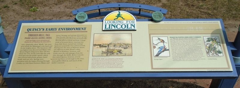
time. Originally called "Bluffs," the town grew along the Mississippi's east bank and on the heights above. The limestone cliff was highest near Second and Maine with Mount Pisgah rising more than 125 feet above the river. In the early days the only level spot was the public square, which was covered with prairie grasses, hazel brush, and one tree. Springs were prevalent with the largest flowing through a valley on 14th Street between Maine and Jersey. Seepage and springs abounded on what became Spring Street. Other springs provided good locations for breweries like Dick Brothers at Ninth and York. A large creek at Vermont Street, running west from 24th Street, turned into swampy land as it neared the river. Johnny Creek, flowing into the river at Delaware Street, was adjacent to John Wood's cabin. Ravines at Delaware, Vermont, and Cedar were the only passages from the river through the bluffs. Before Lincoln first visited Quincy, however, several streets had been cut through to the river, many gullies filled in, and much of the timber removed.
Quincy in 1848 was painted by artist Henry Lewis and depicts the town near the time of Lincoln's first visit. Lewis wrote that Quincy presented a poor appearance from the river but would pleasantly surprise the traveler who climbed the bluff. "The houses are uniform, and built in rows; the streets and byways are suitable and well paved." Lewis noted the "view from the top of the hill over forests reaching as far as the eye can see, is beautiful beyond all description."
Wildlife was plentiful during Quincy's formative years. Wild turkey and prairie chickens were hunted in town. Swampy waterway havens were populated by Great Blue Herons, Coot, Mallards, Wood Ibises and Sandhill Cranes. Geese and other waterfowl populated "Boston Bay," Quincy's natural harbor. At the end of the Civil War, Professor D. C. Musselman was still able to witness thousands of now extinct wild Passenger Pigeons "in aerial layers eight deep until they shut out the vision of the sun" fly over the campus of the Old German and English College. Carolina Parakeets abundant in Lincoln's time disappeared within fifty years. During spring floods, abundant sucker fish migrating up creeks provided an easy catch to fry or salt down as winter preserves. Illinois has long been known as the "Sucker" state. Deer and other large game animals were hunted in the surrounding timber.
Erected 2009 by Looking for Lincoln Heritage Coalition and Advance Physical Therapy & Sports Medicine.
Topics and series. This historical marker is listed in these topic lists: Environment • Settlements & Settlers. In addition, it is included in the Former U.S. Presidents: #16 Abraham Lincoln, and the Looking for Lincoln series lists. A significant historical year for this entry is 1848.
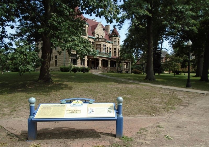
Location. 39° 55.917′ N, 91° 23.415′ W. Marker is in Quincy, Illinois, in Adams County. Marker is at the intersection of Maine Street and 16th Street, on the left when traveling east on Maine Street. Touch for map. Marker is at or near this postal address: 1601 Maine Street, Quincy IL 62301, United States of America. Touch for directions.
Other nearby markers. At least 8 other markers are within walking distance of this marker. R. F. Newcomb House (within shouting distance of this marker); Charles Henry Bull House (about 500 feet away, measured in a direct line); Political Allies (approx. half a mile away); John Wood Mansion (approx. half a mile away); Historical Society of Quincy and Adams County (approx. half a mile away); Lincoln Recuperates (approx. 0.6 miles away); Original Site of Quincy College (approx. 0.7 miles away); Ernest M. Wood Office and Studio (approx. 0.7 miles away). Touch for a list and map of all markers in Quincy.

Click for more information.
Credits. This page was last revised on May 10, 2021. It was originally submitted on September 28, 2020, by William Fischer, Jr. of Scranton, Pennsylvania. This page has been viewed 198 times since then and 37 times this year. Photos: 1, 2. submitted on September 28, 2020, by William Fischer, Jr. of Scranton, Pennsylvania. 3. submitted on May 10, 2021, by Larry Gertner of New York, New York.

