Grand Canyon National Park in Coconino County, Arizona — The American Mountains (Southwest)
The Best Section
—John Wesley Powell, 1868
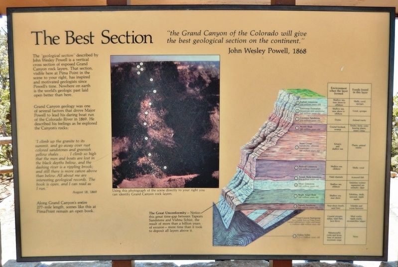
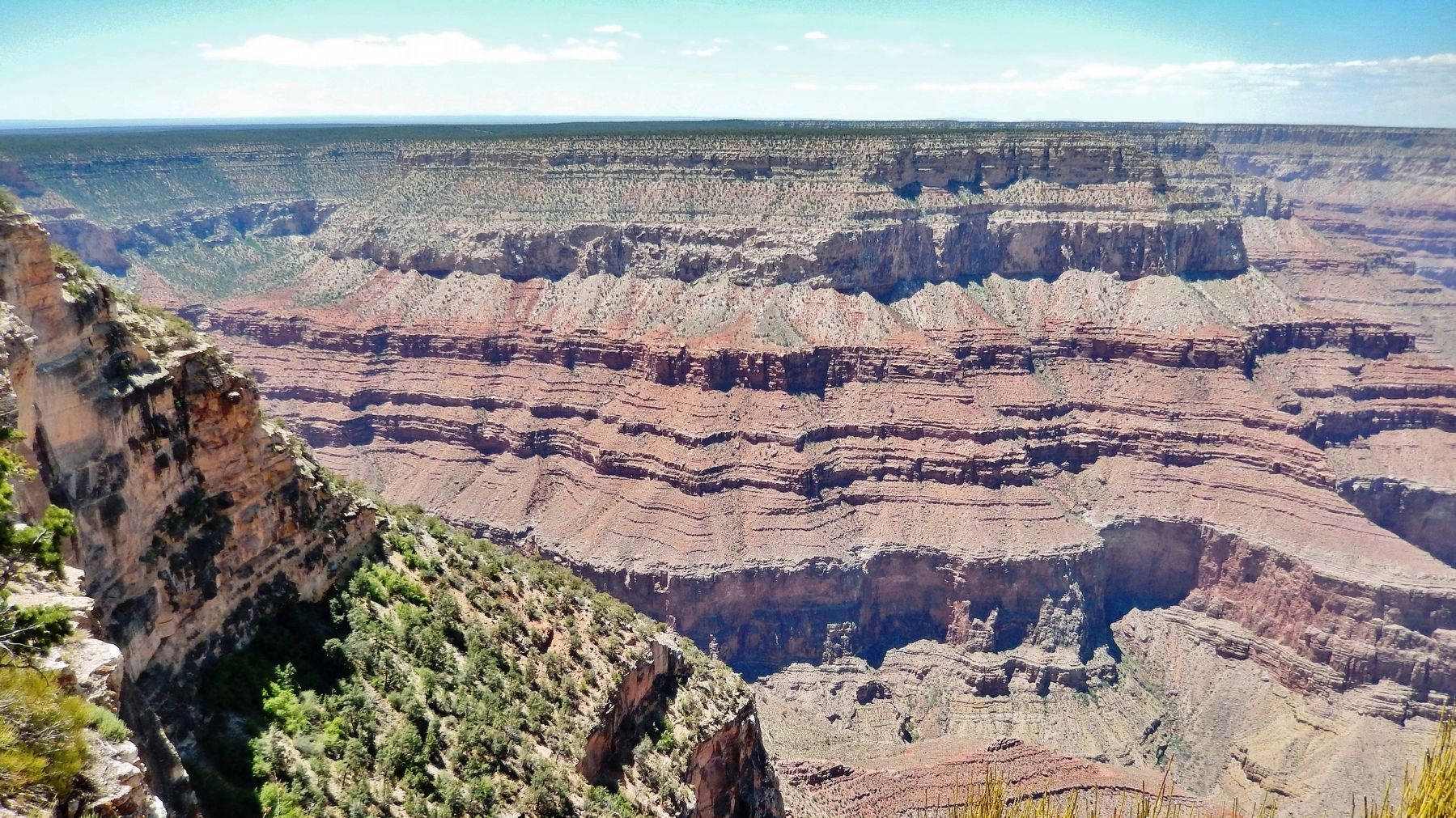
The “geological section” described by John Wesley Powell is a vertical cross section of exposed Grand Canyon rock layers. That section, visible here at Pima Point in the scene to your right, has inspired and motivated geologists since Powell's time. Nowhere on earth is the world's geologic past laid open better than here.
Grand Canyon geology was one of several factors that drove Major Powell to lead his daring boat run of the Colorado River in 1869. He described his feelings as he explored the Canyon's rocks:
”I climb up the granite to its summit and go away over rust colored sandstones and greenish yellow shales… I climb so high that the men and boats are lost in the black depths below, and the dashing river is a rippling brook; and still there is more cañon above than below. All about me are interesting geological records. The book is open, and I can read as I run.”
August 18, 1869
Along Grand Canyon’s entire 277-mile length, scenes like this at Pima Point remain an open book.
(photo caption)
Using this photograph of the scene directly to your right you can identify Grand Canyon rock layers.
Topics. This historical marker is listed in these topic lists: Exploration • Science & Medicine • Waterways & Vessels. A significant historical date for this entry is August 18, 1869.
Location. 36° 4.302′ N, 112° 12.003′ W. Marker is in Grand Canyon National Park, Arizona, in Coconino County. Marker can be reached from the intersection of Hermit Road and West Rim Trail. Marker is located in Grand Canyon National Park (South Rim), along the West Rim Trail, at the Pima Point Overlook. Touch for map. Marker is in this post office area: Grand Canyon AZ 86023, United States of America. Touch for directions.
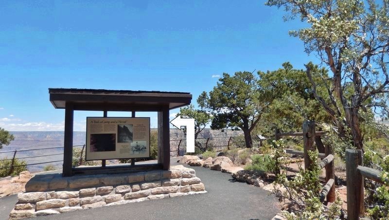
Other nearby markers. At least 8 other markers are within 3 miles of this marker, measured as the crow flies. A Trail, a Camp, and a "Hermit" (here, next to this marker); Hermit Camp (a few steps from this marker); Down Memory Lane (approx. 0.8 miles away); Hermit's Rest (approx. 0.9 miles away); Rest House (approx. 0.9 miles away); Colonel Claude Hale Birdseye (approx. 2½ miles away); Orphan Mine (approx. 2.7 miles away); Early Explorer (approx. 2.7 miles away). Touch for a list and map of all markers in Grand Canyon National Park.
Also see . . .
1. Major John Wesley Powell's 1869 Journey down the Green and Colorado Rivers. The purpose of Powell’s 1869 expedition was to

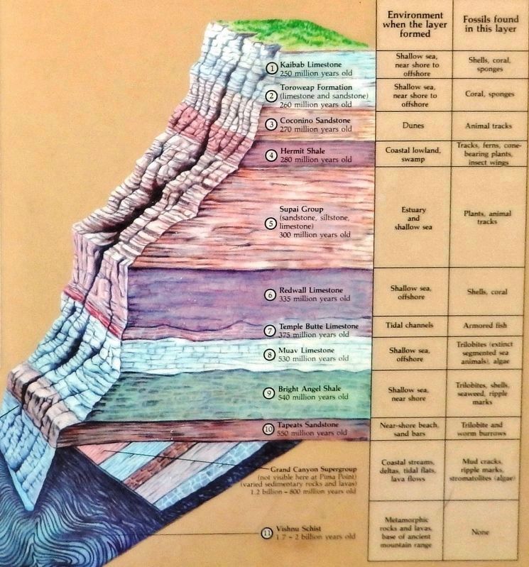
2. Marker detail: Geological Section Diagram
1 Kaibab Limestone 250 million years old
2 Toroweap Formation (limestone and sandstone)
260 million years old
3 Coconino Sandstone 270 million years old
4 Hermit Shale 280 million years old
5 Supai Group (sandstone, siltstone, limestone)
300 million years old
6 Redwall Limestone 335 million years old
7 Temple Butte Limestone 375 million years old
8 Muav Limestone 530 million years old
9 Bright Angel Shale 540 million years old
10 Tapeats Sandstone 550 million years old
Grand Canyon Supergroup (not visible here at Pima Point)
(varied sedimentary rocks and lavas)
1.2 billion-800 million years old
11 Vishnu Schist 1.7-2 billion years old
The Great Unconformity — Notice this great time-gap between Tapeats Sandstone and Vishnu Schist, the result of more than a billion years of erosion — more time than it took to deposit all layers above it.
2. Powell Geographic Expedition of 1869 (Wikipedia). The Powell Geographic Expedition of 1869, led by American naturalist John Wesley Powell, was the first thorough cartographic and scientific investigation of long segments of the Green and Colorado rivers in the southwestern United States, including the first recorded passage of white men through the entirety of the Grand Canyon. (Submitted on October 3, 2020, by Cosmos Mariner of Cape Canaveral, Florida.)
Credits. This page was last revised on October 3, 2020. It was originally submitted on September 29, 2020, by Cosmos Mariner of Cape Canaveral, Florida. This page has been viewed 347 times since then and 46 times this year. Photos: 1, 2, 3, 4. submitted on October 3, 2020, by Cosmos Mariner of Cape Canaveral, Florida.


