Greenville in Darke County, Ohio — The American Midwest (Great Lakes)
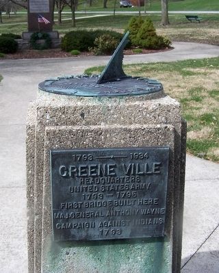
1793 -1934 Greene Ville
Headquarters United States Army

Photographed by Rev. Ronald Irick, March 18, 2016
1. 1793 -1934 Greene Ville Marker
close up, showing text
Greene Ville
Headquarters
United States Army
1793 - 1795
first bridge built here
by
Maj. General Anthony Wayne
in
campaign against Indians
1793
Erected 1934.
Topics. This memorial is listed in these topic lists: Bridges & Viaducts • Wars, US Indian.
Location. 40° 6.547′ N, 84° 37.42′ W. Memorial is in Greenville, Ohio, in Darke County. It is on East Main Street (Ohio Route 121) near East Park Dr., on the right when traveling west. marker is in Greenville City Park. Touch for map. Memorial is at or near this postal address: 910 E Main St, Greenville OH 45331, United States of America. Touch for directions.

Regionally, this memorial is in Ohio’s Till Plains. It is also in the American Midwest and in the Corn Belt. Globally, it is in North America, the Western Hemisphere, the Western World, and the Anglosphere. Historically, it finds itself in what was once the Haudenosaunee (Iroquois) Confederacy, the territory of the Mississippian Culture, and the Northwest Territory.
Other nearby markers. At least 8 other markers
this page online
Photographed by Rev. Ronald Irick, March 18, 2016
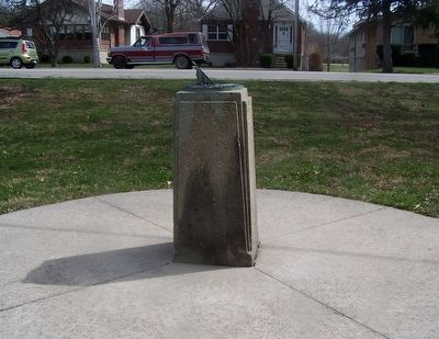
2. 1793 -1934 Greene Ville Marker
full view of marker
Photographed by Rev. Ronald Irick, March 18, 2016
3. 1793 -1934 Greene Ville Marker
marker, at a distance
Photographed by Rev. Ronald Irick, March 18, 2016
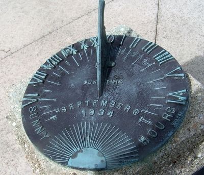
4. 1793 -1934 Greene Ville Marker
the face of the sundial, with date
Credits. This page was last revised on October 2, 2020. It was originally submitted on March 19, 2016, by Rev. Ronald Irick of West Liberty, Ohio. This page has been viewed 950 times since then and 65 times this year. Last updated on October 2, 2020, by Robert Baughman of Bellefontaine, Ohio. Photos: 1, 2, 3, 4. submitted on March 19, 2016, by Rev. Ronald Irick of West Liberty, Ohio. • Devry Becker Jones was the editor who published this page.
