Ponte Vedra Beach in St. Johns County, Florida — The American South (South Atlantic)
Palm Valley
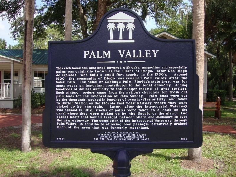
Photographed by Tim Fillmon, August 25, 2011
1. Palm Valley Marker
this page online
Erected 2005 by St. Johns County Board of County Commissioners and the Florida Department of State. (Marker Number F-554.)
Topics. This historical marker is listed in these topic lists: Railroads & Streetcars • Settlements & Settlers • Waterways & Vessels.
Location. 30° 10.627′ N, 81° 23.889′ W. Marker is in Ponte Vedra Beach, Florida, in St. Johns County. It is on Canal Boulevard 0.1 miles east of Roscoe Boulevard South, on the left when traveling east. Marker is located in front of the Palm Valley Community Center. Touch for map. Marker is at or near this postal address: 148 Canal Boulevard, Ponte Vedra Beach FL 32082, United States of America. Touch for directions.

Regionally, this marker is in First Coast and in Greater Jacksonville. It is also in the American South and on the Eastern Seaboard. Globally, it is in the North Atlantic Region, North America, a Gulf of Mexico state, the Western Hemisphere, the Western World, and the Anglosphere. Historically, it finds itself in what was once New Spain, the territory of the
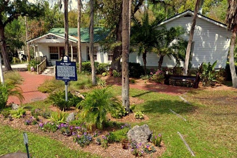
Photographed by Tim Fillmon, circa August 25, 2011
2. Palm Valley Marker in front of community center
Other nearby markers. At least 8 other markers are within 5 miles of this marker, measured as the crow flies: Fort San Diego (approx. 1.1 miles away); Mickler's Landing Park (approx. 2.6 miles away); Mickler's Landing (approx. 2.7 miles away); Mineral City (approx. 2.7 miles away); History of Palm Valley (approx. 3.2 miles away); a different marker also named History of Palm Valley (approx. 3.2 miles away); World War II Operation Pastorius / St. Johns County (approx. 4.6 miles away); Jonathan Dickinson Shipwreck (approx. 4.7 miles away). Touch for a list and map of all markers in Ponte Vedra Beach.
Credits. This page was last revised on October 29, 2020. It was originally submitted on October 7, 2020, by Tim Fillmon of Webster, Florida. This page has been viewed 1,190 times since then and 68 times this year. Photos: 1, 2. submitted on October 7, 2020, by Tim Fillmon of Webster, Florida.
