
Leesburg in Loudoun County, Virginia — The American South (Mid-Atlantic)
Battle of Ball’s Bluff, October 21, 1861
Photographed by Craig Swain, September 1, 2007
1. Battle of Ball's Bluff, October 21, 1861 Marker
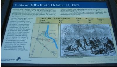
On orders from Brig. Gen. Charles P. Stone, Col. Charles Devens’ crossed a 300-man force to raid this “camp” but soon discovered the mistake. Devens remained where he was and sent word to General Stone. His decision to stay led to the battle. On hearing of the mistake about the camp, Stone sent Devens the remainder of his regiment with orders to reconnoiter closer to Leesburg. He also ordered Col. Edward D. Baker, a U.S. Senator and friend of President Lincoln, to take command of the force, evaluate the situation and use his own discretion about whether to advance more men across the river or to retire those already there.
Unknown to either Stone or Baker, Devens’ original raiding party had already engaged pickets of
this page online
Erected by Ball’s Bluff Regional Park/Northern Virginia Regional Park Authority.
Topics and series. This historical marker is listed in this topic list: War, US Civil. In addition, it is included in the Former U.S. Presidents: #16 Abraham Lincoln, and the NOVA Parks series lists.
Location. This marker has been replaced by another marker nearby. It was located near 39° 7.915′ N, 77° 31.674′ W. Marker was in Leesburg, Virginia, in Loudoun County. It could be reached from Ball’s Bluff Road, on the left when traveling east. Located to the west of the National Cemetery, the center of three markers beside the path to the cemetery enclosure. Touch for map. Marker was in this post office area: Leesburg VA 20176, United States of America. Touch for directions.

Regionally, this marker was in the Washington Metropolitan Area and in Northern Virginia. It was also in
Photographed by Craig Swain, September 1, 2007
2. Three Markers Near the Cemetery
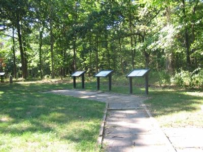
The Battle of Ball's Bluff Marker is flanked by one profiling Northern leaders (on the left) and one for the Southern leaders (on the right).
Other nearby markers. At least 8 other markers are within walking distance of this location: The North: Union Leaders at Ball's Bluff (here, next to this marker); The South: Confederate Leaders at Ball’s Bluff (here, next to this marker); First Black Combatant of the Civil War (here, next to this marker); a different marker also named Battle of Ball's Bluff, October 21, 1861 (here, next to this marker); a different marker also named The North: Union Leaders at Ball's Bluff (here, next to this marker); Thomas Clinton Lovett Hatcher (a few steps from this marker); Clinton Hatcher (a few steps from this marker); 13 Pounder "James Rifle" (a few steps from this marker). Touch for a list and map of all markers in Leesburg.
Other markers no longer nearby. The North (was here, next to this marker but has been replaced with another marker now near it); The South (was here, next to this marker but has been replaced with another marker now near it).
More about this marker. The marker displays a map depicting the operational unit maneuvers during the battle. A newspaper drawing depicts the “Charge of the 15th Massachusetts Regiment” from London News, November 23, 1861.
Regarding Battle of Ball’s Bluff, October 21, 1861. This marker is one of a set along the Balls Bluff Battlefield walking trail. See the Balls Bluff Virtual Tour by Markers link below for details on each stop.
Related marker. Click here for another marker that is related to this marker. This marker has been replaced with the linked marker.
Also see . . .
1. Battle of Ball's Bluff. Wikipedia entry (Submitted on May 18, 2024, by Larry Gertner of New York, New York.)
2. Staff Ride Guide to the Battle of Ball's Bluff. US Army Center of Military History website entry (Submitted on September 1, 2007, by Craig Swain of Leesburg, Virginia.)
3. Balls Bluff Battlefield Virtual Tour by Marker. Over twenty markers detail the action at Balls Bluff and related sites. Please use the Click to map all markers shown on this page option at the bottom of the page to view a map of the marker locations. The hybrid view offers an excellent overlook of the park. (Submitted on November 11, 2007, by Craig Swain of Leesburg, Virginia.)
Credits. This page was last revised on October 11, 2024. It was originally submitted on September 1, 2007. This page has been viewed 2,157 times since then and 19 times this year. Last updated on October 8, 2020, by Bradley Owen of Morgantown, West Virginia. Photos: 1, 2. submitted on September 1, 2007, by Craig Swain of Leesburg, Virginia. • J. Makali Bruton was the editor who published this page.
