Near Kearneysville in Jefferson County, West Virginia — The American South (Appalachia)
Union Church Cemetery
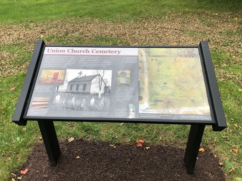
Middleway, founded in the late 1700s, flourished as a trading center for most of the 1800s. About 1820 the Lutherans and German Reformed congregations joined together to build this church. Some years elapsed before the building was erected and finally the Presbyterian agreed to bear one third of the cost. Services were alternated, thus the name Union Church.
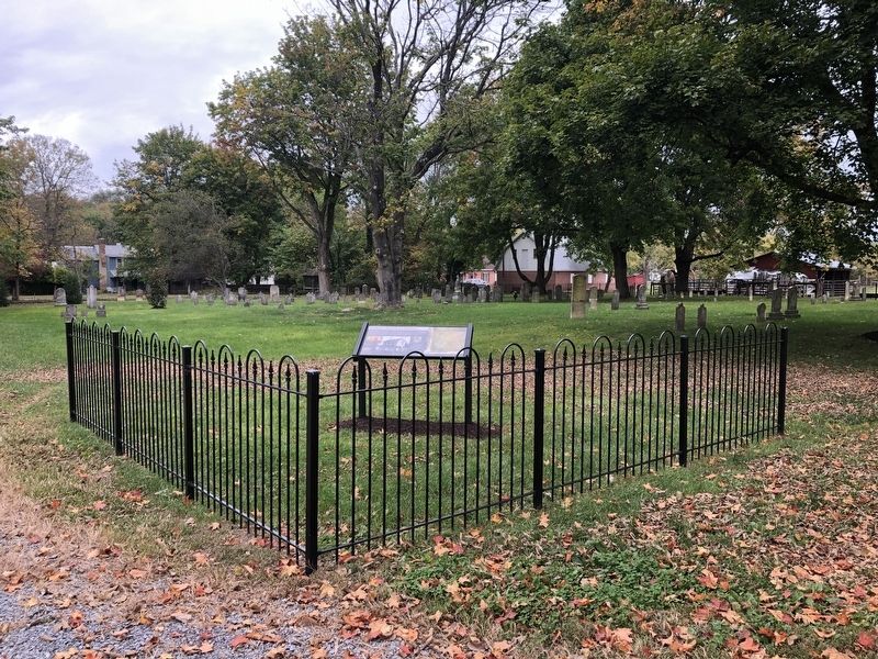
As the village declined, the Union Church and its cemetery deteriorated. In a more recent act of destruction, vandals smashed tombstones with bats, and knocked others askew. The nearby Grace Episcopal Church, having acquired the forsaken property, stepped in and has restored the size to its former dignity.
Captions:
Artist's conception of the church interior when it was an active church. Today the building serves as a church hall for the Episcopalians and the community.
A foot-pumped reed organ from the 1830s remains in the building. The "organ pipes" in the painting above were purely decorative.
This old photo captures the rustic beauty of Union Church, with the cemetery orphaned and overgrown. The building dates to the 1820s.
The earliest graves are located at the far (west) end of the cemetery. Selected family plots are shown on this aerial view.
The marker of Elizabeth Showers — broken in two places — has been repaired and straightened. This Grace Church congregation asks that you do not take rubbings or put anything on the tombstones. We recommend using aluminum foil and your hands to make an image, or taking a photograph.
Volunteers from Grace Episcopal Church mended stones using fiberglass rods, clamps, and a special cement.
Erected by Grace
this page online
Topics. This historical marker is listed in these topic lists: Cemeteries & Burial Sites • Religion & Religious Structures • Settlements & Settlers. A significant historical year for this entry is 1820.
Location. 39° 18.245′ N, 77° 58.878′ W. Marker is near Kearneysville, West Virginia, in Jefferson County. It is on East Street (County Road 1/8) 0.1 miles north of Grace Street (County Road 1/8), on the left when traveling north. Touch for map. Marker is at or near this postal address: 112 East St, Kearneysville WV 25430, United States of America. Touch for directions.

Regionally, this marker is in the Washington Metropolitan Area and in the Eastern Panhandle. It is also in the American South, specifically in the Upper South, in Appalachia, and specifically in Northern Appalachia. Globally, it is in North America, the Western Hemisphere, the Western World, and the Anglosphere. Historically, it finds itself in what was once the territory of the Mississippian Culture and also the
Other nearby markers. At least 8 other markers are within 4 miles of this marker, measured as the crow flies: Masonic Hall (a few steps from this marker); The Gilbert House (about 400 feet away, measured in a direct line); Wizard Clip (approx. 0.2 miles away); Cedar Lawn (approx. 3.1 miles away); Cameron's Depot (approx. 3.1 miles away); Richwood Hall (approx. 3.4 miles away); Harewood (approx. 3.4 miles away); "Locust Hill" (approx. 3.8 miles away). Touch for a list and map of all markers in Kearneysville.
Another marker is no longer nearby. Jefferson County / Berkeley County (was approx. 1.2 miles away but has been confirmed missing).
Credits. This page was last revised on January 17, 2022. It was originally submitted on October 11, 2020, by Devry Becker Jones of Washington, District of Columbia. This page has been viewed 664 times since then and 45 times this year. Photos: 1, 2. submitted on October 11, 2020, by Devry Becker Jones of Washington, District of Columbia.
