Zittlestown in Frederick County, Maryland — The American Northeast (Mid-Atlantic)
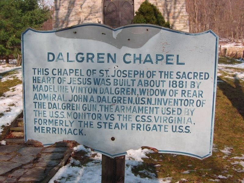
Dalgren Chapel
Topics. This historical marker is listed in these topic lists: Churches & Religion • War, US Civil • Waterways & Vessels. A significant historical year for this entry is 1881.
Location. This marker has been replaced by another marker nearby. It was located near 39° 29.06′ N, 77° 37.143′ W. Marker was in Zittlestown, Maryland, in Frederick County. Marker was on Old National Pike (Alternate U.S. 40) 0.1 miles west of Dahlgren Road, on the right when traveling west. Touch for map. Marker was at or near this postal address: 1514 Dahlgren Rd, Myersville MD 21773, United States of America. Touch for directions.
Other nearby markers. At least 8 other markers are within walking distance of this location. South Mountain Summit (within shouting distance of this marker); Turner's Pass Tablet T. P. 1 (within shouting distance of this marker); Turner's Pass Tablet T. P. 2 (within shouting distance of this marker); Turner's Pass Tablet T. P. 3 (within shouting distance of this marker); Turner's Pass Tablet T. P. 4 (within shouting distance of this marker); Turner's Pass Tablet T. P. 5 (within shouting distance of this marker); Turner's Pass Tablet T. P. 6 (within shouting distance of this marker); The Dahlgren Chapel (within shouting distance of this marker).
Related marker. Click here for another marker that is related to this marker. This marker has been replaced by the linked marker.
Credits. This page was last revised on October 12, 2020. It was originally submitted on October 12, 2020, by F. Robby of Baltimore, Maryland. This page has been viewed 91 times since then and 4 times this year. Photos: 1. submitted on December 1, 2007, by F. Robby of Baltimore, Maryland. 2. submitted on June 24, 2007, by Craig Swain of Leesburg, Virginia. • Devry Becker Jones was the editor who published this page.

