Santa Rita in Grant County, New Mexico — The American Mountains (Southwest)
The Companies & People
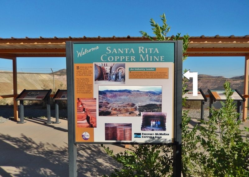
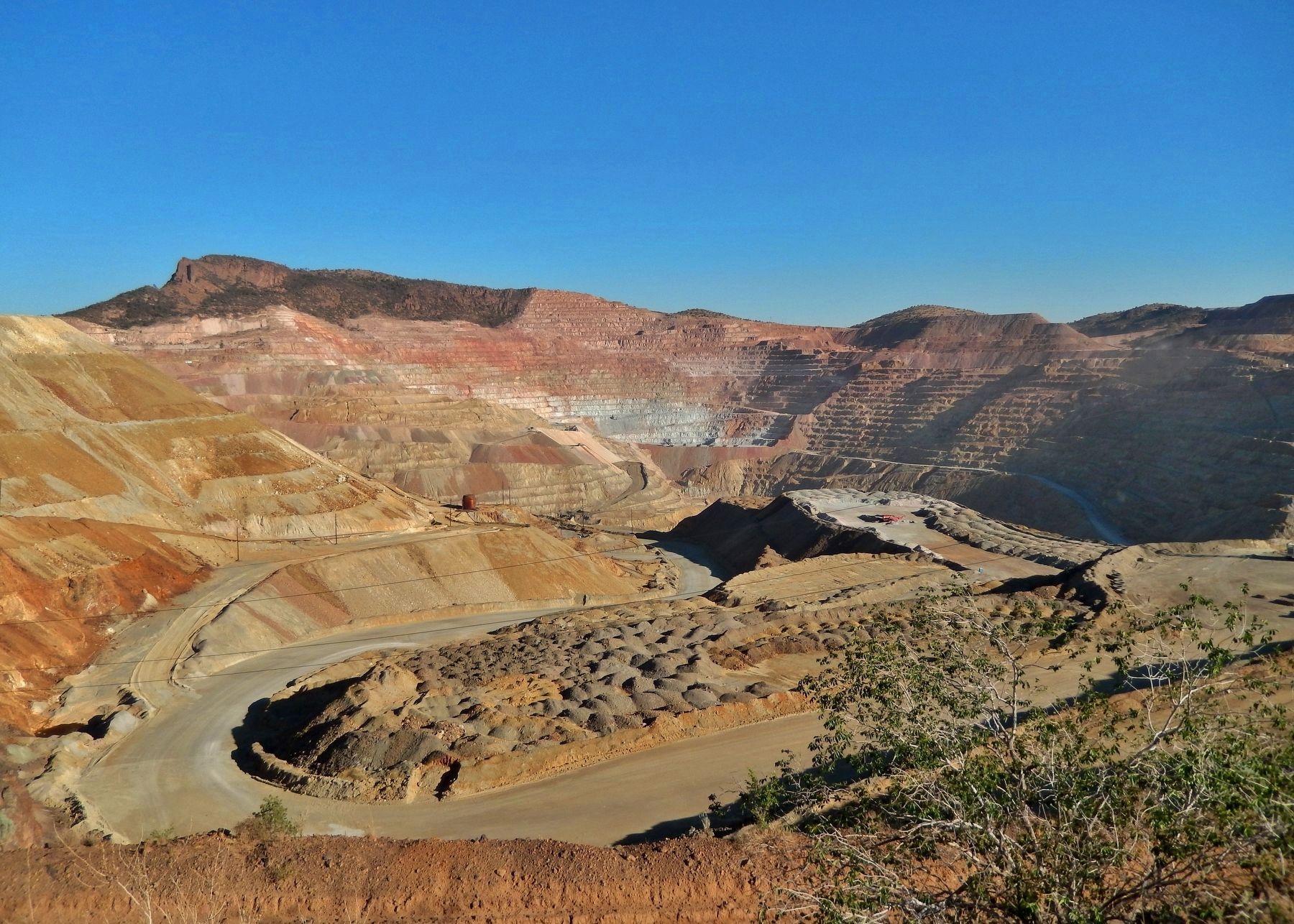
Santa Rita Copper Mine
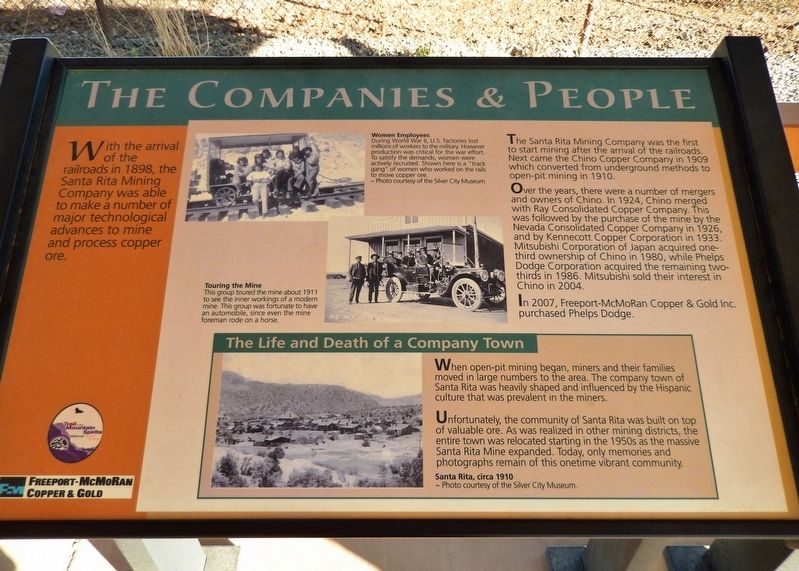
The Santa Rita Mining Company was the first to start mining after the arrival of the railroads. Next came the Chino Copper Company in 1909 which converted from underground methods to open-pit mining in 1910.
Over the years, there were a number of mergers and owners of Chino. In 1924, Chino merged with Ray Consolidated Copper Company. This was followed by the purchase of the mine by the Nevada Consolidated Copper Company in 1926, and by Kennecott Copper Corporation in 1933. Mitsubishi Corporation of Japan acquired one-third ownership of Chino in 1980, while Phelps Dodge Corporation acquired the remaining two-thirds in 1986. Mitsubishi sold their interest in Chino in 2004.
In 2007, Freeport-McMoRan Copper & Gold Inc. purchased Phelps Dodge.
The Life and Death of a Company Town
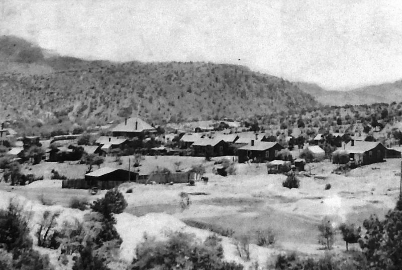
When open-pit mining began, miners and their families moved in large numbers to the area. The company town of Santa Rita was heavily shaped and influenced by the Hispanic culture that was prevalent in the miners.
Unfortunately, the community of Santa Rita was built on top of valuable ore. As was realized in other mining districts, the entire town was relocated starting in the 1950s as the massive Santa Rita Mine expanded. Today, only memories and photographs remain of this onetime vibrant community.
Erected by Freeport-McMoRan Copper & Gold.
Topics. This historical marker is listed in these topic lists: Hispanic Americans • Industry & Commerce • War, World II • Women. A significant historical year for this entry is 1898.
Location. 32° 48.407′ N, 108° 4.395′ W. Marker is in Santa Rita, New Mexico, in Grant County. Marker is on Scenic State Road 152, 1.1 miles east of State Highway 356, on the right when traveling east. Marker is located at an interpretive exhibit overlooking the open pit mine site to the south. Touch for map. Marker is in this post office area: Hanover NM 88041, United States of America. Touch for directions.
Other nearby markers. At least 8 other markers are within 3 miles of this marker, measured as the crow flies. Open Pit Mining (here, next to this marker); Modern Mining & Processing (here, next to this marker); Santa Rita Copper Mine (here, next to this marker); The Early Mining Years (here, next to this marker); Reclaiming the Land (here, next to this marker); The Discovery (here, next to this marker); Kneeling Nun (approx. 2.8 miles away); Ladies Auxiliary of Local 890 (approx. 2.8 miles away). Touch for a list and map of all markers in Santa Rita.
Related markers. Click here
Courtesy Silver City Museum
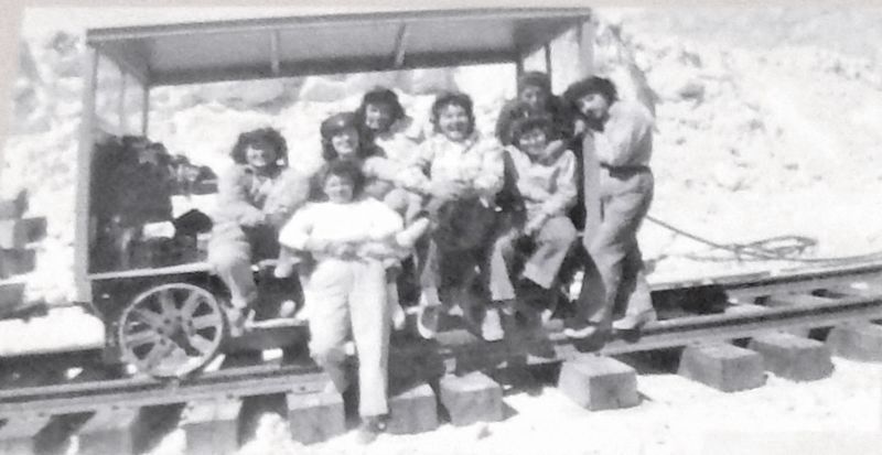
2. Marker detail: Women Employees
During World War II, U.S. factories lost millions of workers to the military. However, production was critical for the war effort. To satisfy the demands, women were actively recruited. Shown here is a "track gang" of women who worked on the rails to move copper ore.
Also see . . .
1. The Santa Rita Mine In New Mexico That Swallowed An Entire Town. In the first half of the 20th century, the population of Santa Rita surged to 6,000 people. Today it’s gone. Swallowed up by this massive copper mine in New Mexico. Where once there was a town, now there’s only the gaping maw of an open-pit copper mine. (Submitted on October 16, 2020, by Cosmos Mariner of Cape Canaveral, Florida.)
2. Santa Rita, New Mexico (Wikipedia). After the Santa Rita mine was converted to an open pit in 1901, the town was forced to move several times as the pit grew. Shortly after the town relocated in 1957, heavy rains washed boulders and mud into the new townsite. The town was abandoned once and for all in 1967. (Submitted on October 16, 2020, by Cosmos Mariner of Cape Canaveral, Florida.)
Credits. This page was last revised on October 16, 2020. It was originally submitted on October 14, 2020, by Cosmos Mariner of Cape Canaveral, Florida. This page has been viewed 151 times since then and 14 times this year. Photos: 1. submitted on October 14, 2020, by Cosmos Mariner of Cape Canaveral, Florida. 2, 3, 4, 5, 6. submitted on October 16, 2020, by Cosmos Mariner of Cape Canaveral, Florida.
