Near Huntington in Hampshire County, Massachusetts — The American Northeast (New England)
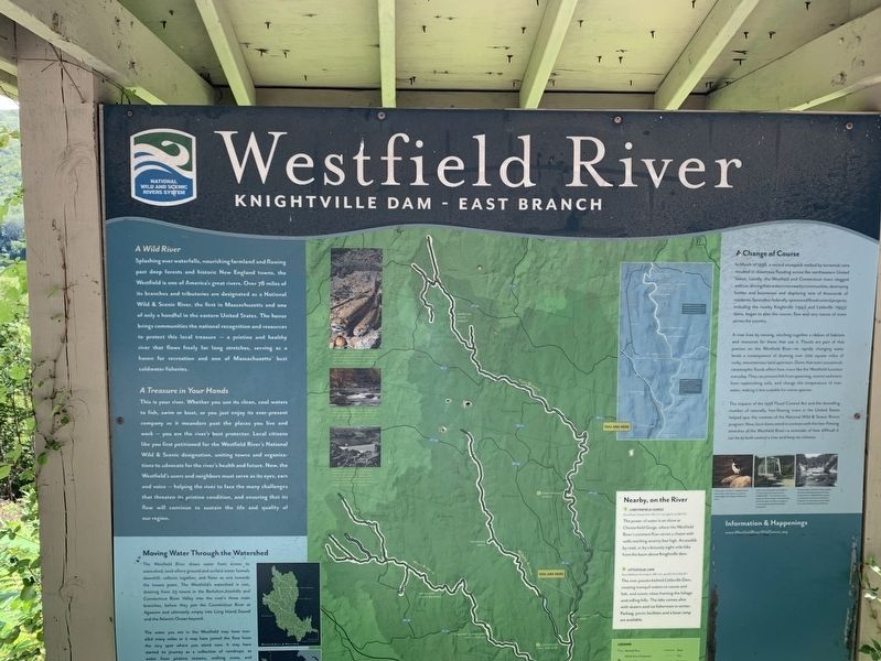
Westfield River
Knightville Dam - East Branch
( upper left inset )
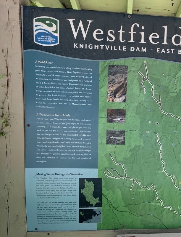
A Wild River
Splashing over waterfalls, nourishing farmland and flowing past deep forests and historic New England towns, the Westfield is one of America's great rivers. Over 78 miles of its branches and tributaries are designated as a National Wild & Scenic River, the first in Massachusetts and one of only a handful in the eastern United States. The honor brings communities the national recognition and resources to protect this local treasure - a pristine and healthy river that flows freely for long stretches, serving as a haven for recreation and one of Massachusetts' best coldwater fisheries.
A Treasure in Your Hands
This is your river. Whether you use its clean, cool waters to fish, swim or boat, or you just enjoy its ever-present company as it meanders past the places you live and work- you are the river's best protector. Local citizens like you first petitioned for the Westfield River's National Wild & Scenic designation, uniting towns and organizations to advocate for the river's health and future. Now, the Westfield's users and neighbors must serve as its eyes, ears and voice – helping the river to face the many challenges that threaten its pristine condition, and ensuring that its flow will continue to sustain the life and quality of our region.
( lower left inset )
Moving Water Through the Watershed
The Westfield River draws water from across its watershed, land where ground and surface water funnels downhill, collects together, and flows as one towards the lowest point. The Westfield's watershed is vast, draining from 23 towns in the Berkshire foothills and Connecticut River Valley into the river's three main branches, before they join the Connecticut River at Agawam and ultimately empty into Long Island Sound and the Atlantic Ocean beyond.
The water you see in the Westfield may have traveled many miles or it may have joined the flow from the very spot where you stand now. It may have started its journey as a collection of raindrops, as water from pristine streams, melting snow, and underground springs or from lawn sprinklers and dirty puddles on roads and parking lots. While the forests of the Westfield River and watershed help clean the water clean, the everyday actions and decisions of people in its watershed can have a great impacts on the River.
( center inset )
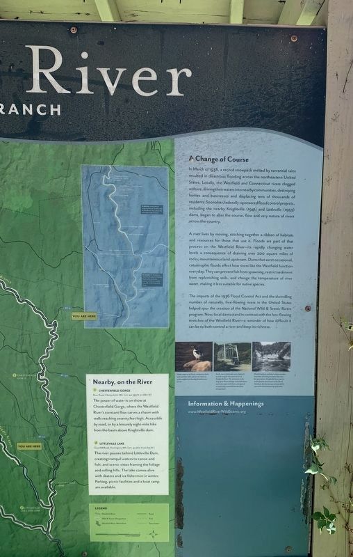
Nearby, on the River
1 Chesterfield Gorge
Washington - Aiddlefield River Road. Chesterfield. MA [GPS 42.393 N. 72.880 W]
The power of water is on show at Chesterfield Gorge, where the Westfield River's constant flow carves a chasm with walls reaching seventy feet high. Accessible by road, or by a leisurely eight-mile hike from the basin above Knightville Dam.
2 Little Lake
Goss H Road. Huntington, MA [GPS 42.267N 72.875 W]
The river pauses behind Littleville Dam, creating tranquil waters to canoe and fish, and scenic vistas framing the foliage and rolling hills. The lake comes alive with skaters and ice fishermen in winter. Parking, picnic facilities and a boat ramp are available.
( right inset )
A Change of Course
In March of 1936, a record snowpack melted by torrential rains resulted in disastrous flooding across the northeastern United States. Locally, the Westfield and Connecticut rivers clogged with ice, driving their waters into nearby communities, destroying homes and businesses and displacing tens of thousands of residents. Soon after, federally-sponsored flood control projects, including the nearby Knightville (1941) and Littleville (1953) dams, began to alter the course, flow and very nature of rivers across the country.
A river lives by moving, stitching together a ribbon of habitats and resources for those that use it. Floods are part of that process on the Westfield River - its rapidly changing water levels a consequence of draining over 200 square miles of rocky, mountainous land upstream. Dams that avert occasional, catastrophic floods affect how rivers like the Westfield function everyday. They can prevent fish from spawning, restrict sediment from replenishing soils, and change the temperature of river water, making it less suitable for native species.
The impacts of the 1936 Flood Control Act and the dwindling number of naturally, free-flowing rivers in the United States helped spur the creation of the National Wild & Scenic Rivers program. Now, local dams stand in contrast with the free-flowing stretches of the Westfield River-a reminder of how difficult it can be to both control a river and keep its richness.
Left photo: Under water or in the air, merganser ducks and countless other species use rivers as a thoroughfare for feeding, breeding, and travel
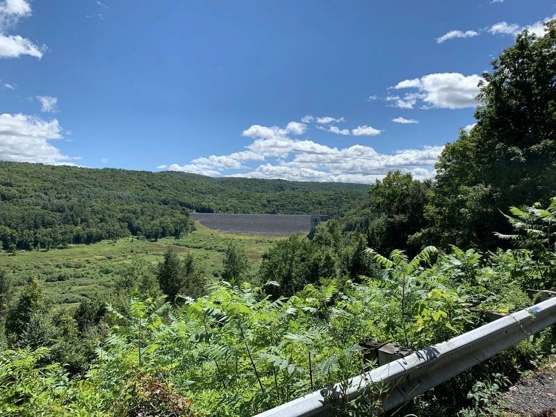
Middle photo: Earth, stone and people were displaced to make way for the construction of the Knightsville Dam. The abutments to the long-gone Pitcher Bridge, noticeable below and to the right in the basin, are signs of a community removed from the damís storage basin.
Right photo: Rock formations and other unique wonders have been attracting tourists to the river for generations. Knightsville Dam now sits on the feature once known as the Devilís Armchair, but the leaning rock can still be seen on the downstream side of the dam.
Information & Happenings
www.WestfieldRiverWildScenic.org
Erected by Nation Wild and Scenic Rivers System.
Topics. This historical marker is listed in these topic lists: Disasters • Environment • Waterways & Vessels. A significant historical month for this entry is March 1936.
Location. 42° 17.809′ N, 72° 52.107′ W. Marker is near Huntington, Massachusetts, in Hampshire County. Marker is on Huntington Road (Massachusetts Route 112) 0.4 miles north of Kimball Road, on the right when traveling north. Touch for map. Marker is in this post office area: Huntington MA 01050, United States of America. Touch for directions.
Other nearby markers. At least 8 other markers are within 11 miles of this marker, measured as the crow flies. In Memoriam (approx. 4.4 miles away); In Honor Of (approx. 6.3 miles away); Roll of Honor (approx. 7.4 miles away); Town of Worthington Honor Roll (approx. 7.9 miles away); General LaFayette (approx. 8.6 miles away); Gen. Henry Knox Trail (approx. 8.6 miles away); Easthampton Korean War Memorial (approx. 10.1 miles away); Easthampton World War II Monument (approx. 10.1 miles away).
Also see . . . Wild & Scenic Westfield River Committee. (Submitted on October 16, 2020, by Steve Stoessel of Niskayuna, New York.)
Credits. This page was last revised on October 19, 2020. It was originally submitted on October 15, 2020, by Steve Stoessel of Niskayuna, New York. This page has been viewed 392 times since then and 52 times this year. Photos: 1, 2, 3, 4. submitted on October 15, 2020, by Steve Stoessel of Niskayuna, New York. • Michael Herrick was the editor who published this page.


