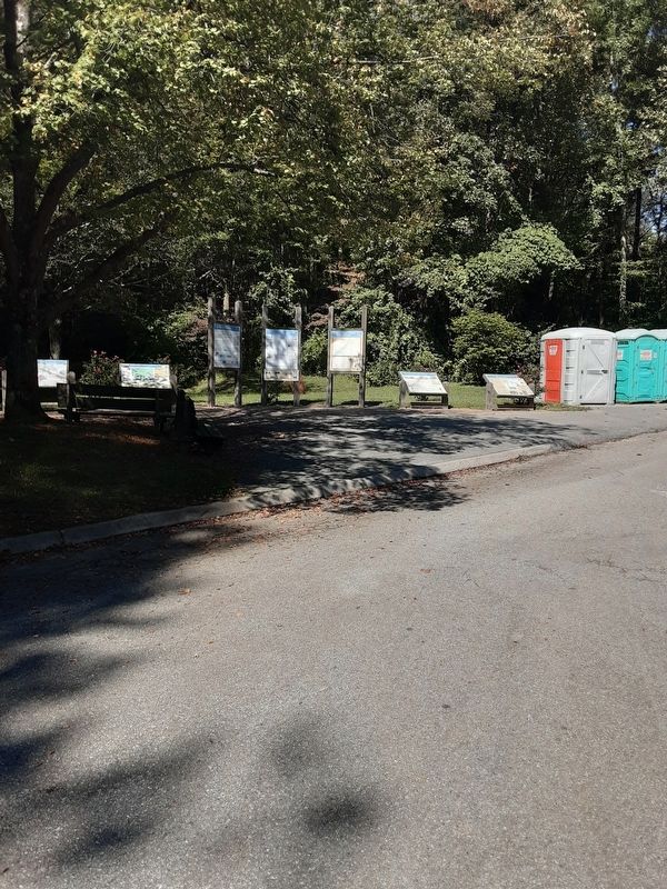
Iron Hill Park near Newark in New Castle County, Delaware — The American Northeast (Mid-Atlantic)
Welsh Tract
The Origin of Pencader Hundred
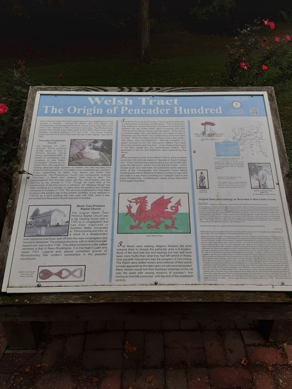
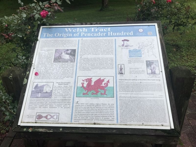
One of the first tasks the Welsh performed was the establishment of two houses of worship. Among the Welsh were both Baptist and Presbyterian and the Baptist built their church on the north side of Iron Hill in 1703. Rebuilt in 1746, it remains in use today. The Presbyterians located their church a few miles south of Iron Hill in what is now called Glasgow between 1702 and 1710. The current building, which was the third to be built near the site of the original, was built in 1852.
Pencader Presbyterian Church
On October 15, 1701, William Penn granted 30,000 acres of land to William Davies, David Evans, and William Willis "in behalf of themselves and company of new Welsh Purchasers." Known as the Welsh Tract, this expansive holding attracted large numbers of settlers who had migrated from Wales to Colonial America. The settlers soon established two churches, known respectively as Welsh Tract Baptist and Welsh Tract Presbyterian. The Presbyterian Church was subsequently renamed "Pencader", a Welsh term meaning "chief chair or seat." The congregation's first recorded pastor was Rev. David Evans, who was serving as lay minister in 1710. Though the exact date of construction of the first church is unknown, the "Meeting House" had been standing for a number of years when the property was formally conveyed to trustees in 1742. The structure is believed to have been located in the eastern rear of the present cemetery. It was replaced in 1782-83 by a brick building that was used until 1852, when it was dismantled and the present church was built in its place.
Welsh Tract Primitive Baptist Church
The original Welsh Tract Primitive Baptist Church was a log meeting house built in 1703 by a congregation that had been organized in Southern Wales, immigrated to Pennsylvania, and then, as a result of a disagreement over baptismal practices, split off from the main congregation and moved to Delaware. The present structure, with its distinctive half-hipped roof, was built in 1746. The oldest tombstone in the walled cemetery is that of Rees Rhyddracks. It is inscribed in Latin and dated 1707. Legend also places unmarked graves of Revolutionary War soldiers somewhere in the peaceful churchyard.
The Welsh Tract lay mostly in New Castle County with a small portion extending into Maryland. That in Maryland may well have resulted from lack of positive boundary lines between the two states which were in dispute until after 1763 when the Mason-Dixon Line was drawn. Penn was in a constant battle with Lord Baltimore over rights to the land in Delaware and the Welsh Tract settlement put the land titles to a test. When the Welsh arrived they found a few settlers with claims from Lord Baltimore. With the exception of a peach orchard on Iron Hill, the current settlers had made few improvements upon the land. Under threat of being put in the New Castle jail, the outnumbered settlers, who appealled in vain to Lord Baltimore, were removed by the Welsh.
The northeast corner of the Welsh Tract is a few hundred yards from the old train station in Newark on South College Ave. From there the line extends about four and a half miles west into Maryland, not far from the Big Elk Creek. It then travels south and east back into Delaware some distance south of the Chesapeake and Delaware Canal before heading east a short distance where it winds its way north and east in a way that is anything but "straight" back to the place of beginning. In Delaware it nearly covers that which is Pencader Hundred.
The Welsh were seeking religious freedom but what induced them to choose this particular area is a mystery. Much of the land was low and swampy but may well have been more fruitful than what they had left behind in Wales. One possible inducement was the prospect of iron mining. The Welsh were skilled miners and evidence of their earlier tunnels appeared as the later open ore pits were excavated. Many owners would test their business schemes on the hill over the years with varying amounts of success. Iron mining on Iron Hill continued
until the end of the nineteenth century.
"Men must be governed by God, or they will be ruled by tyrants."
William Penn
Delaware State Historic Marker #NC-47
39°31'05" N 75°42'51" W
Location: The marker is located on Rt. 896 below the C&D canal at the south end of Summit Air Field near the boundary between Pencader and St. George's Hundred.
[Captions:]
Welsh "Love Spoon" given as a gift when Courting
Engraved on the pedestal of this statue by Charles Parks:
"The Citizens of New Castle Delaware presented to William Penn the key of the fort, one turf with a twig upon it, a porringer with river water, and soyle."
Statue of William Penn, 1644-1718 on the Green in New Castle
Pensilvania
William Penn [ --- ] Proprietor and Governor of the Province of Pensilvania and Counties annexed
At the Request of William Davies, David Evans & William Willis in behalf of themselves and Company of new Welsh Purchasers That I would grant them to take up in ye County of Newcastle thirty thousand Acres of Land or so much as there is to be had beginning at a line distant Westward from Newcastle seven miles and from there extending Northward and Southward by Straight Lines as near as may be sufficient to comprehend the said Number of Acres upon the terms already agreed on under their hands. These are to require the forthwith to survey or cause to be surveyed to them the said number of Acres in the said place and make particular Returns of the Subdivision to each Man under his proper Name unto my Secretaries office. The whole to be laid out according to the Method of Township by me appointed. Given under my hand and Seal at Philadelphia the 15th day of October 1701.
To Edward Penington Surveyor General of the Province of Pensilvania and Territories
William Davies and Companies Warrant for thirty thousand acres of land in Newcastle County Dated the 15 day of 8 ber 1701 Entered page 43 Recorded and Examined A23
Agreed this day of October 1701 between William Penn Esq. Propietor and Governor of the Province of Pensilvania on the one hand and William Davies, David Evans and William Willis all of Radnor Township in the County of Chester & Prov. Of Pensilvania. In behalf of themselves & Company Purchasers of Land in the county of Newcastle on the other hand as Follows . viz. That the said Purchasers shall have in the said County of Newcastle, a Tract of Land Containing in the whole Thirty Thousand acres if there should be so much vacant in the place hereafter expressed, that is to Say behind the town of Newcastle Westward extending Northward and Southward beginning to the Westward Seven Miles from the said town of Newcastle and extending upwards and Downwards as there shall be found room by regular straight Lines as near as may be, and be all subdivided according to the Manner of Townships, Leaving to the Proprietors according to regulation one Tenth part of the whole. For which Land they the said purchasers shall pay to the Proprietors twelve pounds ten Shillings, for every hundred acres in Manner followings, that is to say for Seven Thousand acres thereof at the Expiration of two years next after the Date of Proprietors warrant for the remainder of the whole Tract at the end of three years next after the Date of the said warrant and for every acre of the whole the said purchasers shall pay one English penny or value thereof in Coin Currant for a yearly Rent til such time as the Prospective purchase money for the same Shall be paid and after the payment of this said purchase money shall be paid one English silver Shilling or value thereof for every hundred acres in yearly Rent for ever and it is further agreed That if there be found vacant Land enough that can conveniently be spared to be in The Said Tract, at the distance of Six Miles only, from the Town of Newcastle and the prop. think fit to spare the same Then the said purchasers over and above the prices aforesaid shall pay one hundred pounds in Consideration of the Situation of the Said Land. Signed in behalf of the Proprietory and Governor and by his order [ --- ] James Logan Secretary [ --- ] Recorded the 8th June, 1749 [ --- ] Richard M. William Recorder Deeds
Topics. This historical marker is listed in these topic lists: Churches & Religion • Colonial Era • Industry & Commerce • Settlements & Settlers. A significant historical date for this entry is October 15, 1701.
Location. 39° 38.342′ N, 75° 45.378′ W. Marker is near Newark, Delaware, in New Castle County. It is in Iron Hill Park. Marker is on Robert L. Melson Lane near Whitaker Road, on the left when traveling north. Although Whitaker Road is named above (because Robert L. Melson Lane intersects it), the Lane is blocked at Whitaker Road, so Iron Hill Park, which includes this marker, has to be reached by road from Old Baltimore Pike. Touch for map. Marker is in this post office area: Newark DE 19702, United States of America. Touch for directions.
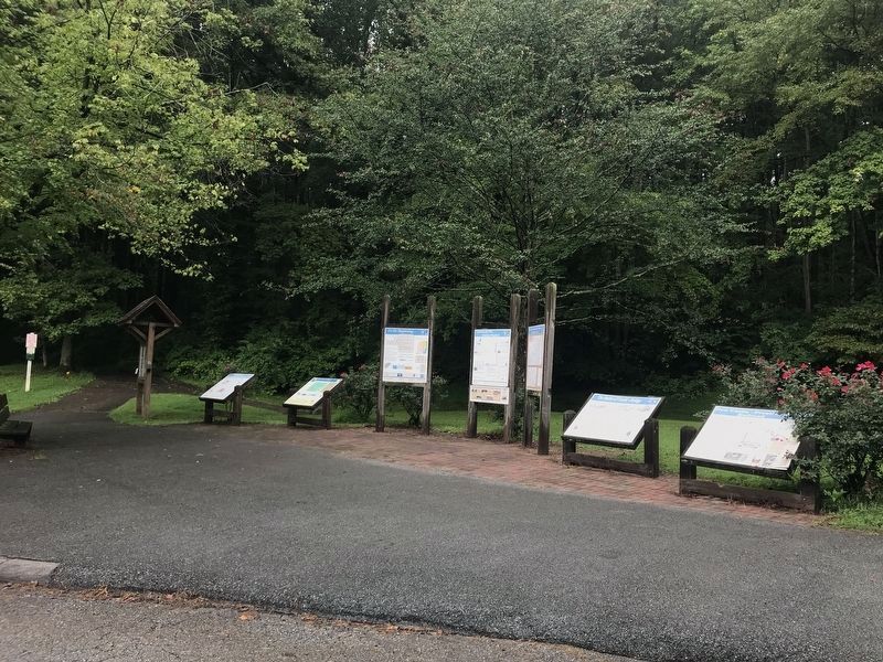
Other nearby markers. At least 8 other markers are within walking distance of this marker. Historic Iron Ore Mining (here, next to this marker); In the Beginning … (here, next to this marker); The March Through Pencader (here, next to this marker); Exploring the Past of Pencader Hundred (here, next to this marker); Robert V. Yost (a few steps from this marker); Iron Hill (within shouting distance of this marker); a different marker also named Iron Hill (approx. 0.3 miles away); Iron Mining on Iron and Chestnut Hills, A Timeline (approx. half a mile away). Touch for a list and map of all markers in Newark.
Regarding Welsh Tract. Early in the last paragraph, what should be "Proprietor" is missing 2nd "r".
Credits. This page was last revised on January 8, 2024. It was originally submitted on October 2, 2020, by Carl Gordon Moore Jr. of North East, Maryland. This page has been viewed 543 times since then and 65 times this year. Last updated on October 18, 2020, by Carl Gordon Moore Jr. of North East, Maryland. Photos: 1. submitted on October 2, 2020, by Carl Gordon Moore Jr. of North East, Maryland. 2. submitted on August 12, 2022, by Adam Margolis of Mission Viejo, California. 3. submitted on October 2, 2020, by Carl Gordon Moore Jr. of North East, Maryland. 4. submitted on August 12, 2022, by Adam Margolis of Mission Viejo, California. 5. submitted on October 3, 2020, by Carl Gordon Moore Jr. of North East, Maryland. • Bill Pfingsten was the editor who published this page.
