Near Stevenson in Skamania County, Washington — The American West (Northwest)
Gatekeepers of the Columbia
"romantic scenes"

Photographed By Barry Swackhamer, August 12, 2020
1. Gatekeepers of the Columbia Marker
Captions: (bottom left) Kama'gwaih (Virginia Miller), Cascade Indian, circa 1910.; (bottom center-right) William Clark's drawing of the shaped heads of American Indians of the lower Columbia River region and the method of shaping that involved applying dental pressure to infants' soft heads.
The Lewis and Clark Expedition first met Chinookan tribes as they traveled through the Columbia River Gorge in autumn 1805. At the time, Chinookan society consisted of many bands living between the narrows of the Columbia River and the Pacific Ocean. Chinookan people were seasoned traders, who had long controlled commerce on the lower Columbia.
While camped near here, the explorers encountered several Upper Chinookan villages and found a well-worn path used to portage around the rapids. On a visit to a village, Clark noticed trade items, such as "Blue and white beeds copper Tea Kittles, brass arm bands, some Scarlet and blue robes and a few articles of old clothes." That Chinookans had extensive experience trading with Euro-Americans was obvious: "They (ask) high prices for what they Sell and Say that the white people below give great prices for every thing."
The Watála People
Lewis and Clark met the Watála Indians in 1805-06 including the "Sha-ha-la.""Clah-lel-lah," and "Wah-cleh-lah" bands. Later pioneers called them the "Cascade Indians" because they lived along both sides of the river near the Cascades of the Columbia. Like other Upper Chinookan tribes, their way of life was closely tied to the river and fishing. They also practiced the custom of head shaping. Clark wrote "This amongst those people is considered as a great mark of buty - and is practices in all the tribes we have passed on this river more or less."
October 30, 1805
"Capt. Lewis and 5 men went to the Town found them kind they gave Bereis & nuts, but he ed. get nothin from them in the way of Information, the greater part of those people out collecting roots below, rained all evining Those people have one gun & many articles which they have purchased of the white people their food is principally fish" - William Clark
November 1, 1895
"Those people gave me to eate nuts berries & a little dried fish, and Sold me a hat of ther own taste without a brim, and baskets in which they hold their water" - William Clark
April 9. 1806
"these people were on their return up the river, having been on a trading voyage to the Columbean vally, and were loaded with wappetoe dyed anchovies, with some beads & c" Meriwether Lewis
(sidebar)
What do you want for that?
The value of American Indian trade items was influenced by supply and demand use like today's economy. Observe how the prices change from region to region. Trade a favorite possession

Photographed By Barry Swackhamer, August 12, 2020
2. "romantic scenes" Marker
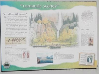
Captions: (center left) Meriwether Lewis's journal sketch of Oregon grape (Berberis aquifolium or Mahonia aquifolium); (bottom left) Lewis's collected specimen of Oregon grape; (sidebar on right) Dog Creek Falls, 11 miles east of Stevenson.
"several beautifull cascades"
The beauty and grandeur of the Columbia River Gorge awed the explorers of the Lewis and Clark Expedition. In their journals, Captains Meriwether Lewis and William Clark described this spectacular passage through the Cascade Range:
"the Mountains through which the river passes ... are high broken rocky, particularly Covered with fir and white Cedar, and in many places very romantic scenes. Some handsom Cascades are Seen on either Side tumbling from the Stupendious rocks of the mountains into the river."
Congress recognized the Columbia River Gorge as a National Scenic Area in 1986.
Transitions
The Columbia River Gorge is a unique environment. Weather can vary dramatically between the east and west ends, creating a chain of diverse ecosystems. The climate and landscape of the east end of the Gorge is drier with less trees and vegetation than the west end.
As they paddled down the river in fall 1805, Expedition members noticed these changes in the landscape. Clark wrote. "the Countary a high mountain on each Side thickly Covered with timber, Such as Spruc, Pine, Cedar, Oake Cotton." Lewis collected and drew pictures of some of the plants from
this area, including the Oregon grape specimen on the right, collected near here.
Ice Sculpture
The Columbia River Gorge is the only near sea-level passage through the Cascade Mountains. The Gorge was sculpted by recurrent Ice Age floods. During these massive floods, the river flowed hundreds of feet higher than present-day levels and scoured the landscape. Look around at the cliffs and bluffs throughout the Gorge. What remnants of the flood can you see?
April 9, 1806
"on our way to this village we passed several beautifull cascades which fell from a great hight over the stupendious rocks which cloles the river on both sides nearly ... the most remarkable of these casscades falls about 300 feet perpendicularly over a solid rock into a narrow bottom of the river on the south side. ... several small streams fall from much greater hight, and in their decent become a perfect mist." ~ Meriwether Lewis ~
Poetic Passages
Meriwether Lewis had a tendency to write long, poetic passenger describing the beauty and grandeur of the landscapes the Expedition encountered. Upon reaching the White Cliffs along the Missouri River, Lewis wrote, "As we passed on it seemed as if those scenes of visionary enchantment would never have an end." Upon his arrival at the Great Falls of the Missouri he wrote, "To gaze upon this sublimely grand spectacle ... forms the grandest sight I every (sic) beheld."
Gorgeous Gorge
What scenes in the Columbia River Gorge do you most enjoy? What makes these places so scenic? There are numerous waterfalls in the Gorge. Write the names of the ones you visit in journal. Describe your scenic experiences like Lewis and Clark did.
Erected by Lewis & Clark Expedition - Washington.
Topics and series. This historical marker is listed in these topic lists: Exploration • Native Americans • Natural Features. In addition, it is included in the Lewis & Clark Expedition series list. A significant historical date for this entry is April 9, 1806.
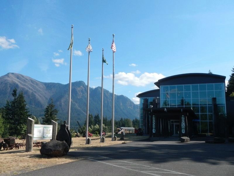
Location. 45° 41.161′ N, 121° 53.926′ W. Marker is near Stevenson, Washington, in Skamania County. Marker is on Southwest Rock Creek Drive near Foster Creek Road. The marker is located in the Columbia Gorge Interpretive Center parking lot. Touch for map. Marker is at or near this postal address: 990 Southwest Rock Creek Drive, Stevenson WA 98648, United States of America. Touch for directions.
Other nearby markers. At least 8 other markers are within one mile of this marker, measured as the crow flies. Lewis and Clark Trail (within shouting distance of this marker); Great Depression Threatens Bank (approx. 0.9 miles away); "The Great Shoote" (approx. 0.9 miles away); Steamboats Docked at Stevenson (approx. 0.9 miles away); "Stump Lifter" Elected First Mayor (approx. 0.9 miles away); Stevenson Washington (approx. 0.9 miles away); "White Lightning" In The Back Alley (approx. 0.9 miles away); Bretz Floods (approx. one mile away). Touch for a list and map of all markers in Stevenson.
Credits. This page was last revised on October 20, 2020. It was originally submitted on October 19, 2020, by Barry Swackhamer of Brentwood, California. This page has been viewed 164 times since then and 10 times this year. Photos: 1, 2, 3. submitted on October 19, 2020, by Barry Swackhamer of Brentwood, California.
