Niskayuna in Schenectady County, New York — The American Northeast (Mid-Atlantic)
John Brown Hiking Trails and Mohawk River State Park
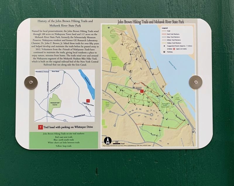
Photographed by Steve Stoessel, October 12, 2020
1. John Brown Hiking Trails and Mohawk River State Park Marker
History of the John Brown Hiking Trails and Mohawk River State Park
Named for local preservationist, the John Brown Hiking Trails wind through 100 acres on Niskayuna Town land and 117 acres on the Mohawk River State Park, formerly the Schenectady Museum Preserve. Niskayuna resident and former GE Research Laboratory Chemist, Dr. John F. Brown, Jr. hiked these trails for over fifty years and helped develop and maintain the trails before he passed away in 2012. Volunteers from the Friends of Niskayuna Trails have continued to maintain the trails, giving local residents a place to enjoy nature, minutes from home. The trails wind over and around the Niskayuna segment of the Mohawk Hudson Bike Hike Trail, which is built on the original railroad bed of the New York Central Railroad that ran along side the Erie Canal.
Topics. This historical marker is listed in this topic list: Parks & Recreational Areas. A significant historical year for this entry is 2012.
Location. 42° 48.83′ N, 73° 51.747′ W. Marker is in Niskayuna, New York, in Schenectady County. It can be reached from River Road (County Route 19) south of Line Drive,
this page online

Regionally, this marker is in Upstate New York, in the Capital District, and in the Albany Metropolitan Area. It is also in the American Northeast and in the Mid-Atlantic. Globally, it is in North America, the Western Hemisphere, the Western World, and the Anglosphere. Historically, it finds itself in what was once New Netherland and also one of the original Thirteen Colonies.
Other nearby markers. At least 8 other markers are within 2 miles of this marker, measured as the crow flies: Knolls Atomic Power Laboratory (approx. half a mile away); Erie Canal, Lock 7 (approx. 1.1 miles away); Margaret Lordi & Eleanor Brown (approx. 1.1 miles away); Hydroelectric Power Plant (approx. 1.1 miles away); Edith M. Boldebuck (approx. 1.2 miles away); Shepherd House (approx. 1.2 miles away); GE Global Research (approx. 1.2 miles away); General Electric Research Laboratory (approx. 1.2 miles away). Touch for a list and map
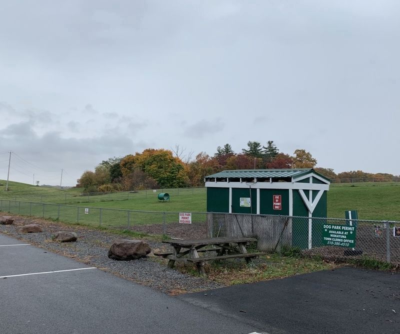
Photographed by Steve Stoessel, October 20, 2020
2. John Brown Hiking Trails and Mohawk River State Park Marker
Marker is in the center of green shelter. Part of the trails mentioned are in the woods seen in the background.
Also see . . . Mohawk River State Park. Wikipedia entry (Submitted on October 23, 2020, by Michael Herrick of Southbury, Connecticut.)
Credits. This page was last revised on November 5, 2023. It was originally submitted on October 20, 2020, by Steve Stoessel of Niskayuna, New York. This page has been viewed 1,025 times since then and 41 times this year. Photos: 1, 2. submitted on October 20, 2020, by Steve Stoessel of Niskayuna, New York. • Michael Herrick was the editor who published this page.
